Monday, July 04, 2005

Fergus Falls, Minnesota

Day 3 - Fergus Falls, MN to Chicago, IL - 644 miles

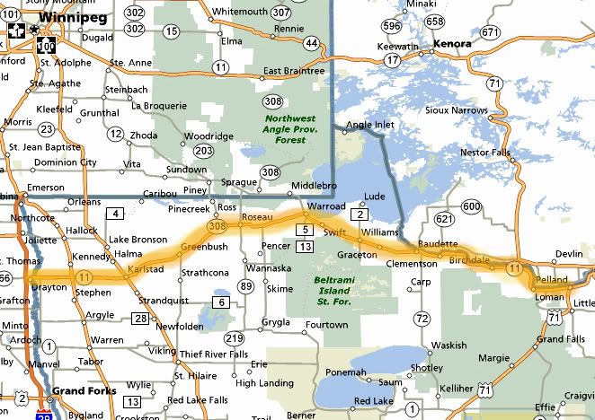
The complimentary breakfast was pretty decent at the Best Western. I don’t usually stay at this chain but almost every motel in town was booked when I called two days ago to make a reservation. After packing up the bikes, Tony and I said our good byes to Jim and headed toward I-94 East. There was 12 miles of constructions early on and we couldn’t pass at all. The morning was in the mid 60’s and cloudy, rain was expected in Chicagoland all day and into the night. We stopped for gas once, I also grabbed a Red Bull. The coffee at the motel was weak and I only had one cup. I needed some energy. Once we got near St. Cloud there were a bit of LEO’s on the road but they all already had people pulled over. The traffic was already getting thick and it would continue like that through the Twin Cites. By the time we reached St. Paul I was hot, the traffic was heavy but at least moving at speed limit or above. Not too bad considering that it was a holiday weekend, two cars cut me off but that was the worst of it as we continued East and crossed in to Wisconsin taking an exit for 35 South.


Best Western in Fergus Falls, MN

We stopped for gas right off the interstate, it was totally busy here. After a break and taking all the extra layers off and opening all the vents in my jacket we took off to have lunch in River Falls. I assumed the road we exited off was 35, but it wasn’t. It was F South. If my GPS wasn’t broken I could have simply looked and found a road to turn on to get us back on track, but without one I was had to ride until I would see a sign for another road that also went to River Falls. Yea, I could have pulled over and checked Tony’s GPS but all this stopping gets annoying and it was hot now.

F was a nice road, started straight but then there was a big “S” curve that came down from a huge hill, it was awesome, although there was a bit of traffic here. I kept heading south on F thinking at least we were going in the right direction, but now looking at the map I realized that we passed two roads which could have gotten us to River Falls earlier. Also F went straight South and 35 went southeast. Near Prescott I saw a sign for River Falls so we turned. It took a while before we got there. We ended up going many miles out of the way. The town of River Falls looked abandoned and most of the restaurants in town were closed for the holiday except for the fast food chains. We stopped in at the subway next to the river. The air-conditioning was not working inside and it was a gazillion degrees in there. We sat outside where it was hot but still not as hot as it was inside, although an umbrella on the table would have been nice. I didn’t know how hot it was supposed to be today, so far the weekend was pleasant and on the cool side, nothing above 85 degrees. Today seemed much warmer.


Lunch in River Falls, WI

After lunch we took 65 S. In Ellsworth we took 10 East, there was plenty of nice sweepers and some elevation changes. In Mondavi we took 37 South for a bit and then turned on 88 South. I have wanted to ride 88 for a while, it looked really curvy on the map and it was curvy in real life too. I liked the scenic aspect of this road the best, it doesn’t look like the Midwest here, almost looks like the foothills of some mountains. There were a few elevation changes here also. The pavement is not all that great though, most of the road is patched up and the pavement is two-tone, light and dark in color, pavement like this always playes tricks on my eyes. 88 is also narrow with no shoulder and most of the turns are blind. There are many curves on this road, most of them are marked at 30-45MPH, some are even tighter. There is only one turn that messed me up, the one that goes through a small town, it was a left hander marked at 15MPH, it was tight and ran real close to some buildings.

We turned southeast on 35 and stopped for gas in Fountain City, right on the Mississippi River. Fountain City is a cool little town, nestled in the bluffs along the Mississippi River. It’s the oldest settlement in Buffalo County, rich in natural and historical beauty. Fountain City is highlighted by Eagle Bluff, which stands 550 feet above the river, the highest point on the Mississippi River. We took a break here and it was a long one. I was tired and overheated now. The sad part was that it was getting late now and we were still way out here. At this rate we wouldn’t get home until 5AM. I didn’t see how we could continue riding the back roads, we needed to make up some times, so once we got on the I-90 East past Winona, MN I planned on taking the interstate all the way to Janesville, WI. We continued on 35 South and crossed in to Winona and took 14/61 until it merged with I-90 East. First traffic was OK, then it got crowded. We stopped for gas and I grabbed another one of those Twix ice cream bars. This time it didn’t have the same effect, no extra energy. By the time we got near Madison the traffic was unbearable. We took an exit at 19 for gas.


Fountain City, WI

At the gas station I grabbed a meatball sandwich for dinner, which was barely edible and a Red Bull to wash down the nastiness. It seemed that all the stops were longer now. Somehow I didn’t have the enthusiasm to hit the road right away even if it was going to cost me getting home later. By now the temperature had finally cooled off, and amazingly it cooled off a lot in a short amount of time. It was dark now, I was layering up and I rested my Red Bull can on the curb right next to my bike. Some drunk punk came out of the gas station and kicked it as he passed by me on his way to his car. It was an accident, he didn’t mean to do it, he apologized and bought me another one. So now I drank half of the one Red Bull and a whole can. I was going to be flying home for sure.

We were not taking the interstate, so I looked at the map and came up with a plan. We took 19 East and turned South on 73. We had finally caught up to the heavy rain that was hitting the Chicago area all day. The roads were all wet and there was lightning in the distance, but it was not raining on us yet. 73 turned in to 51 South. All along these roads we encountered 4th of July celebration and fireworks were going off everywhere. After the rain there was also a fair amount of low lying fog, which we rode in and out of, it was a bit eerie to see a shadow of yourself against the fog. At times it was almost impossible to see the road through the thick fog. I was hoping that all the deer were hiding tonight spooked by the fireworks. The rain stayed ahead of us, just when I though we were heading in to it, we would turn away from it. We made it to Janesville and turned on 140 south and stopped for gas in Clinton. I was surprised how quick it took to get here using those back roads. It was nice and cool now and I felt like I had more energy, those Red Bulls did their job. We got our gas and used the facilities just as the place was closing. We continued and stopped one more time, just to take a break. Still no rain, but the roads continued to be wet. I pulled in to my driveway at 1AM. It was a great trip overall, it was nice to see new places, ride new roads and the company was good too. But it was good to be home after 1802 miles in three days.


Three days and 1802 miles

Sunday, July 03, 2005

Minnesota's Waters of the Dancing Sky

Day 2 - Falls, MN to Fergus Falls, MN - 453 miles

In the middle of the night I woke to thunder and lightning and pouring rain. In the morning there was drizzle but by the time Lee invited us to the house for breakfast, it started pouring again. Breakfast was awesome and we just sat around for at least two hours and talked.


A lot of rain last night


The bunkhouse in the distance


Jim's bike and weekend home


From left to right: Lee, his daughter, me, Jim

By 10:30AM it had stopped raining and there were some blue skies visible between the rain clouds. It was time to hit the road. Tony left me a message to call him. He was staying at a motel in International Falls. I called him back and we decided to meet up at the corner of 11 and 71, but I didn’t know when we would be there, we still had to pack up the bikes. After some pictures, we left the Ripple Inn, as Lee’s family calls it, and followed Lee to the Big Falls. He said “you can’t come to Big Falls and not see the falls”. We hung out by the river and took some pictures. The river water was orange in color, which was pretty neat. Jim and I said good bye to Lee and we headed on our way.


Looks like root beer


Lee's daughter and me


By the time we left Big Falls it was totally sunny and warm. It looked like another great riding day. We headed northeast on 71, but before we got to the corner of 11 a BMW GS passed us and waved and then pulled over on the shoulder. That wave was somehow different from a 'hello' wave, so I pulled over on the shoulder and the BMW rider made a u-turn and pulled over next to us. Apparently this guy and Tony had been talking earlier at the gas station and Tony left a message with him to tell us he had to run out for a bit but he’ll be back to meet us at the gas station later on. We arrived at the corner of 71 and 11, and parked at the gas station. Tony wasn't there yet. They didn't have any Red Bull, so I got some other stuff that tasted like cherry flavored cold medication. Then I sat down with the map to figure out how to make the route for today shorter. I had originally planned to ride 520 miles but it was already 12PM. Tony showed up about 30 minutes later and since he was hungry and there was a cafĂ© at the gas station, we decided to just have lunch and get that over with.


Lunch in Pelland, MN at the gas station

After lunch we headed West on 11, also called the Waters of the Dancing Sky byway, named for the northern lights that can often be seen dancing in the sky during the summer nights. This is Minnesota's northernmost byway. This route travels 191 miles along the Canadian border through lakes, the legendary Rainy River, forests, farmland, and several towns.


Highlighted is the Waters of the Dancing Sky byway which is 191 miles long

With the late start we only rode the scenic byway 11 as far as Roseau, about 100 miles. It was starting to get a bit windy and more clouds were rolling in. The further we went the windier it got. From Pelland to Baudette, the road travels through forests along the Rainy River and has many high speed sweepers. This was my favorite section of 11. On top of that, there was hardly any traffic on this section of the road. In Baudette, another giant walleye statue greets visitors. I somehow missed the 40-ft. long Willie the Walleye, which weights about two tons. When I rode in to town I was already feeling beat up from the wind. I kept thinking we had so many more miles to go yet. I remember looking at the bridge across the water to the right thinking of maybe pulling over for some pictures. The scenery was nice, but with pulling over for pictures it's never a 5 minutes of less type of thing, so I dismissed that thought and kept going. From there to Roseau, the road is mostly straight running through farmland, and there was more traffic too. We would have lost nothing by skipping that section, especially since we had no time to check out the water front or go to the Angle Inlet, the northernmost part of Minnesota.


Very windy by the Canadian border, a tornado is spotted just a few miles away

By the time we pulled over in Roseau, the winds were blasting. I almost dropped my bike in the parking lot because of the wind, it almost pushed me over bike and all. On the radio at the gas station they were reporting tornado just a few miles from us in Canada, the skies looked dark and menacing in that direction. The storm last night hit this area hard. We turned South on 89 and I was hoping since we were riding away from the storm, we would be riding away from the source of the wind. But the windy conditions continued. But it wasn’t like normal wind, it wasn’t even gusty. The air was just turbulent. The wind would keep pushing me mostly to the left, then violently change direction and push me to the right, which I could not prepare for so I would end up getting catapulted to the edge of my lane, then back to the other side. It felt like an invisible person was holding my helmet and pulling it in all different directions the whole time. Let’s just say riding was not as fun as I wanted it to be, at least there was hardly any traffic here. At times the road would change direction and travel East, and there would be no wind what so ever, but for the most part it would travel South and it was very windy. The Northern part of 89 traveled though the open fields and the southern through lakes and forests. There was the occasional sweeper here and there, but through the Red Lake Indian reservation there were a few nice and curvy sections and nice views as the road traveled along the edge of Red Lake. This was also where a deer decided to cross the road just ahead of my bike. But I had plenty of distance to react.

We turned East on 2 and headed toward Bemidji. We stopped for gas and I wanted to check the progress of our route. It was already 6PM so I implemented another short cut shaving another 30 miles from the route. The temperature was only in the low 70’s today, now it was getting cooler so I added another layer and we continued south on 2. The road I was looking for was indicated as county 7 on my paper map but on Jim’s and Tony’s paper maps it was county 3. The detail wasn’t really great but on all 3 maps it looked like we could catch this road from 2. Just shortly after we got on 2 I saw an exit for 7, so we took this exit, but the road was going west and the sign indicated a town in the distance that I was not familiar with. The only town my map showed me was Becida. I made us turn around thinking this was not it. Maybe I should have been looking for 3 instead, maybe my map was wrong. We continued on 2 which traveled south for a bit, there was no exit for 3 anywhere, then the road turned and started heading east again, away from where we needed to go. I pulled over and had Tony look at his GPS. We devised an emergency escape route from here that would lead us to the next road we had to be on which was 71. Too bad, by not finding this road we wanted to ride we missed our opportunity to stop at the Mississippi headwaters, which we all wanted to see.

Totally sucks when the leader doesn’t have a GPS (that would be me). Tony led the way. At Cass Lake we took an exit for 371 South and took that to 200 West. Both roads were nice with great scenery, some lazy curves, many lakes, forests and little traffic. At the 71 junction, we turned south, there was more traffic here, the road was sort of straight but very scenic with many lakes below to the right and left. I wanted to pull over and grab some pictures, since there was a shoulder on this road, but we were riding pretty fast and by the time I saw the lake, we were already passing it. I finally ended up pulling over missing the lake by a few feet since I didn’t want to slam on the brakes with two bikes behind me. The lake was still visible thought the trees and since the sun was setting in that direction, having trees in the way made for a nice effect.


From left to right: my bike, Tony with his Trophy and Jim with his Connie


Just as we were preparing to take off again a Honda Valkrie pulled over towing a trailer. Not a motorcycle trailer either, a big metal frame trailer with regular sized tires, a trailer like a car would be towing. I didn’t talk to the guy, I was already getting ready to leave, so I don’t know the deal with the trailer, but the guy took off and he had loud explosive pipes on that bike.
We turned west on 113 and the curves started immediately, not too many straight sections on this road. This road was recommended to me and the reason why we were even riding in this direction today. Curves posted at 40-45MPH to the left and right, many “S” type curves, just a great road to rail on at high speeds. Which I attempted to do but the sun was low on the horizon and we were traveling west in to the sun. With each turn I was blinded, not even able to see the road. Then once I plunged in to the shadows my eyes took a few seconds to re-adjust, then back in to the blazing sun again. The sun was playing havoc on my eyes and the idea that there were deer in these woods wasn’t comforting.


113 in Northwest Minnesota, what a wonderful road

We caught up to the guy on the Valkrie as he rode through the curves ahead of us. After a few curves I even thought of passing him, even though he wasn’t going slow at all. His trailer was shooting up all kinds of gravel though. Then I saw a deer jump out in front of him and I quickly decided to stay where I was and watch the road ad the woods a bit better. There were a few scenic pullouts here on 113 but I had a hard time reading the road signs with the sun in my eyes so I missed all of them, too bad, one scenic stop overlooked a lake, that would have been a great picture.

Once we got to Waubun we stopped to put on more layers and change our tinted shields to clear ones. Then we turned south on 59. We stopped for gas in Detroit Lakes and took off again quickly. There were a lot of tiny little bugs flying around and my shield was getting covered by the nasty things. There was also a lot of traffic on this road. Now it was completely dark and many towns were shooting off fireworks, the nearby lakes were reflecting the colorful lights as we passed by them. Smoke from the fireworks hovered over the road in places. I caught a magnificent display of fireworks as I crossed over a bridge near Pelican Rapids, colors exploding above and below me. I don’t really care for fireworks but this was really neat.

We made it to the end of 59 in Fergus Falls and took I-94 East one exit over to the 210 where I had a reservation at the Best Western. By the time I checked in, unloaded the bikes and got up to the room it was already 11PM. The Best Western had a Bar & Grill inside and when I made the reservations I specifically asked if it would be open on Sunday, July 3rd. I was told that it’s open every day. Guess what, it was closed because of the holiday. We went up stairs to get our jackets and walked across the parking lot to Perkins, which was packed. We waited at least 15-20 minutes before we even got a table. By the time we made it back to the motel it was already 1AM. I wanted to leave early tomorrow morning but I also needed to get some sleep. I decided to have my alarm go off at 6:30AM. Hopefully the nice weather would return for tomorrow's ride home.

Saturday, July 02, 2005

Big Falls, Minnesota

Chicago, IL to Big Falls, MN - 705 miles

So I get this idea to do a ride. 4th of July being on a Monday this year leaves me with three days off in a row. In July I definitely want to go North where it's cooler and the days are longer. There are still a few places I have not been to on a bike up north, so I grab a map and start looking.


Northwest Minnesota looks exciting. I realize that there probably aren’t that many twisty roads up there, but still I want to go just to see what it looks like. I get on exploreminnesota.com and instantly I'm intrigued by a road called Waters of the Dancing Sky Scenic Byway and within minutes I'm planning a trip up there and figuring my route. It’s a holiday weekend and many of the people I ride with already have plans, but I manage to find a couple of people with no plans that want to do the trip.


It was still dark outside when my alarm went of at 4:30AM this morning. And I still need to finish packing; I want to be out the door by 5AM. I'm meeting up with a couple of riders from the sport-touring network. I'm meeting Jim in Taylors Falls, MN for lunch at 12:30PM and hopefully running in to Tony on the road somewhere between Illinois and Minnesota. Packing my stuff on the bike took a bit longer than anticipated (it always does).

By 5:50AM I'm on the road ready to make up the 50 minutes I lost by 'slightly' speeding. The sun had been up now for about half an hour but its still a chilly 57 degrees. Even this early in the morning, I-90 heading West is already packed. Passing is difficult with slow cars traveling in both lanes. Even after entering Wisconsin, looking at the license plates on the cars around me, the majority are from Illinois. My first gas and bathroom stop is Stoughton, WI, my second gas stop is in River Falls, WI. After 360 miles of slab I finally take an exit at 63 North just south of Baldwin and stop for gas again. My stops were very short, just under 10 minutes each, I have no time to waste. The town of Baldwin has a real cool windmill, but I didn’t want to waste precious time on pictures this early in the day.

At the junction of 63 and 46 there is a stop sign and cars are back up for about a half a mile. Even on these back roads there is still a lot of traffic. I continue on 46 North and turn West on 8 arriving in Taylors Falls, MN at exactly 12:30PM. Jim is already there but I never did run in to Tony. I check my voice mail and he did leave a message saying that he left late and might not make it to lunch on time. Jim and I go to grab some lunch at the Chisago House on the corner of 8 and 95. It’s one of those places that serves breakfast all day. I have a chicken salad on a croissant and I have to say it was the best I’ve ever had, I don’t usually like fries, but these are good, or maybe I'm just very hungry since I only had a cup of coffee at 4:30AM this morning. I leave Tony a voice mail updating him on our current status and he calls me back saying that he is still an hour away from Taylors Falls. He is planning to catch up to us and meet up with us on the road. After lunch we take off on 95 heading Northwest.

It's in the upper 70’s now, no wind, what I'd call a perfect riding day. There isn't a lot of traffic on this road, and other than me looking away for a few seconds glancing at my directions and almost running over 3 birds that are crossing the road, all is going well. We turn North on 169, which is a two lane highway. After getting gas we continue until we run in to extremely slow stop and go traffic. At first I though there might have been an accident, but I think it was just all the holiday traffic. We pass the Mille Lacs Lake on our right, it's huge. After taking about 20 minutes to travel just about 2-3 miles we arrive in Garrison, MN. While getting ready to turn on 18 West, I notice a big fish statue to my right.


Mille Lacs lake in Garrison, MN

The Garrison Walleye statue sits right next to the Mille Lacs lake, I decided to take some pictures of the 15-ft. long fiberglass Walleye Pike. The Walleye is a favorite catch for sportsmen angling in America's north-central lake regions. Walleye worship became official in Minnesota after it was designated as the state fish in 1965 by the MN legislature.

Walleye Pike in Garrison, MN


That's a big mouth you got there

From 18 we turn on 6 North and after a while turned on 11 West, finally some curves started to appear in the road. 11 had really nice sweepers and I caught a glimpse of a deer running in to the woods. A reminder that they were everywhere, it’s all forest up here. The next road which is 3 North, has even more curves. 3 was supposed to turn in to 6 then 66, but in reality 3 turned right, so I stayed straight but I soon realized something was fishy. The roads were not the way they appeared on the map. We stop for gas and after checking the map and still being confused, I asked the gas station attendant. We take 16 West to Jenkins and turn North on 371. Since my GPS broke over Memorial Day Weekend, I have to go back to the old style of touring, reading maps and following road signs. I miss my Garmin.

In Pine River I found 84, a supposedly twisty road. The road had very little traffic and nice scenery, with turns posted at 30-35MPH, a few even tighter. The only thing is, there are long straights between the turns, only a few sections have two or three turns right after one another or a nice “S” turns. It is still a great road with good pavement, I just like to have the curves closer together. Once you pass 200, 84 turns to 8 and becomes kind of straight. The Federal Dam is a very small dam, wasn’t worth pulling over at. There are a few more curves in the road before reaching Bena, that's where we turn and headed East to Deer River.

I was a bit tired now, I have ridden already 636 miles today. We pull over at a gas station in town and I grabbed a Twix ice cream bar, it is really good and exactly what I needed, cool and refreshing. I start getting a headache so I take some Excedrin. The temperatures are still pleasant but we still haven’t seen Tony anywhere. I called and left him a message on his cell phone to meet us in Big Falls outside the liquor store and bar on 6. Lee, another rider on the sport-touring network is letting us stay in his bunkhouse but we have to find him in town when we get there.

We leave the gas station in Deer River at 8:30PM and ride the last 64 miles to Big Falls. 6 is a pretty straight road with a sweeper here and there, no towns on the way, just miles and miles of forests. I was hoping that I would make it to Big Falls before it got completely dark, which according to the internet is 9:30PM in these parts this time of year. I'm actually refreshed now, the long break we took and the ice cream gave me plenty energy to go at least another 100 miles if I need to. With dwindling sunlight, I increase my traveling speed. There is no one on the road but us. But then the road narrowes and the trees close in on us, so I decide to slow it down a bit. There are a lot of deer in these forests, I don't want to meet any of them personally.

The sun slowly slides behind the tree line and by the time we pull in to Big Falls, it is pretty dark, especially for me since I still have on my dark tinted helmet shield. I’ve never met Lee but I know what bike he rides and I spot his blue FJR parked in town. The minute we pulled the bikes over, the mosquitoes were on us, I don't even take my helmet off since I don't want them to bite my face, the only exposed skin. A few get in from the bottom though. I go to a few establishments and ask for Lee. After some looking around and asking some people, we find him. Still no Tony.

Lee, Jim and I ride over to the bunkhouse, which is located next to Lee’s family’s weekend house. After unpacking the bike, the first thing I have to do is coat myself in a thick layer of insect replant. I have never seen so many mosquitoes before. Tony calles me as my phone battery dies. I never get the the opportunity to ask where he's at. He does say that his phone is not working up here, he called using a phone card. I guess we'll have to meet up with him tomorrow.

Since we didn’t eat dinner Lee took out all the fixings to make some sandwiches along with some baked beans. Lee and his family were super nice people, taking in some strangers for the night and feeding them. You met the nicest people on motorcycles. The food hit the spot. After some motorcycle stories, it was time for bed.