
The weather was looking iffy this week. By this weekend the weather people were predicting up to a foot of new snow. And the following weekend I had already signed up to climb my first 14er (14,000 foot mountain) with a group. What I really wanted to do between now and then is hike to the summits of some smaller mountains, and get used to hiking at higher elevations. I even made a list of some easy summits to hike to and figured I could do about two summit’s a week before doing the easy 14er but now with this crazy spring weather I wasn’t so sure I would be able to do it.
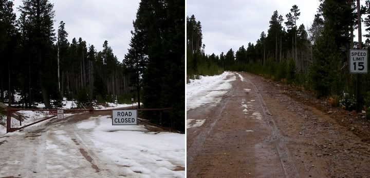
The road to the trailhead was closed (left), since I couldn't drive to the trailhead, I had to hike the road instead (right)
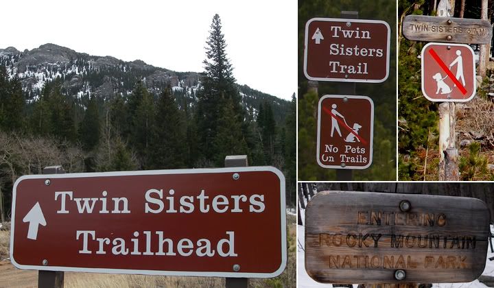
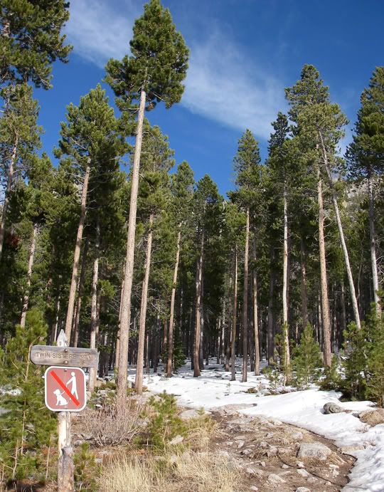
Twin Sisters sign off highway 7 (left), Twin Sisters Trail sign at the end of the dirt road (center), Twin Sisters 3.7 mi sign at the actual start of the trail (right)
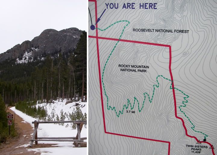
No cars beyond this point, the trailhead is still a but further up (right), Map of the trail (right)
Today was kind of cloudy with possible rain in the afternoon. I was hoping to be off the mountain by then. It was sunny in Fort Collins when I left, but it was cloudy in Estes Park. The mountains were beautiful though, all white. I forgot that when it rained in Fort Collins two days it had snowed up in the mountains.
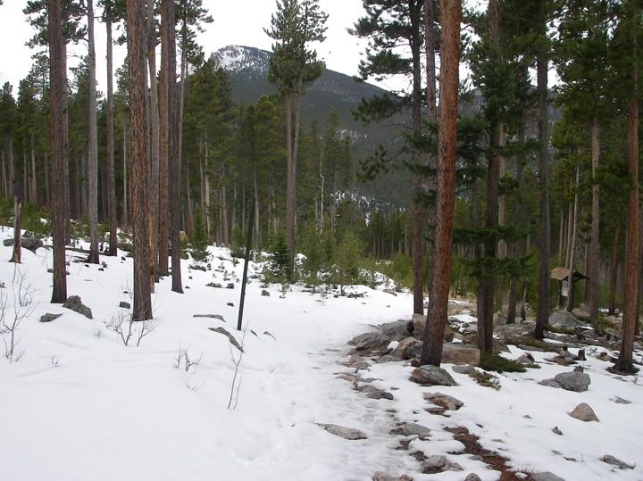
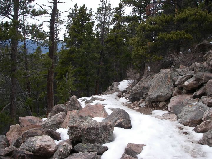
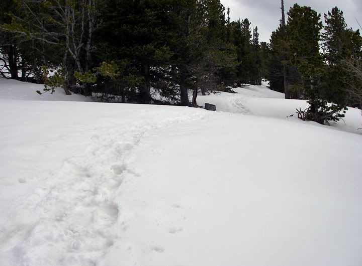
Looking back at the beginning of the Twin Sisters Trail
When I made the decision to hike this mountain this morning, I was already pushing it for time. I ate a good breakfast, got my stuff ready and got the trailhead by 11:30AM, which I thought was a bit late but still doable.
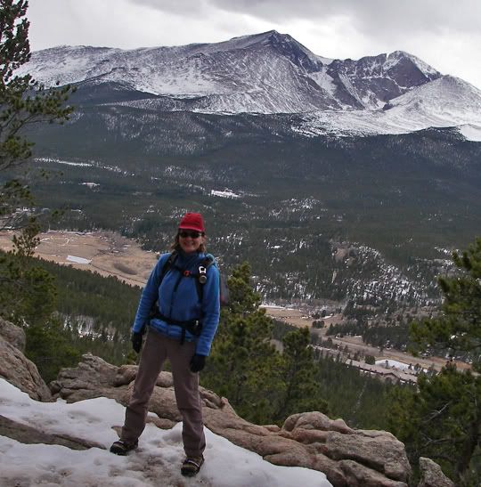
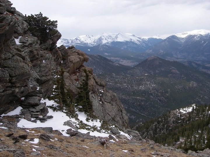
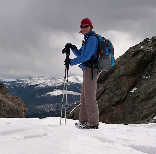
That's Highway 7 behind me and Mount Meeker, Longs Peak, and Mount Lady Washington
The Twin Sisters Trailhead is located on highway 7 just south of Estes Park at 9,040 feet in elevation. Even though this trail travels in to the Rocky Mountain National Park, there is no fee to hike this trail. I parked the car in the muddy parking lot just off highway 7 across from Lily Lake. The dirt road to the actual trailhead was closed, so I had to hike to the trailhead, maybe a quarter of a mile, maybe a bit more.
Mt Meeker (13,911), Longs Peak (14,259), Mt. Lady Washington (13,281)
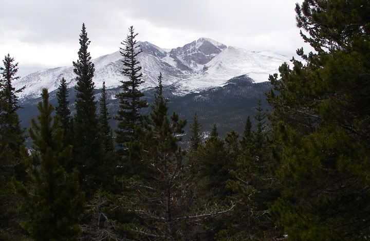
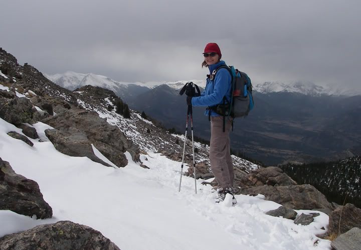
Same picture as above but zoomed in - hard to believe a few weeks ago I was standing on the summit of the mountain on the right, Mount Lady Washington at 13,281 feet, looks taller now then the day I climbed it
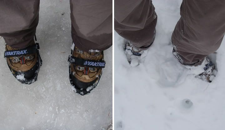
Yaktrax on icy trail at the lower elevations and in deeper snow near the summit
At the trailhead I put my Yaktrax on. I’ve had them for a few weeks now but this would be my first time wearing them. They were perfect for a trail covered in hard snow and ice. They would help my traction for sure. Spring time is definitely Yaktrax time here in the mountains. Not enough snow for snowshoeing but too slippery to hike just with hiking boots.
Less trees at this higher elevation
This was a steep climb in the snow
Looking to the west
Looking west, at this point the trail heads east towards the summit
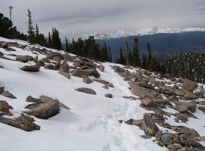
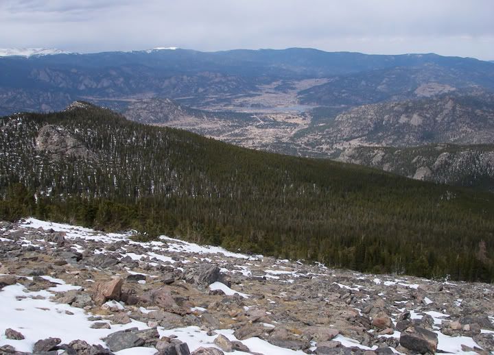
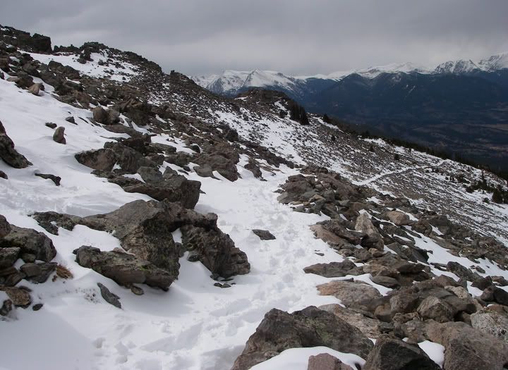
The trail climbed steadily. It was somewhat steep, but the trail was smooth, wide and well maintained and was not technical at all. After a while the switch backs started to appear regularly although they were far apart. The scenery wasn‘t changing much at first. Trees, more trees, trail, more trail and a few times through an opening in the trees I could see Mount Meeker, Longs Peak, and Mount Lady Washington, among other mountains to the west. Seeing these mountains so close was just amazing. Not to mention seeing the peak of Mount Lady Washington, my first big summit, which I only climbed a few weeks ago. From here I could clearly see the route we took to the summit. The mountain sure looked bigger now, then when I was climbing it. The mountains were covered in lots of snow now. There was only snow on the ground at the bottom of Longs Peak Trail a few weeks ago.
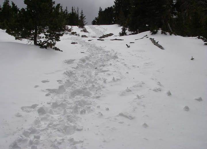
Another steep climb through the snow, the peaks are visable now
Looking back at the trail toward the west
Looking east
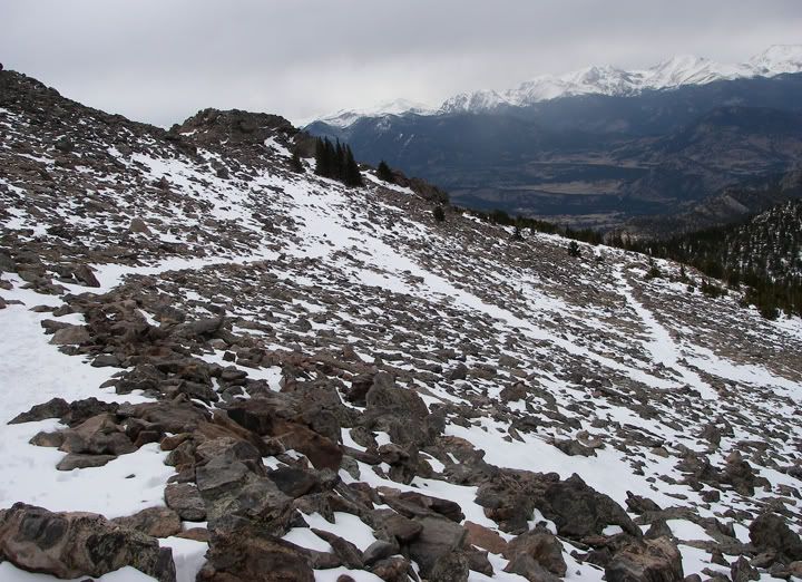
Finally after what seemed like a while, I turned a corner and instead of seeing one more same switchback and view of more trees, I was heading for a clearing. Then the trail went east and caught a glimpse of Estes Park to the North. Now the trail and scenery was way different from before and more unpredictable. I climbed some steep sections and gazed at Mount Meeker, Longs Peak, and Mount Lady Washington for the last time until my return trip.
Looking North, that's Estes Park down there
Looking back at the trail toward the west, you can really see the trail climbing up the slope
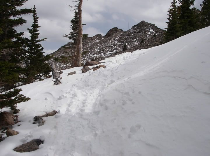
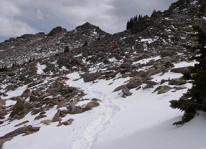
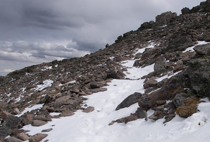
The trail headed east again and I hiked out of the trees and continued hiking up a bare slope, littered with small and medium sized boulders. I was above the tree line now and I could see the peaks. The trail became narrower, but it was still very recognizable especially today, that’s where the deep snow was. There was definitely way more snow up here and I should have brought my gaiters. The bottom of my pants were getting wet but temperatures were in the low 50’s so it didn’t really bother me.
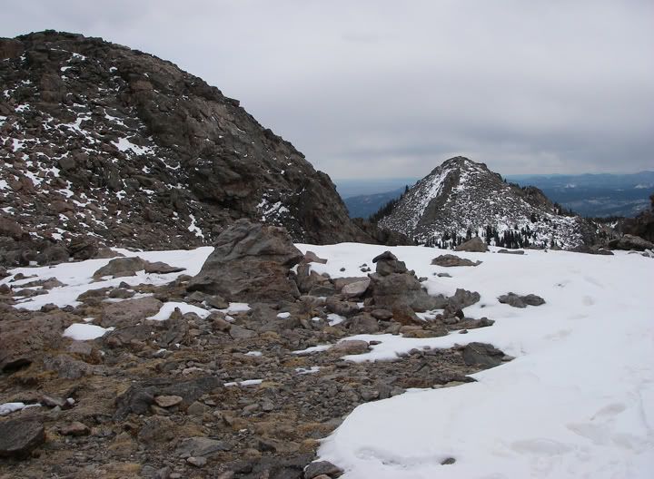
On top of the saddle between the two peaks looking southeast
On top of the saddle between the two peaks looking southwest
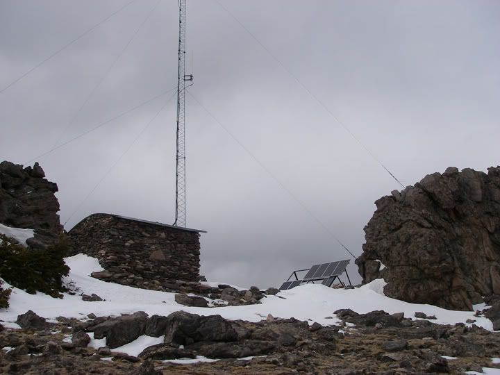
Twin Sisters Electronic Site
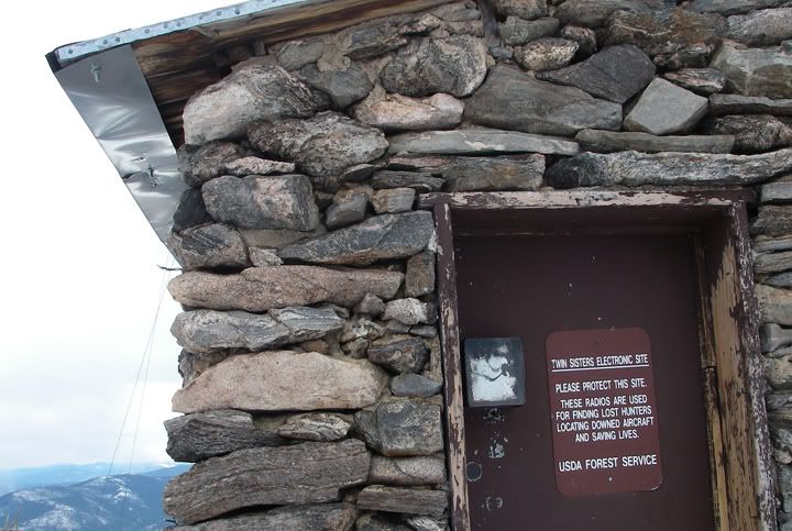
The sign on the door says “These radios are used for finding lost hunters locating down aircraft and saving lives”
Is that a lightening rod?
The scenery was getting more impressive with each step, I could see clearly to the east, north and west from here. As I approached the saddle between the two peaks, I finally got a glimpse of the mountains to the south of Twin Sisters Peaks. It was amazing how much more snow was up here. And how they got that building up here, which appeared to be some radio station.
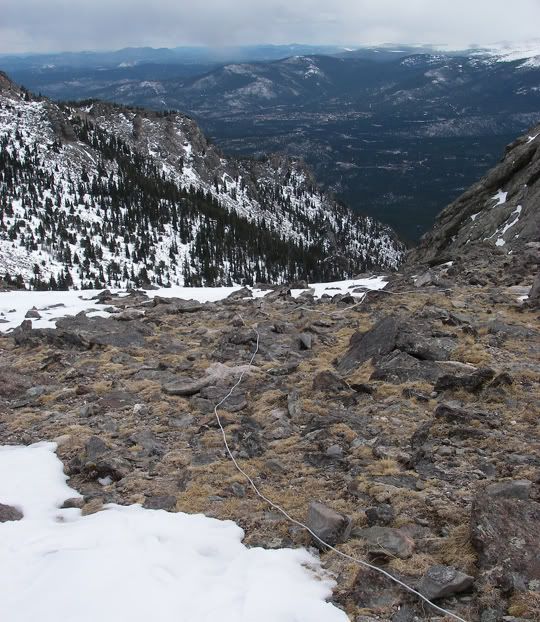
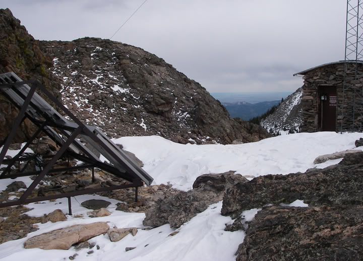
A cable going from the building down the south slope of the mountain
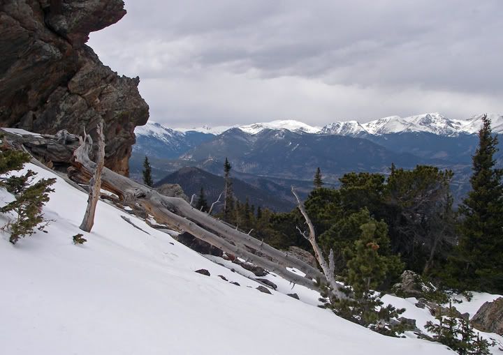
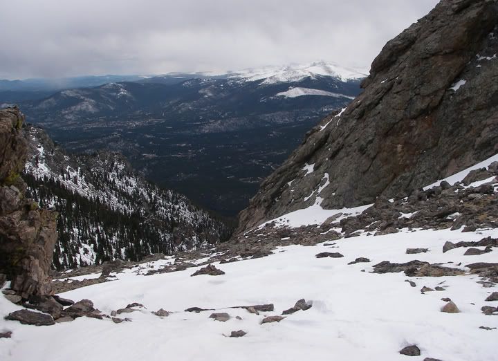
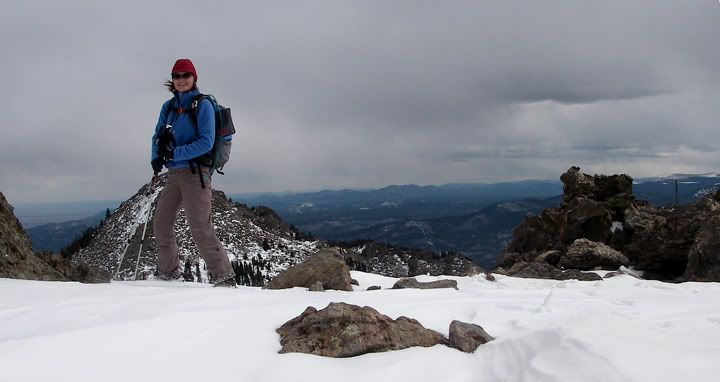
On top of the saddle at around 11,370 feet in elevation, views to the south
The dark clouds were hanging just above me. At times a few small snow flakes would fall down from the sky. Here on top of the saddle it was a lot more windy and the temperature was only in the low 40’s.
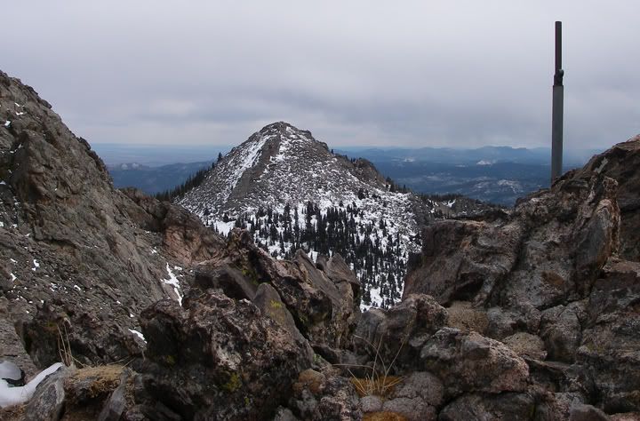
The saddle separates the east (11,428') and west (11,413') Twin Sisters Peaks. From this point cairns mark the way to each summit. The west peak near the research station is easier to get to and to climb. The route to the east peak is harder to find and the climb to the peak is harder also, requiring a steep scramble up boulders and loose rock.
Heading back down, views to the northwest
I wouldn’t make it to the actual peaks today, even though I was standing right underneath the west peak. The saddle between the peaks at 11,370 feet in elevation would be as high as I would get today. Unfortunately by the time I made it to the saddle, walked around to check things out it was almost 4PM and time to start heading back. I was surprised it took me almost 4 hours to get up here, the snow made my progress slower I’m sure. At this point I just wanted to make sure I got off the mountain before it got dark. I would be making another trip up here during summer I’m sure, when the weather was nicer.
As I started to head west I noticed that the clouds were darker now. Maybe this was the rain that was supposed to be arriving this afternoon, at this elevation it would be snow. A few snow flakes started to fall out of the sky again. It was time to go. I only had about 3.5 hours of daylight left, way less here on this trail with huge mountains just to my west.
I was very happy when I saw the sign for trailhead again. The last miles hiking down was hard and I was getting tired. The Yaktrax gave me more traction, especially on the icy sections, but there were still a few snowy sections that made my feet slide out from under me and brought me to my knees.
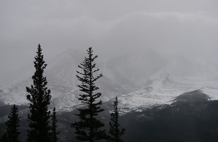
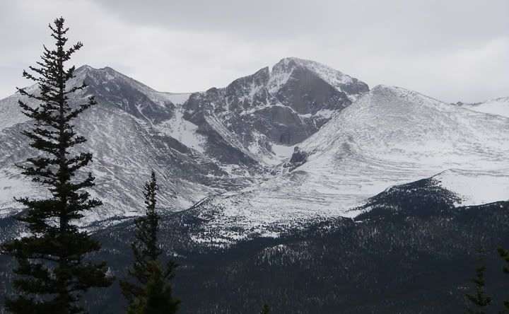
Mount Meeker, Longs Peak, and Mount Lady Washington in the clouds on the way down
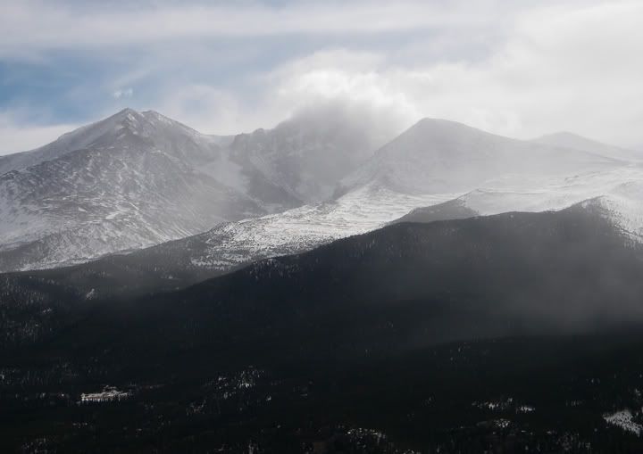
About an hour later the sky is clearing over Mount Meeker, Longs Peak, and Mount Lady Washington
I made it down from the saddle in about 2 hours with some daylight left. All together I hiked about 7.5 miles up 2,330 feet in elevation and I was just 43 feet shy of reaching the western peak. Even though at some point I couldn’t even see Mount Meeker, Longs Peak, and Mount Lady Washington through the dense clouds, now the sky looked to be clearing and I could see brilliant blue sky above the trees. That’s the thing with the weather in the mountains, it can change really quick and predicting it is hard.
Clear blue skies as I get to the start of the trail
Twin Sisters TH elevation: 9,040 feet
Summit elevation: 11,428 feet
Elevation gain: 2,388 feet
Distance: 7.4 miles round trip
Difficulty: Moderate
Grade I (A short day and up to 3,000 feet of elevation gain)
Class I (On the trail all the way to the sumit)

No comments:
Post a Comment