
My alarm went off just a bit after 4AM this morning. I still had a few things to do before driving out to the trailhead. At 5:30AM I was finally on my way. It was still dark outside. This morning I had my usual cup of coffee to wake up, but after that I started to drink water - lots and lots of water to hydrate myself for today’s summit ascent of Mount Lady Washington - my first real big mountain summit hike.
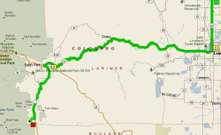
Longs Peak Trailhead located on Highway 7 south of Estes Park
Mount Lady Washington summit sits at 13,281 feet in elevation. The Lady’s neighbor is the very popular Longs Peak, which may just be one of the most popular peaks to climb on the Front Range and in Rocky Mountain National Park. In order to get to Longs Peak one has to hike around Mount Lady Washington, since she’s kind of in the way.
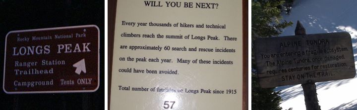
Longs Peak Road Sign (left), sign posted at the trailhead (center), Alpine Tundra signalong the trail (right)
Today I was heading out with a group to climb the eastern face of Mount Lady Washington, which is the harder but shorter route to the summit. This route is considered a grade 2 (A full day and up to 5,000 feet of elevation gain) class 3 (Scrambling, use of hands for balance required) summit hike. The route is approximately 9 miles round trip with 3,891 feet of elevation gain, that includes a scramble up some huge boulders the last 1,600 feet to the summit. Yea, that’s a lot of boulders to climb.
And these boulders, well, they aren’t just smooth boulders that you see on other hikes at the lower elevations. These are talus slopes, an accumulation of broken rock that sit on a steep mountainside. A talus slope could be dangerous because these big sharp rocks are sitting at the steepest possible slope. Some may be loose, a misstep can easily get these large rocks rolling downhill. Stepping with caution is advisable.
So now that I’ve painted the picture of what I was in for, lets get to the hike. I arrived at the Longs Peak Trailhead located just off Highway 7. Even though Mount Lady Washington is located in the Rocky Mountain National Park, you do not have to pay an entrance fee to hike from the Long Peaks Trailhead. There is a ranger station there, a pit restroom and a bit further there is a campsite as well.
I watched the sun come up while parked at the trailhead, waiting for others to show up. It was very cold up here at 9,390 feet in elevation, probably in the upper teens, I was wondering if I had enough layers with me. All the layers I had with, I was wearing right now and I was a bit cold. It would be around 60 degrees in Fort Collins today, much colder near the summit of Mount Lady Washington.
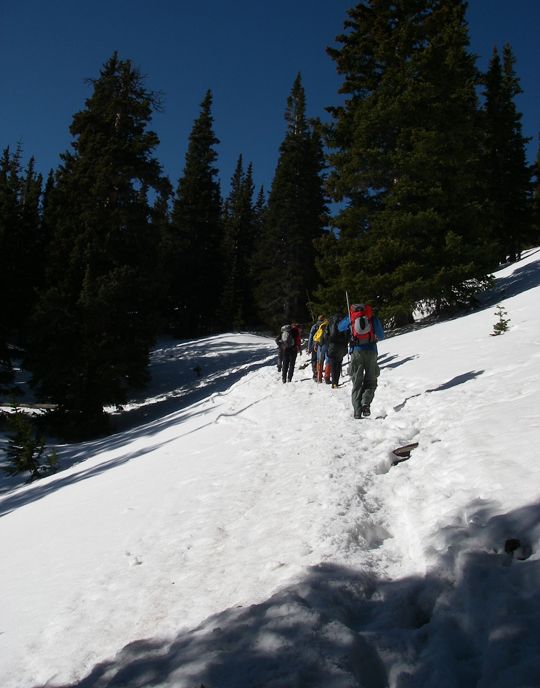
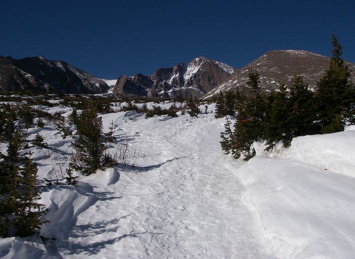
Hiking in some snow on Longs Peak Trail
Parts of the trail were steep
Once everyone showed up, I popped two Excedrin hoping to alleviate any altitude sickness I might get later on today. We got our gear together and just before 8AM we signed in at the trailhead and started hiking. The Long Peaks Trail was covered in snow, but not enough to require snowshoes, which was good because we didn’t bring them. The snow was well packed. The trail climbed and climbed and I had t stop many times to catch my breath. I was glad that I wasn’t the only one having a rough start. With all this exercise it was starting to get warm and pretty soon I was taking off a layer.
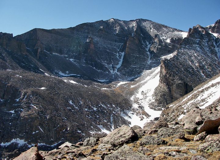
A view of the peaks, Mt Meeker (13,911), Longs Peak (14,259), Mt. Lady Washington (13,281)
Longs Peak in the back, Mt. Lady Washington in the front
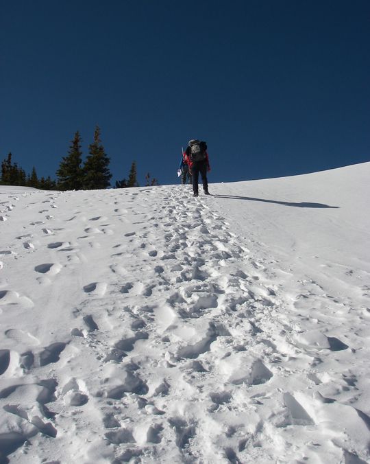
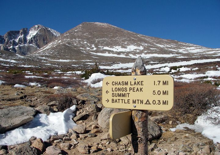
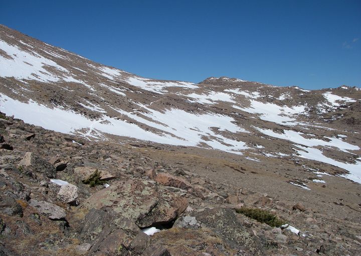
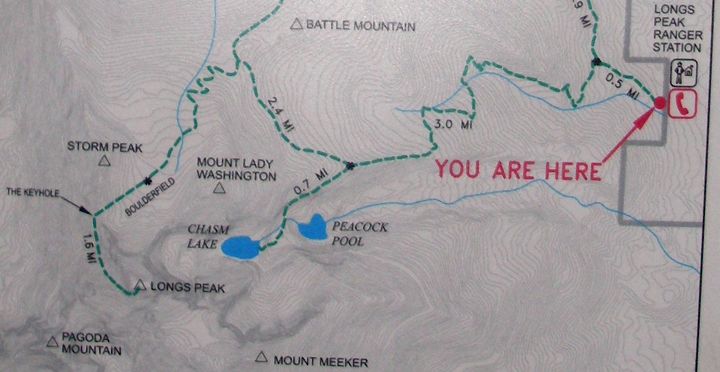
The hiking through snow continued for a while, as we ascended many switchbacks, finally after a while we hiked up past the tree line, what was in front of us was a huge open area, mostly flat, and beyond that a tundra of dry grass and shrubs and small rocks. We stopped for break here at the sign. We were still 1.7 miles from Chasm Lake, but Mount Lady Washington was already in view, not very impressive, looked like a very large round mound. From here it appeared like we would be at the summit in no time, but it was an illusion. Since everything seemed so far away up here, the nearest thing I could see, Mount Lady Washington with Longs Peak to it left, seemed really close.

Mount Lady Washington is just a huge mound of boulders
The boulders start, Mount Lady Washington is on the right
I must say I have never seen scenery and views like these on any of my other hikes. The smaller mountains I have climbed don’t even compare. From here I could see for miles and miles, all the way to the eastern prairie. If this was the furthest I got today, I would be satisfied.
Approaching Mount Lady Washington on the right, Longs Peak in the middle
Getting closer to Mount Lady Washington

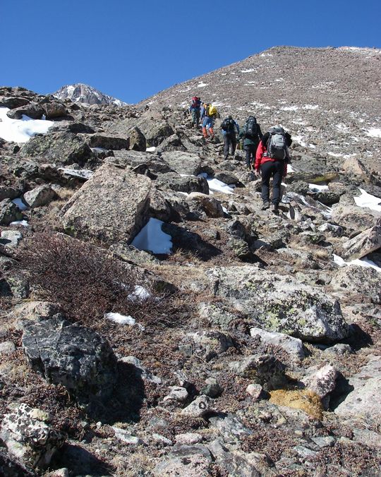
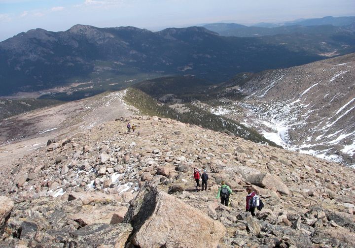
Ascent to the summit of Mount Lady Washington via the eastern talus slope - can you see the 6 people in this picture?
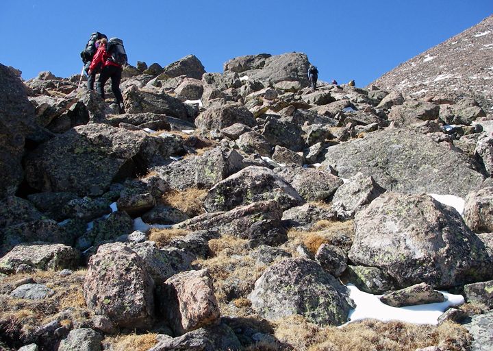
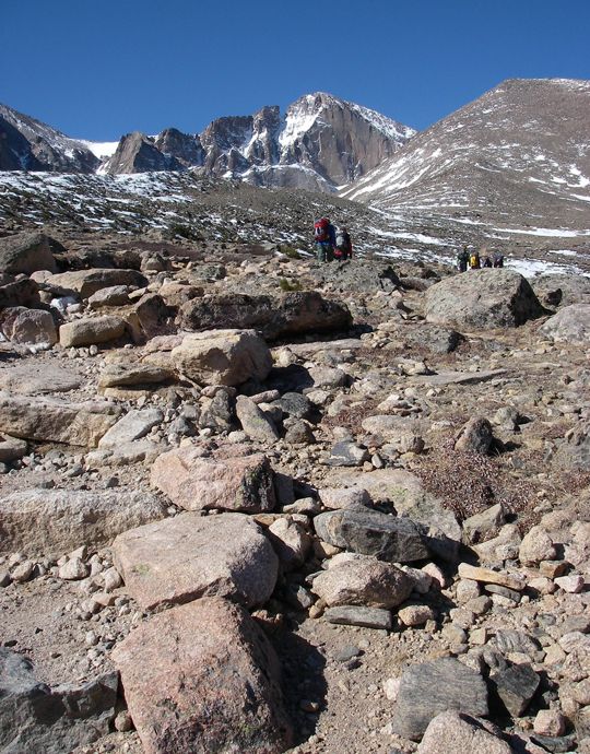
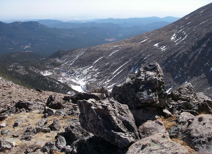
But we kept on hiking toward the large mound in front of us, which didn’t seem to get any closer. Then we stepped off the trail which continued to the right and up. We continued up the small boulders, which turned in to larger boulders, which turned in to huge boulders. I kept looking behind me, the view was just unbelievable. Now hiking at over 11,500 feet in elevation it felt no different to me then at 9,000 feet, I was so glad, or maybe my Excedrin was working. I felt great so far. I wanted to be the last one, this way I could take pictures of the whole group ahead of me. The start of every hike is hard for me, especially when the trail starts ascending right away. I ended up getting a bit behind, but once we got into the open tundra and mostly flat terrain I caught up again. Now having to hike up so many boulders, I was getting behind gain. And the further up we went, the further behind I got. The boulders just kept getting bigger, and harder to get through. There was also snow in between the boulders, since I didn’t know how deep it was, I couldn’t step into it. The higher I got the larger the boulders were, now some of them were the size of cars and even trucks.
I think that line going to the ridge is the Longs Peak trail traveling around to the west side of Mount Lady Washington and furhter to Longs Peak
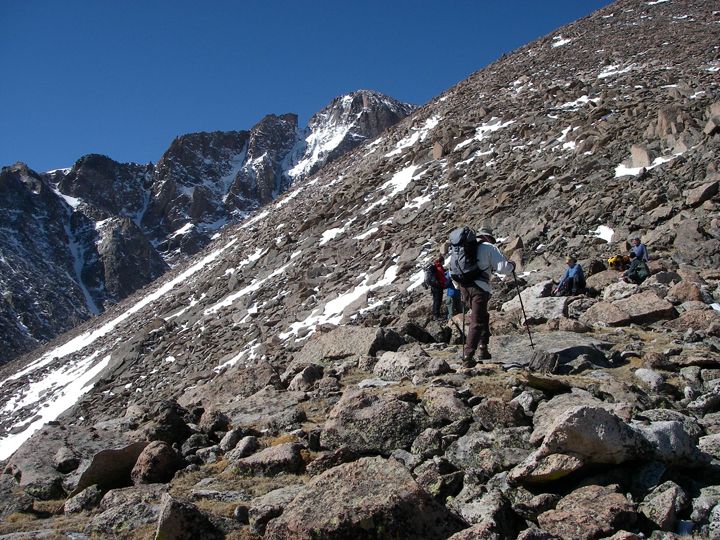
A glimpse of Longs Peak from the east talus slope of Mount Lady Washington
Climbing the talus slope was hard work. So many times I would get stuck, not being able to go further up, and I would have to climb a boulder or two or three down and choose a different route up. I just had a hard time visualizing the route and I didn‘t see any cairns to show me the way. Further up the slope the wind was also picking up a bit.
How much further did I still have to go still? I couldn’t even tell, every time I looked up I still could see thousands of boulders above me. It seemed like they went on forever. Two people from the group noticed that I had a hard time figuring out the route toward the top of the slope and waited for me to catch up with them so they could show me the way. They said I was about half an hour from the summit.
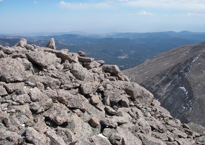
Amazing views from the eastern slope of Mount Lady Washington

The boulders got quite large near the summit, I couldn't even tell how much further to the top
Amazing views just to the south of Mount Lady Washington
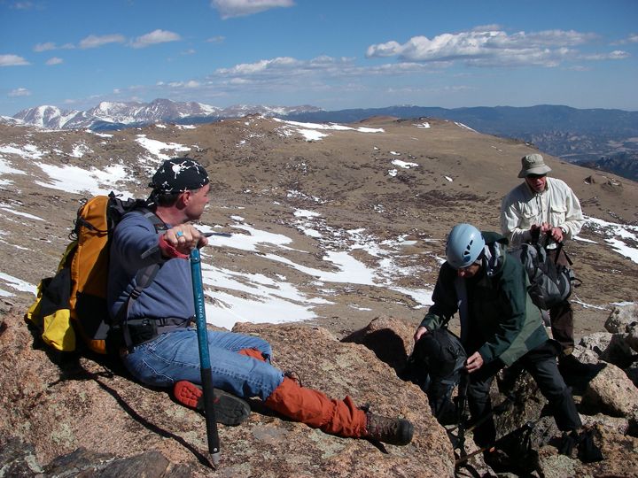
“Step on this boulder, pull yourself up holding this one, step here, jump over there” were the instructions. I followed them and all the sudden I was making progress. All the sudden I was at the top. We walked a bit further to the “actual summit”. There was a register under a rock, one of the people pulled it out and opened the canister, pulled out the piece of paper which I signed. I officially climbed my first 13er… not only did I make it to the summit of Mount Lady Washington, but I did it via the harder Eastern slope.
The summit of Mount Lady Washington

Signing the summit register
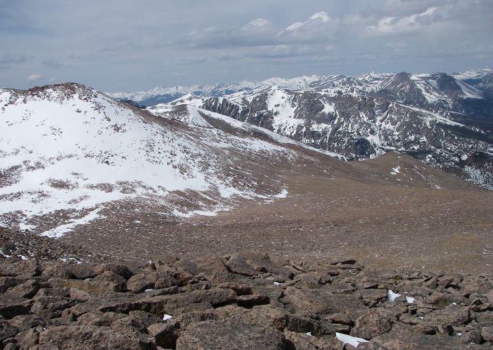
The view from the summit of Mount Lady Washinton, looking northwest
I was really excited but I still had a long way to go before I was done. I continued following the others down, stepping on the exact boulders. One of the girls was pointing to what she said were cairns, but they didn’t look like cairns to me, they weren’t these neat piles of small rocks I’ve been used to seeing on other hikes, here there would be two large rocks or one rock on top of a boulder. At first they looked just like regular rocks, but then I was told to notice the rock’s placement, if they didn’t look natural, they were cairns.

Longs Peak from the summit of Mount Lady Washington

Heading back down
The first hour of climbing down the boulders wasn’t too bad, although my legs were getting tired. These people I was with would “hop” from bouldbr to boulder like bunny rabbits, and here I was doing the butt slide from boulder to boulder trying to keep up. There weren’t too many boulders I was trusting to jump on to. By the time I got to the bottom of the boulders I had to get my trekking poles out, my knees were starting to give out on me. I’ve never had that happen before.
The view to the east from the eastern slope of Mount Lady Washington
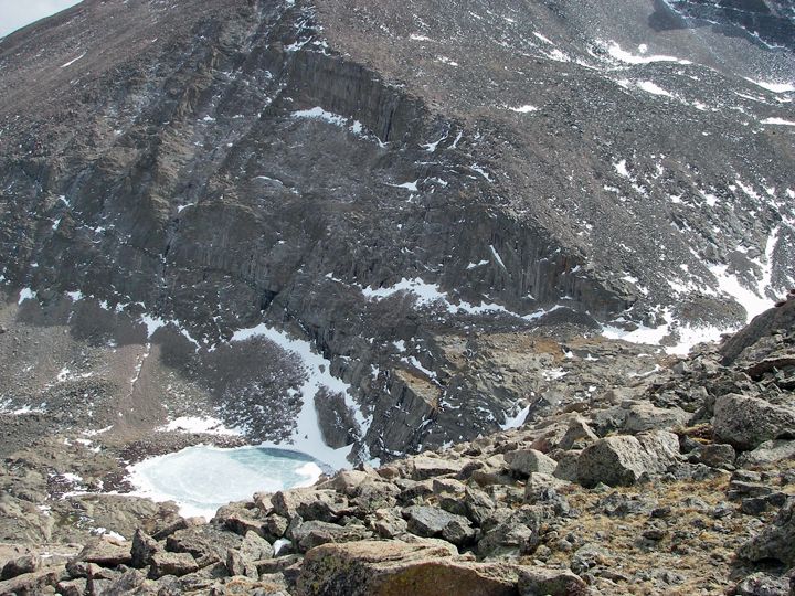
Chasm Lake
The large boulders were behind me, but I still had to get through all the small boulders. It’s been hours since I had a break, I couldn’t wait to sit down. Finally, once we got to the tundra, we took a short break again. The clouds were moving in now, up to this point we had such beautiful weather, blue skies and pretty decent temperatures, in the 30’s and 40’s.
Finally we arrived at the switchbacks covered by snow. The snow was very soft now and I sinking in and slipping at times. Walking in in the snow was harder now then before when the snow was hard. Before I knew it, we were back down in the parking lot. It was 4:30PM.
What a hike! 9 miles and 8.5 hours later I was beyond tired, but not too sore, just my knees - they felt so weak. I ate some breakfast at home at 5AM, a sandwich during the first break and a CLIF bar during the second break. I was starved! I had to stop at a drive-through and grab some for food in Estes Park.
I did drink all the water I brought, all 3 liters of it. I had an extra bottle of water in the car that I was drinking now. Surprisingly I suffered no altitude sickness, whether it was drinking enough water or/and the Excedrin, I was very glad. The hike was hard enough feeling perfectly fine.
Now that it was over with I can say that this was the hardest hike I’ve done so far and I have to admit, I wasn’t ready for a class 3 summit hike yet. But at least now I knew what a class 3 hike was. I’ll be looking to do some class 1 and 2 summit hikes before I attempt a 3 again. The boulders were too many and too much work and I felt like I was just trying to catch up to the group all day. It was still a good time and an experience I will never forget.
The next time I climb Mount Lady Washington - oh, yea, there will be a next time - I’m thinking the easier but longer western route will be better for me, I think that route is rated as class 2 summit hike.
Longs Peak Trailhead elevation: 9,390 feet
Mt. Lady Washington summit elevation: 13,281 feet
Elevation gain: 3,891 feet
Distance from TH to summit via eastern approach route: est. 9 miles round trip
Difficulty: moderate to difficult
Grade II (A full day and up to 5,000 feet of elevation gain)
Class III (Scrambling, use of hands for balance required)

No comments:
Post a Comment