
After doing several hikes at the Rocky Mountain National Park I wanted to check out a different location and one that was closer to home. There were many hiking trails just outside out Fort Collins, the trick was to pick one.
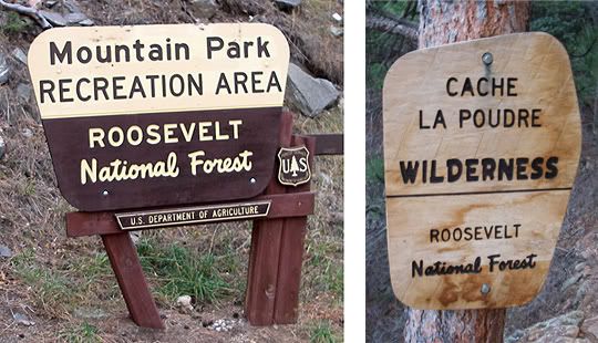
The Kreutzer Nature Trail starts at the Mountain Park Campground in the Cache la Poudre Wilderness area
I read something about the Cache la Poudre Wilderness and wanted to check it out. Located on US 14 twenty one miles west of US 287, a bit further than many of the other trails along the Poudre River and not as popular.
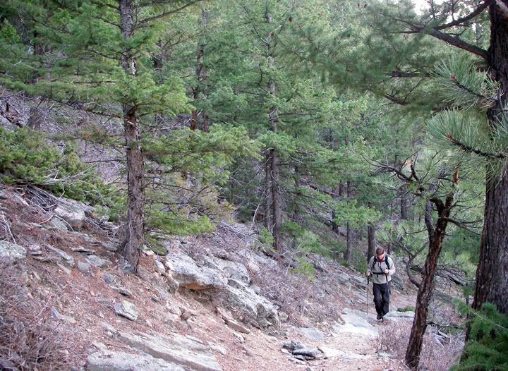
Mike on the Kreutzer Nature Trail
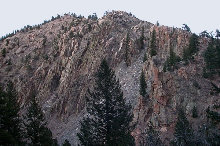
The Cache la Poudre Wilderness is not visited much and the short trail system on the northern slopes of Mount McConnel are the only official trails here. There are two trails. The Kreutzer Nature trail is about 2 miles long, it’s a loop that travels across the mountain at a lower elevation. The Mount McConnel Trail goes to the summit of Mount McConnel and this trail of 3 miles starts on the Kreutzer Nature Trail and forms it’s own loop. The trail head is located at about 6,680 feet in elevation and reaches the peak at 7,960 feet. Unlike the other trails we have been hiking that climbed to 10,000 feet in elevation, where it was much colder, today’s temperature on the trail was close to the temperature in Fort Collins, about 60 degrees.
When I was reading about the trails here I was hoping to do another summit hike, but when we arrived and started hiking we realized that we wouldn’t have enough time to the longer summit trail. It was already in the afternoon and within the first quarter mile we lost the trail and hiked in to the forest having to backtrack. We started hiking at the trailhead and headed west then we would travel east, the end of the trail would take us along the Poudre River and drop us off at the bridge near the river.
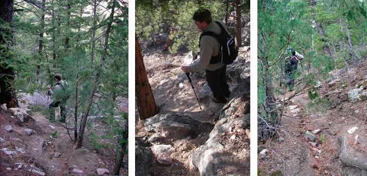
We’ve gotten used to national park trails, meaning, very well maintained, very well traveled trails, also trails with excellent signage. This was not a national park, this was a wilderness area and we probably should have brought a GPS.
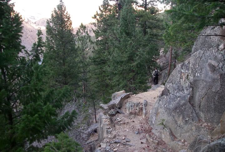
The Kreutzer Nature Trail had interpretative signs along the way that talked about the animals, trees and rocks in this area. The trail started out pretty good but quickly it became narrow. It’s hard to believe that we continued hiking and we weren’t even on the trail, but there were many “trails” here just not the “official” trails.
Here is the dialogue that goes with these pictures: "Where's the trail?" "Is this the trail?" "This can't be the trail" "Ok, we have to go back"
At first we weren’t sure that this wasn’t the trail and we continued about a quarter mile. The hike continued to get more and more difficult and then we realized that we haven’t seen those interpretive signs for a while. We decided to hike back to the last spot where we last saw the interpretive signs.
Nice views from the trail of the mountains to the north of us
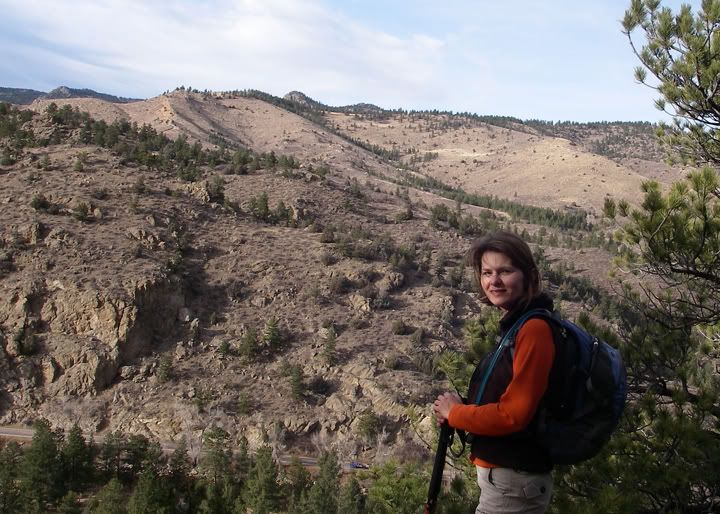
If you look close you will see a car on US 14 below to the left of my trekking poles
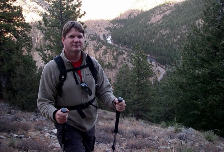
Mike with the Poudre River behind him
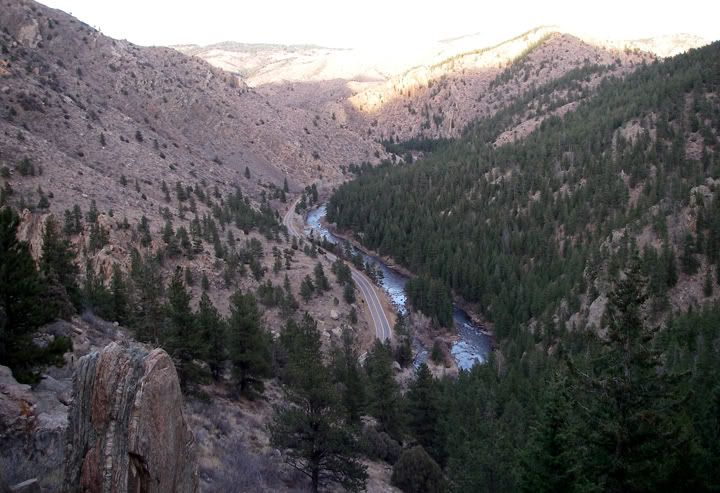
Another view of Poudre River and US 14, aka Poudre Canyon Road
Sure enough, had we looked up, there was the trail. We missed it. We were distracted by a scenic view and two interpretive signs, not realizing that the trail did a switch back and headed up from this large clearing. We continued straight ahead mindlessly probably because after hiking at the Rocky Mountain National Park so many times we got used to following an obvious trail and if the trail deviated there would be a signs posted with an arrow telling is where to go. We realized quickly that here you had to pay attention where you were going, the trail wasn’t always obvious.
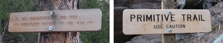
Here is where the McConnel Trail intersects, we continued on the Kreutzer Nature Trail - further east toward the end of this trail we saw this "Primitive Trail" sign posted, the trail here is much rougher than on the west side
Having now hiked an extra half mile through very steep terrain, slipping on small rocks and loose soil we definitely weren’t going to make the summit, at this point we were hoping we could finish the shorter loop at all. In a few hours the sun would be setting.
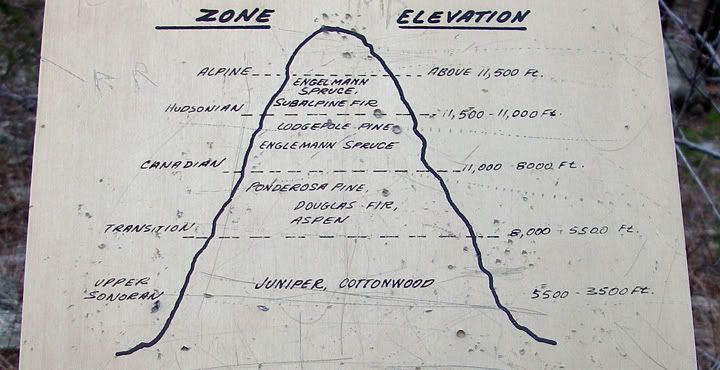
One of the many interpretive signs along the trail, this one shows at what elevation the different types of trees grow
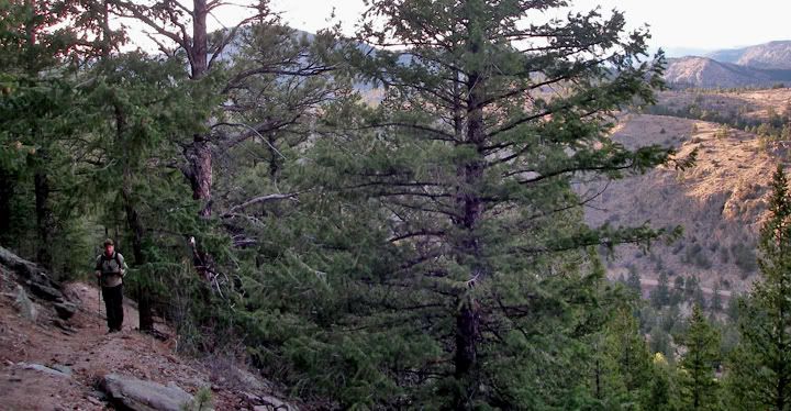
The trail continued through Ponderosa and Lodgepole Pine, Douglass Fir, Juniper and on the drier southeastern side of the mountain there were cactus growing and other desert plants.
The interpretive signs were actually pretty cool, we learned many things like that we could eat the small blue berries from the Juniper trees and that the Douglas Fir tree is the most important tree in the US, more timber comes from this tree then any other tree species.
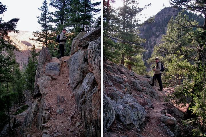
A couple of the many steep sections of the trail
Looking down at the trail
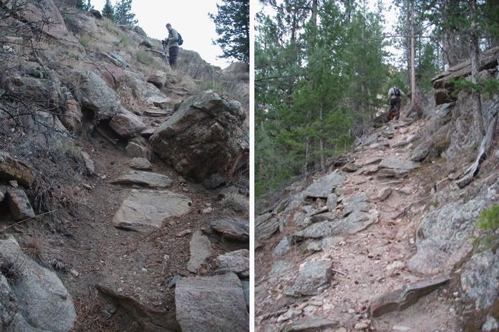
The trail climbs again, these sections are still steeper
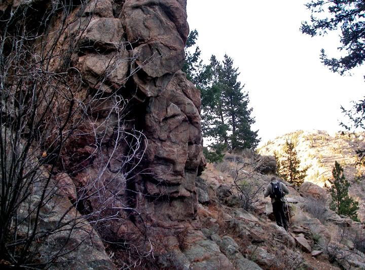
Neat rock formation along the trail
Even though this trail was classified as “intermediate” it much hard harder of a hike then the intermediate trails at the Rocky Mountain National Park. The soil was loose and there was lost of sliding on the steep parts, the trail was rough and the further east we went the rougher and steeper it got. At times the trail wasn’t much of a trail. And from what I read on the internet, the Mount McConnel Trail that heads to the summit is much harder and steeper and less obvious then this trail.
There was another place in the trail that got us confused. It was right at the interpretive sign about the snakes. It looked like the trail went to the left and right but there was no sign telling us where we should go. We went left since we figured that the trail we wanted needed to be heading down to the river, we were right. Not sure where the other trail went, if indeed it was even a trail.
Looking to the west at the Poudre River
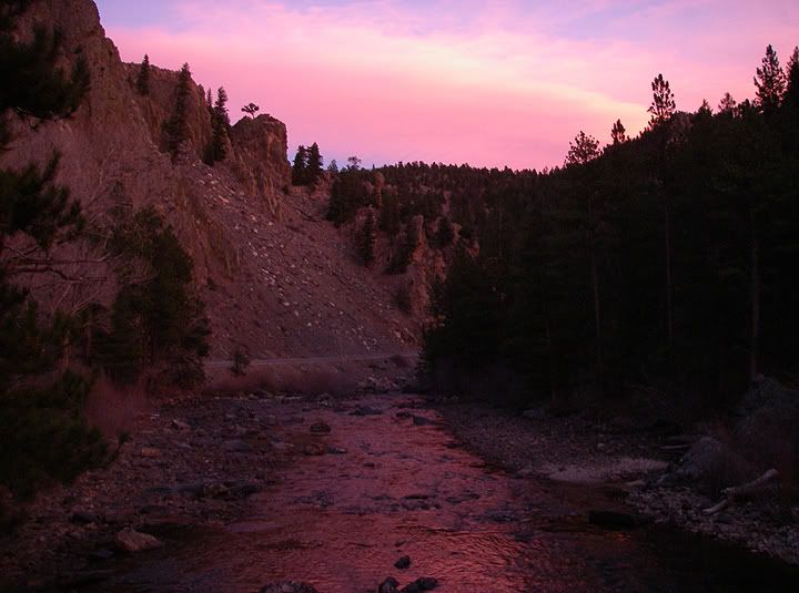
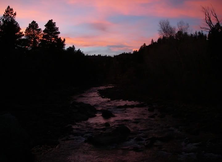
Looking to the east, pink clouds of the setting sun
We made it to river just in time to catch some spectacular views of pink clouds as the sun set behind the canyon. Even though the trail we did was about 2 miles long and we hiked an extra half mile or so, this was definitely a work out.
When we arrived here today the gate to the Mountain Park campground was locked so we couldn’t park in the day use area. I think the campground closes at the end of October. The bathroom was closed as well.
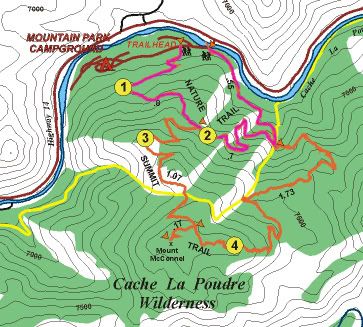
Pink = Kreutzer Nature trail 2 miles
Orange = Mount McConnel summit trail 3 miles
We parked along the Poudre River along with two other cars, but the whole time hiking we only saw one person.
I really enjoyed this trail, it was harder, more of a workout and definitely a trail that I couldn’t have done as easily without the trekking poles. And it reminded it us that even out here on the trails, a person can get lost, so bringing a flash light, some food, extra warm clothing and a compass or GPS is always a good idea. We’ll have to come back one of those days and get up to the summit.

1 comment:
Thanks for the great pics and commentary. Your experience helps me 'see' the trail before checking it out myself.
Post a Comment