
Today we were going to hike to the top of Deer Mountain, one of the easiest mountains to summit at the Rocky Mountain National Park.
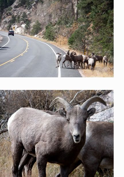
The first few times at the park we hoped to see some Bighorn Sheep, but it wasn’t until two weeks ago driving 34 to the park that I got a glimpse of some sheep on the side of the road of all places. Today we finally got to see the elusive Bighorns.
Silly things were hanging out right by highway 34, playing in the road at times.
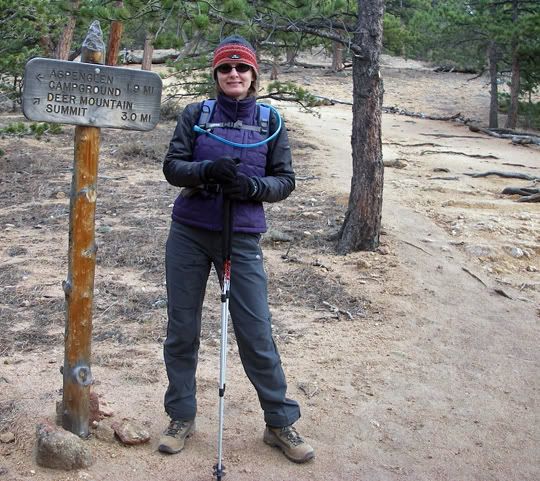
At the trailhead
The Deer Mountain trailhead sits at 8,930 feet in elevation, the summit of Deer Mountain is at 10,013 feet. The 3 miles of trail in between the trailhead and summit, climb 1083 feet in elevation.

Mike at the beginning of the trail among the Ponderosa Pine

The beginning of the trail is easy

I’d categorize this hike as “intermediate” but when searching for information about this trail I also saw it categorized as “difficult” and “easy“.

Beautiful views from the trail, I think those are Lodgepole Pine trees I'm standing next to
The 6 mile round trip hike took us 5 hours complete. I think the actual hiking time was only about 4 hours, the rest was stopping for pictures and lunch at the summit.

Mike with a scenic backdrop

Looking back at the rocky trail I just hiked

More rocky trail ahead of me

Very rocky section of the trail
There was no snow what so over on this mountain which is odd because two weeks ago we hiked to Emerald Lake located at 10,080 feet in elevation and there was already snow on the ground as low as 9,500 feet in elevation. Must be the location.
Today forecast was in the upper 50’s in town, on the trail the temp was in the mid 40‘s. By the time we reached the summit our thermometer was reading 42 degrees and by the time we finished the hike at 5PM it was 40 degrees.
 I brought two additional layers today, but held out from putting them on as we started the hike even though I was cold. I was glad I wore my thicker fleece gloves today, my fingers were cold. Within 30 minutes of hiking I was comfortable, my body temperature warmed up quite a bit as I was hiking, well, climbing in elevation, my heart pumping blood in to every corner of my body. Even though the body gets warm during the work out, the head stays cold. And the cold wind hurts my ears so I have to wear a hat.
From the trailhead the trail starts climbing through an open field, then the switch backs start and the trail continues through trees all the way to the summit. The last .02 miles to the summit is the most strenuous. I lost my breath a few times and my heart was pounding all the way up the steep rock stairs to the summit.

Steep stairs to the summit

Success! We made it to the summit of Deer Mountain

Mike at the summit with Longs Peak behind him


That's Estes Park behind me
There are amazing views along the way that stopped me in my tracks. From the trail there are awesome views of Longs Peak and Ypsilon Mountain.
Click on the above image to see a short video from the summit
The summit of Deer Mountain is small and since there aren’t too many trees at the top you get a awesome 360 degree view of the surrounding area.

A summit lunch: home made sandwich with deli turkey, havarti cheese and honey mustard

Back on the trail heading back down

These evergreen trees are dying that's why they have red needles instead of green


Nice orange rock formations near the trail
While hiking I wasn’t cold at all, but the minute we sat down on some rocks to eat the sandwiches we brought with us I got very cold and had to put on one extra layer. I kept that additional layer on all the way back down the trail since the temperature was dropping and heading down the trail wasn’t as big of a workout as heading up the trail.

That's Mike in the lower right corner

Mike ahead of me on the trail
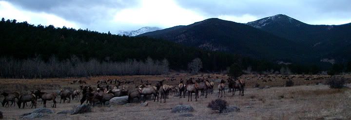
We've been to the park so many times but we've never seen so many huge herds of elk like today
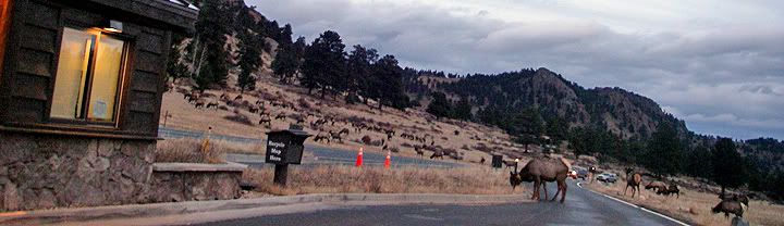
Huge herds of elk, these guys were near the entrance to the park

Deer Mountain Summit trail (high-lighted on the map)
Trailhead: 8,930 ft
Summit: 10,013 feet
Elevation gain: 1083 ft
Length of trail: 3 miles one way

No comments:
Post a Comment