
I’ve been hiking and snowshoeing a lot lately and I was ready to see if I could do a longer hike. There are a lot of hikes out hereon the Front Range that are 10-16 miles long. I’d like to be able to do those as a day hike.
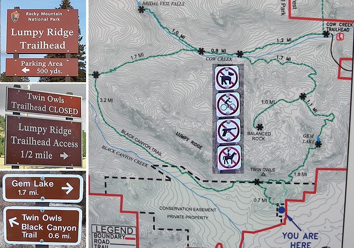
The old Twin Owls Trailhead is closed now, the new Lumpy Ridge Trailhead with a large paved parking lot and pit toilets is located at Devil’s Gulch Road and Lumpy Ridge Road just 1/2 mile east of McGregor Ranch
After searching on the internet for possible longer hikes I found a really detailed hike report and I decided this would be the one. The hike would start at the Lumpy Ridge Trailhead just east of the Rocky Mountain National Park and north of Estes Park.
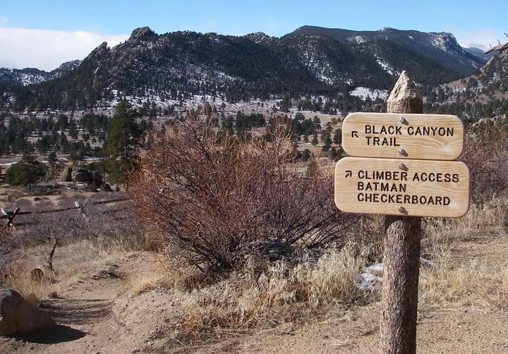
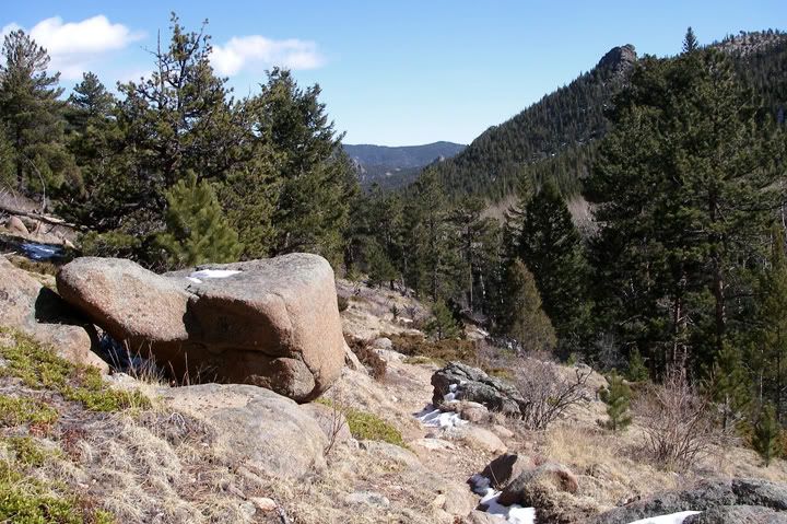
Black Canyon Trail and the views to the west
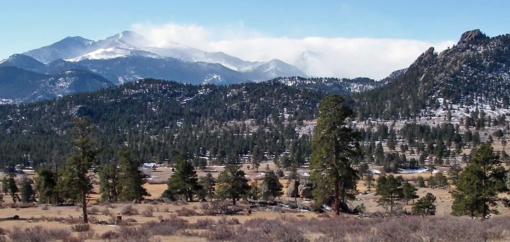
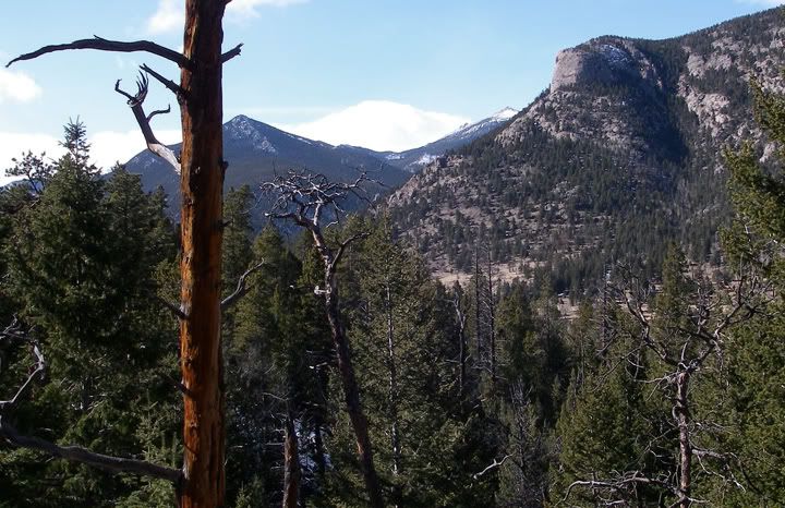
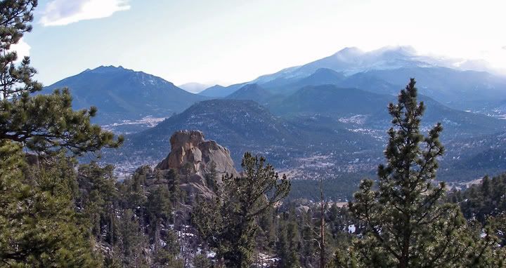
The tall peaks of the Rocky Mountains in the south viewed from the Black Canyon Trail
This hike would consist of multiple trails that would make a loop 11.1 miles long and with the total elevation gain of about 2100 feet. The Lumpy Ridge trailhead is located outside of Rocky Mountain National Park so no fees are required even though the actual trails travel inside the RMNP. Consistent with all the other trails that I have been on at the RMNP, the trails here were very well marked as well.
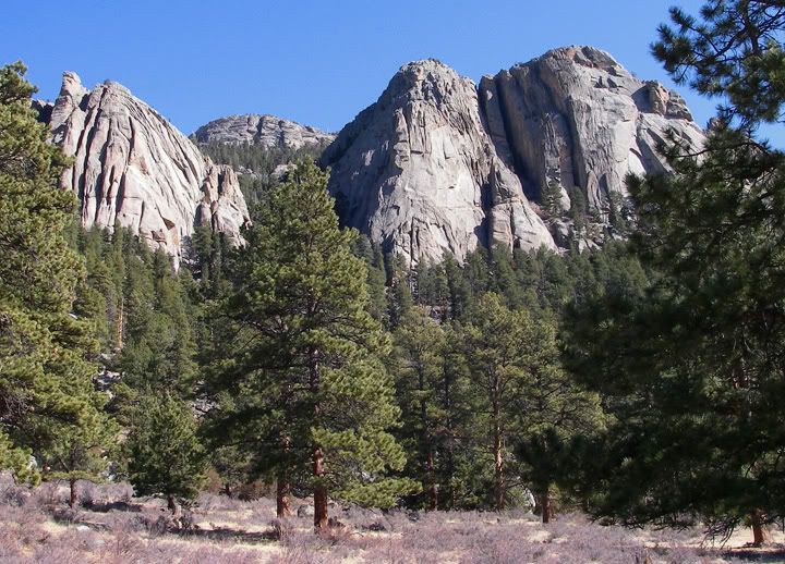
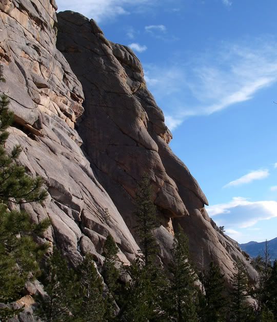
The big rock on the right is called the Twin Owls
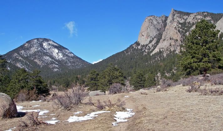
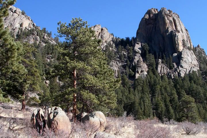
Lots of open space on the Black Canyon Trail
I started out at 10AM and hiked west from the Lumpy Ridge Trailhead past the Twin Owls, a pair of gigantic rocks that look like two owls. Actually from the trail they don’t look like owls as much as from the corner of highway 7 and 36 in Estes Park especially when the sun gets low on the horizon.
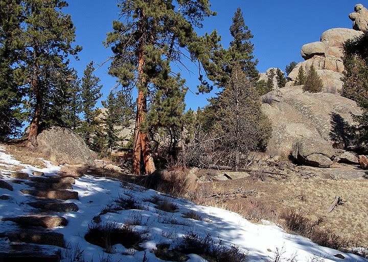
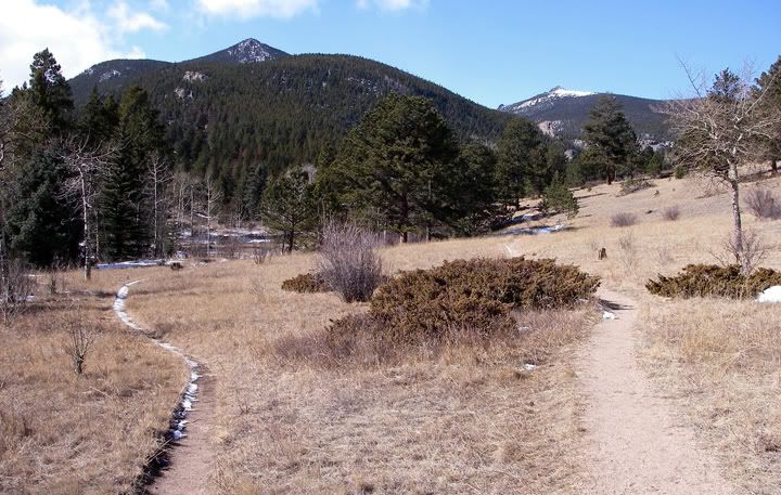
Starting to climb on the Black Canyon Trail
Lumpy Ridge is better known as a rock climbing destination, but Lumpy Ridge is also a mountain toping out 10,068 feet in elevation. I’m sure these trails here get lots of visitors during the summer months but today it was rather chilly and windy, the temperature never got over 35 degrees, so the trails were mostly empty.
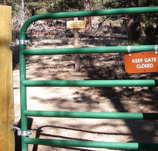
You have to enter through this gate to continue the hike, the sign behind the gate says "Entering Rocky Mountain National Park"
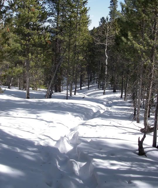
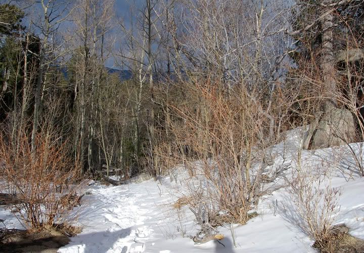
Lots of snow on the Dark Mountain Trail
The hike up the Black Canyon Trail was windy but sunny, as this part of the trail travels through an open area. Once this trail connected with the Dark Mountain Trail, I was in the shadows of the trees and there was quite a bit of snow on the ground. Not enough for snowshoes, so I‘m glad I didn‘t bring them. My feet did get a bit cold and I could have used a second pair of socks during this part of the hike. This is the highest part of the loop. Once I got on the Cow Creek Trail heading east, I was hiking in the sunshine again and there was no snow on the ground. On the Dark Mountain Trail I was heading down hill and the Cow Creek Trail was mostly level with some downhill. It was a nice break and I was making great time here.
The snow disappears toward the end of Dark Mountain Trail
The trail on the left is the Dark Mountain Trail where I came from (looking west), the trail on the right goes to Bridal Veil Falls
Finally turning on to the Gem Lake Trail
High on the Gem Lake Trail looking towards the northwest
Dark clouds chasing me on the Gem Lake Trail (looking north)
Once I turned on to the Gem Lake Trail it was uphill again and there was snow on the ground again. Parts of the trail was covered in ice, which slowed me down a bit. I have to admit that by the time I started hiking the Gem Lake Trail I was already kind of tired and having to climb back in elevation was even more tiring. I was so glad I had my trekking poles with me.
I was looking forward to getting to Gem Lake and finally stopping to take a break. My feet were cold again as I hiked in the shadows and in the snow and now there were dark clouds looming behind me and I would not have been surprised if it had started snowing.
After hours of hiking I finaly made it to Gem Lake (looking south)
Finally after so many hours I was relieved to see the sign for Gem Lake, although this meant I still had 1.7 miles to go, but at least it was all downhill from there.
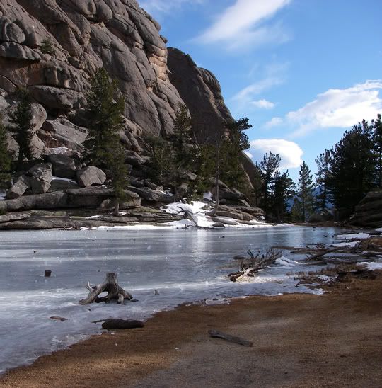
Gem Lake - the north shore
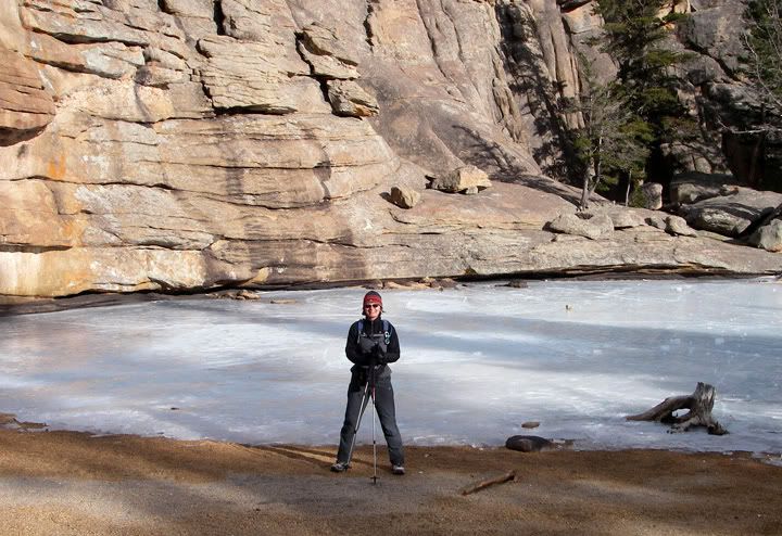
Posing in front of Gem Lake
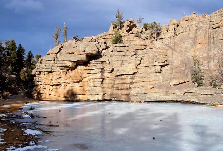
Gem Lake itself was beautiful. It‘s a very small lake, more of a pond really, it was frozen solid now. Surrounded by a wall of rocks of many different shapes and size on one side and a beach of loose sand on the other, it almost looked like it was man-made. The wind was blowing hard here and it was getting late so I decided not to take my long awaited break and pushed forward.
Neat looking rock formations on the Gem Lake Trail
The view from the Gem Trail all the way to the Lumpy Ridge Trailhead was amazing. At the higher elevation you could see the many mountain peaks in the south and west, now backlit by the setting sun. A bit lower on the trail there were a couple of places where you could see the whole town of Estes Park. I’d have to say that this part was the most scenic of the whole loop and unfortunately I was too tired to take many pictures, so I think I’ll have to come back here again just for the hike up to Gem Lake.
Looking south from the Gem Lake Trail
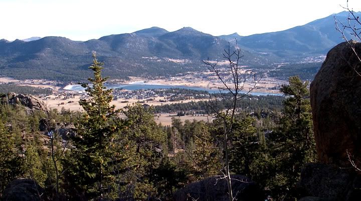
That's Estes Park down there
Just before 5PM I arrived in the parking lot, where I finally got to sit down and eat the lunch I bought with - which was now my dinner - a sandwich and a some warm green tea.
The hike was great, although I’m sure it would be a lot easier to hike the trails without all the snow. As I spent the evening lounging in my pajamas on the couch a bit sore from the hike, I was content with my new hiking record of 11.1 miles.
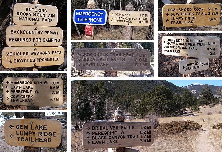
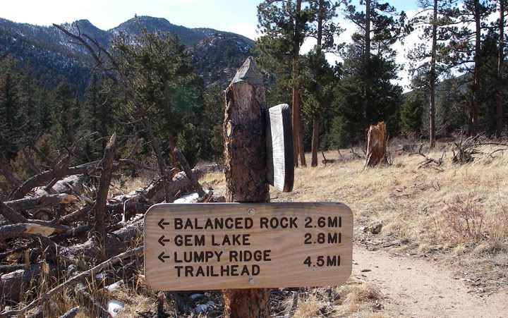
There were lots of signs to follow on this hike, but as long as you follow the signs and know where you want to go, it's very easy to navigate
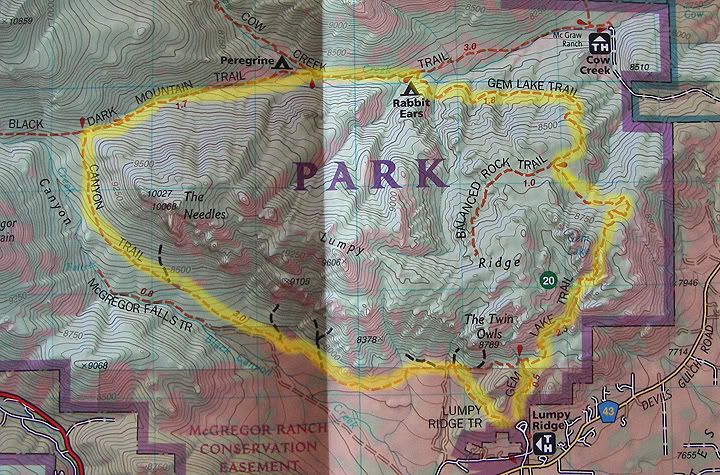
My 11.1 mile route around the Lumpy Ridge: Lumpy ridge to Black Canyon to Dark Mountain to Cow Creek to Gem Lake Lake Trail
Trailhead elevation at Lumpy Ridge: 7,920 feet
Gem Lake elevation: 8,830 feet
Highest point on the trail: 9,139 feet
Total elevation gain: about 2,100 feet (there are two sections where you climb in elevation on this loop)
Distance: 11.1 miles
Difficulty: Moderate

No comments:
Post a Comment