
This three day trip was a kind of a continuation of the big ride Dalton and I took last week. We kind of cut the route short after experiencing lots of rain in Utah. We were running out of time and knew that we weren’t able to ride whole original route. We made some adjustments in the route and ended up cutting out the Colorado National Monument even though we rode right by it, it would have cost us some 3-4 hours which we didn’t have. We also ended up cutting out highway 149 which we were supposed to ride on our last day.
So pretty much even before our big ride ended we had already started to think about the next few rides. The ride out to the Colorado National Monument, we might do over Labor Day Weekend and the ride out to highway 149, we are doing this weekend.
Since I didn’t have very much time to plan an elaborate ride for this weekend with only having been back in town for 4 days from my big trip, starting a new job, moving and working on the ST3 prior to this trip, the route was simple. Even though I was just there a couple of weeks ago, we chose Gunnison as our destination for a few reasons. First, we knew we could find camping around Gunnison. Second, highway 149 was just south of Gunnison. Third, one of Dalton’s favorite restaurants is in Gunnison and we could eat there if we could find a place to camp near Gunnison.
The plan was to find a campground near Gunnison and camp there Saturday and Sunday and ride highway 149 as a day ride on Saturday. Dalton found a private campsite for us to stay at just north of Gunnison. Neither of us had been there before but it sounded really nice and had all the amenities we were looking for.
So Friday morning we rolled out of Loveland and headed west on highway 34. The plan was to ride through Rocky Mountain National Park which I wanted to do with Sandy but since Scott had his chain issue on our trip we couldn’t leave early enough and the traffic at the park gets bad, so it takes a while to get through it.
As we headed on highway 34 up to Estes Park, the traffic was already getting bad. Then the rain started and I had to pull over in Estes Park to get my rain gear on. At this point I was a bit concerned since rain in Estes could easily mean that it was snowing on Trail Ridge Road at Rocky Mountain National Park. Trail Ridge Road get up to 12,183 feet in elevation. We decided to continue.
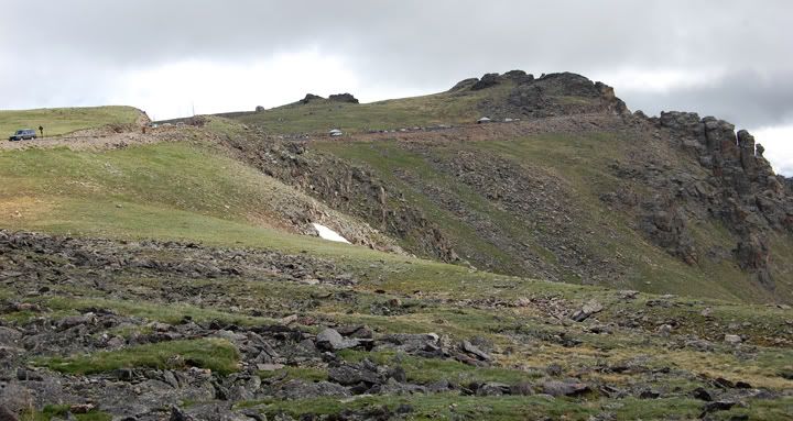
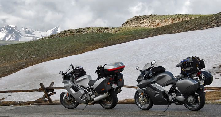
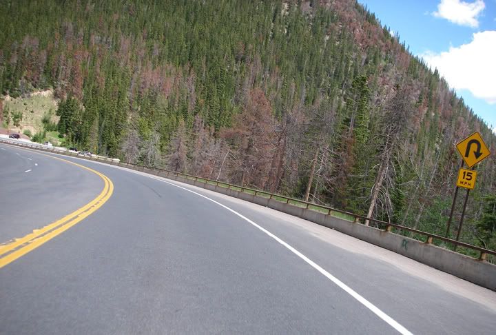
Trail Ridge Road at Rocky Mountain National Park

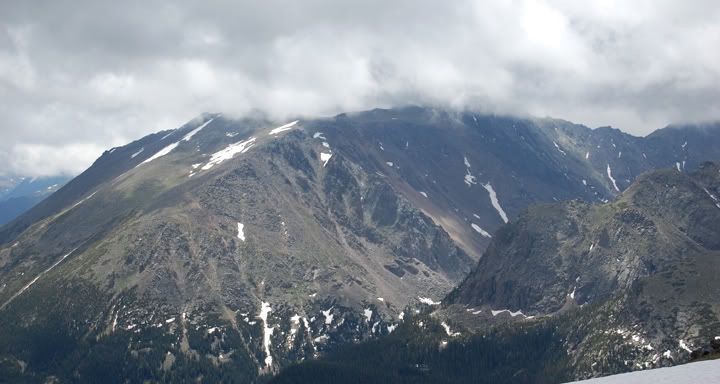
Views from Trail Ridge Road
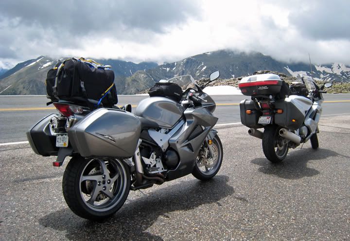
We only stopped one time in the park for some pictures
Same spot different views
Dalton took this picture with his camera
We knew it was a holiday weekend and we expected the traffic to be bad through the park. And it was. The road through Rocky Mountain N.P. is a great motorcycle road with many twists and turns but when you have an endless caravan of slow cars in front of you, all you can do is enjoy the scenery and that is what we did.
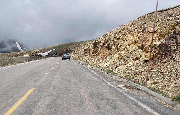
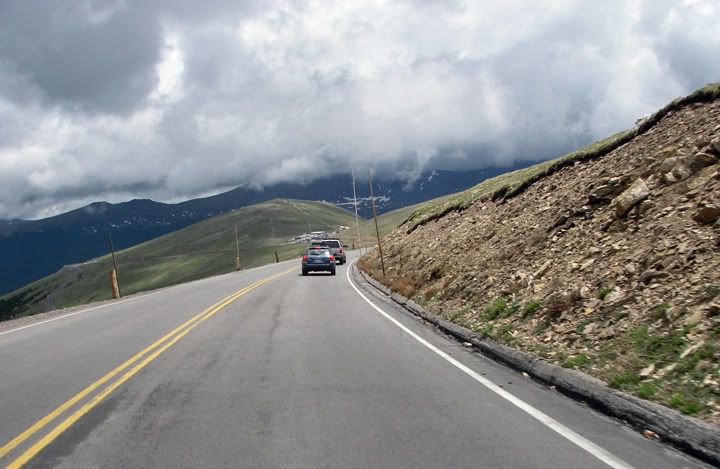
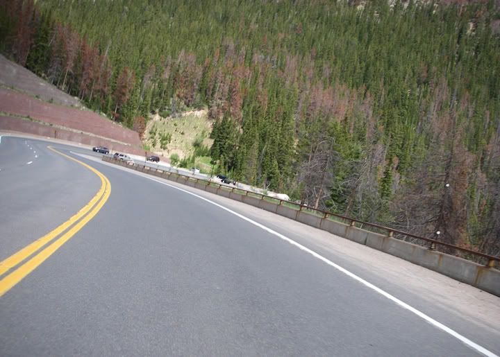
Trail Ridge Road

Trail Ridge Road is usually paved all the way through the park, there was some construction going on
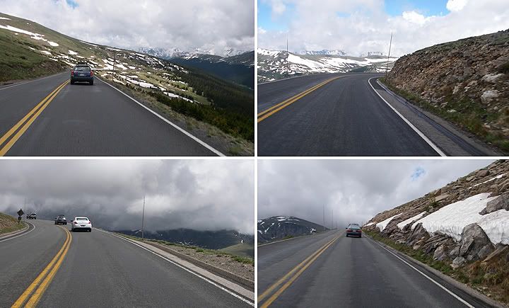
More Trail Ridge Road
Trail Ridge Road - pavement ends
It rained off and on at the park, not too bad. We had made it to the west side of the park with not too much delay and then all the sudden we came to a complete stop. We turned the bikes off and waited and waited. Every 7-10 minutes or so the cars would creep forward a bit but the process was slow. Half an hour later we had finally moved up enough to see what this delay was all about. There was road construction in the park and there was a traffic light placed to direct traffic on a portion of road that only had one lane open for both directions. Since the light took forever to turn green, vehicles would turn off their engines and when the light turned green only 3-4 vehicles would manages to get through before the light turned red again.
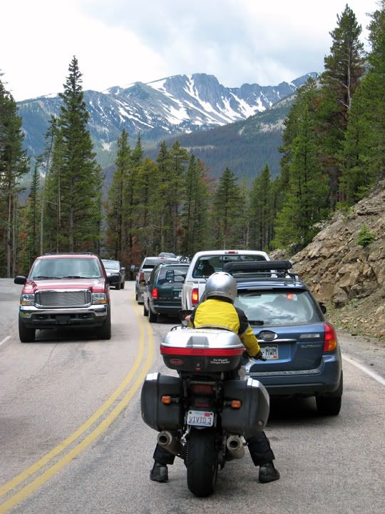
Major construction delay on Trail Ridge Road through Rocky Mountain National Park
We finally got past the traffic light and were glad that the construction delay was over with. Then we noticed more orange signs along the road and then I caught a glimpse of the most dreaded construction sign - the “pavement ends” sign. How bad could it be though, this was a national park. And why didn’t the ranger at the park’s gate tell us about the construction, we were on motorcycles for Pete‘s sakes. The pavement ended and a dirt road continued for about 15 or more miles. The first few miles were not too bad but as we caught up to slow vehicles which we couldn’t pass, the ride became not so pleasant. On dirt or gravel I like to keep moving, I don’t like to ride slow or stop. The road also started to deteriorate with many ruts and pot holes to navigate through. I don’t have any pictures of the really bad sections because I had to keep both hands on the handle bars and not be messing with the camera while I ride. Meanwhile it was also drizzling off and on.
We finally got past the traffic light and were glad that the construction delay was over with. Then we noticed more orange signs along the road and then I caught a glimpse of the most dreaded construction sign - the “pavement ends” sign. How bad could it be though, this was a national park. And why didn’t the ranger at the park’s gate tell us about the construction, we were on motorcycles for Pete‘s sakes. The pavement ended and a dirt road continued for about 15 or more miles. The first few miles were not too bad but as we caught up to slow vehicles which we couldn’t pass, the ride became not so pleasant. On dirt or gravel I like to keep moving, I don’t like to ride slow or stop. The road also started to deteriorate with many ruts and pot holes to navigate through. I don’t have any pictures of the really bad sections because I had to keep both hands on the handle bars and not be messing with the camera while I ride. Meanwhile it was also drizzling off and on.
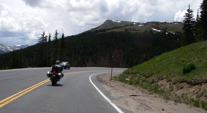
Dalton on highway 40
The twisty highway 40 south of Winter Park
In real life it's much steeper than this
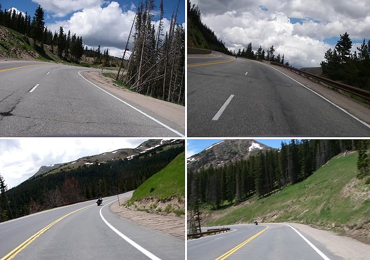
More highway 40
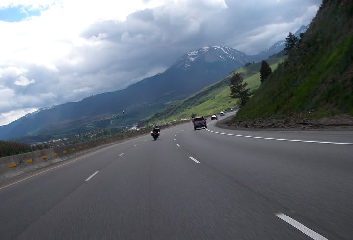
I-70 west of the Eisenhower Tunnel at 11,158 feet in elevation
The pavement started back up at the west gate to the park. We turned on highway 40 and headed toward the interstate. Highway 40 just south of Winter Park gets really twisty. I’m talking about 15 MPH curves. It’s a fun road when you can get it all to yourself.
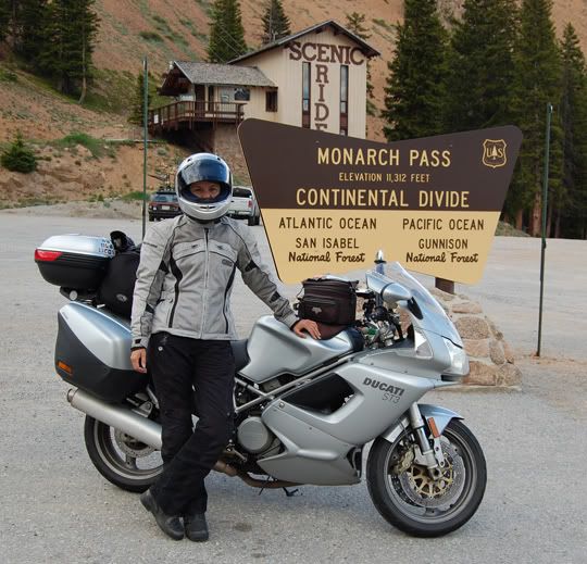
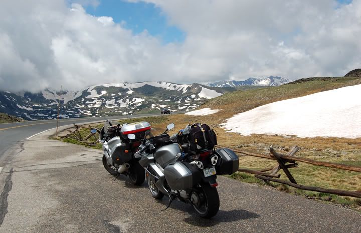
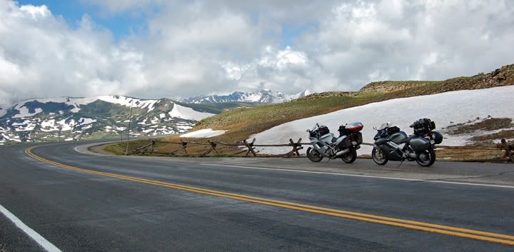
Monarch Pass on Highway 50 at 11, 312 feet in elevation
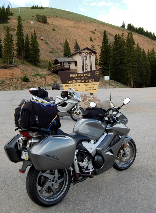
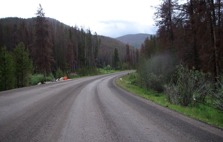
From 40 we jumped on I-70 and headed west. We stopped for gas and a quick lunch at Subway. After lunch we continued west on I-70 until we reached the exit for highway 91 south. Before the town of Leadville highway 91 ends. We continued south on highway 24 and then stayed on highway 285 and turned west on highway 50. Its seems like I’ve been this way so many times already. We actually made some good time and before we knew it we were rolling through the town of Gunnison. In the center of town we turned north on highway 135 and rode a few miles to the Tall Texan RV Park and Campground located on CR11. CR11 is paved but none of the roads through the Tall Texan campground are but they are hard packed dirt, not gravel. Even though the Tall Texan is mostly an RV park. There are a few tent sites located on the other side of the campground, away from the RV's. We were pleasantly surprised. This was a very nice campground.
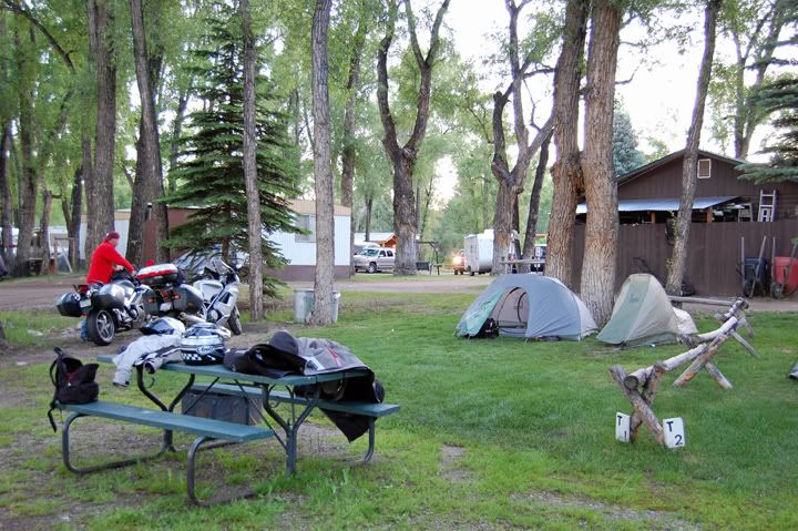
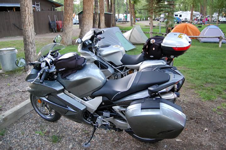
Tall Texan Campground just north of Gunnison
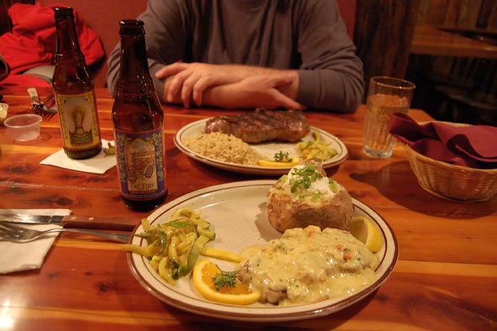
Dinner at the Trough in Gunnison - I had fish Dalton had steak - fantastic food
We quickly set up our tents and unpacked. Then we rode back out to Gunnison to a restaurant called the Trough, which is on highway 50 just west of Gunnison. The food was great. By the time we made it back to the campground it was dark and we were beat.
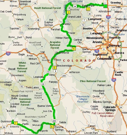
Our 320 mile route today: Highways 34, 40, I-70, 91, 24, 285, 50 and 135

3 comments:
The last weeks have been a treat! Great photos, great posts. Thanks for posting so much, especially as we enter 'no ride season'.
I traveling to Ft. Collins for lectures this week...can you guys do lunch on Thursday? Consider it a form of payback for the entertainment over the years?
Gunner,
I'm glad you're enjoying the new posts! I'm still very behind, which means there are many more trips to write about still.
Shoot me an e-mail at excessivelocity@gmail.com - I might be able to get up to Fort Collins on Thursday.
Anna
I love riding through RMNP. I have not ridden HWY 40 south of Granby yet I have driven it in a car, but that has been 7-8 years ago. I have been on 125 to Walden.
I love that area.
Good blog. I look forward to reading more.
Some friends and I will be riding through Estes & RMNP this July on our way to Yellowstone.
Post a Comment