
The XT225 hasn’t had a workout in a while, so CJ and I decided to head out and ride some dirt roads today. The goal was to ride all of Crown Point Road, since two months ago I didn’t get to ride all of it because it was raining, which made it pretty cold at higher elevations.
This was going to be an interesting ride since CJ doesn’t get to ride much on the dirt roads, he’s more of a single track rider - the more technical the better. Where I prefer non-technical dirt roads.
Today seemed like a nice day, it was a bit overcast but the temps were very pleasant in the low 70’s. Unfortunately as headed in to the mountains we encountered darker clouds, drizzle and much cooler temps. We rode the curvy but paved Stove Prairie Road. Then turned off on Buckhorn Road - the first dirt road of the day. From Buckhorn we took Monument Gulch Road. I have never been on this road before, but I’ve read ride reports about it and it was on my list of roads to ride.
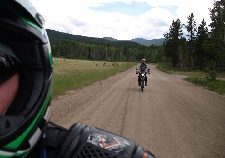
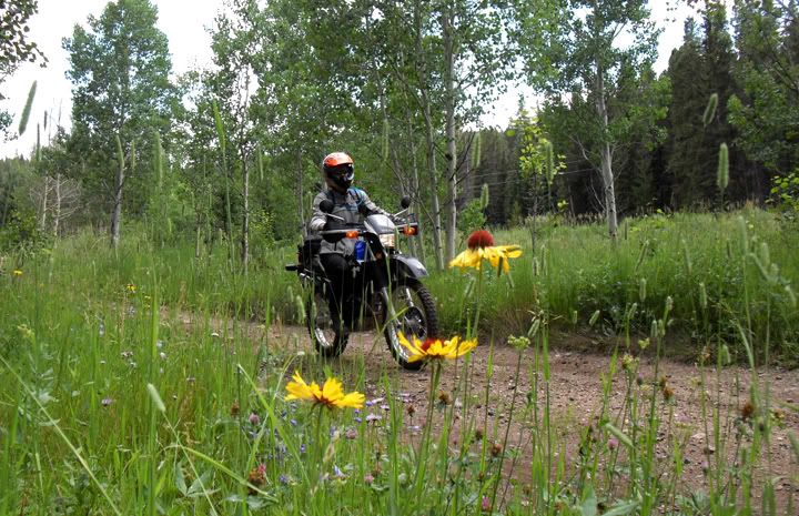
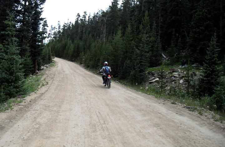
Chasing CJ on Buckhorn Road
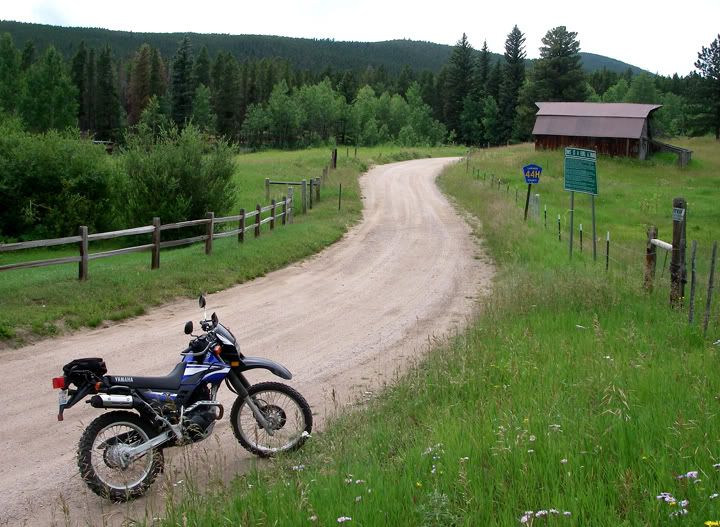
This is Buckhorn Road (44H) at Monument Gulch Road
Buckhorn Road made be very twisty, but it’s a wide dirt and gravel road with only one section that is a little rocky and bumpy. Cars have no problem driving on Buckhorn and I have taken my Acura RSX-S on it before. Monument Gulch on the other hand is more of a 4X4 road. From Buckhorn Road, Monument Gulch Road climbs for a bit, but then it’s downhill all the way to Pingree Park Road.
Just a few minutes of riding Monument Gulch and I was already getting myself in to the trouble. Riding the up hill section, rode over a huge wet rock, not sure what happened next but I almost ended up dumping the bike. After I got that over and done with early on, the rest of the ride on Monument Gulch went without any more incidents, although the road required my full concentration since there were lots of sections with rocks, tree roots, puddles and large holes. Monument Gulch Road is only 4 miles long but at the pace I was riding it, it took me about 40 minutes to get through it. At one point CJ turned around and rode pretty much half of it back to make sure I was still back there.
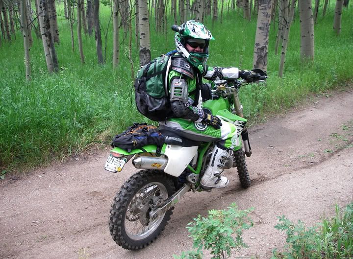
CJ on Monument Gulch Road
This was after I "almost" dropped my bike
CJ had a lot of time to kill waiting for me, so he took a bunch of cool pictures of me riding
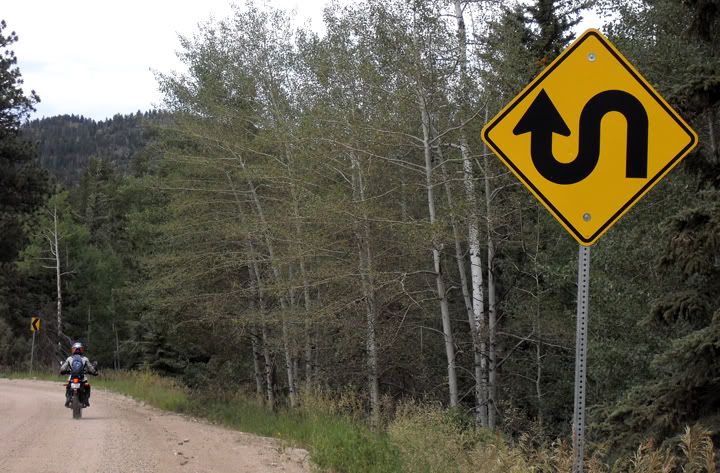
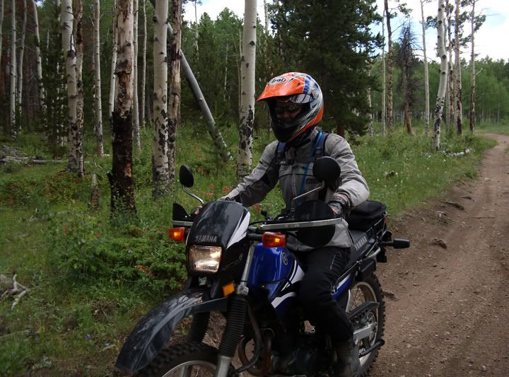
I just love that "S" curve sign, this is on Pingree Park Road
Monument Gulch Road dropped us off on Pingree Park Road, which is another wide dirt and gravel road where regular cars can drive on with no problem. We took Pingree Park Road north for a bit before turning on to Crown Point Road. Then we rode Crown Point all the way to end. This road is 18 miles long and at the end there is a parking lot and a trailhead.
Monument Gulch Road dropped us off on Pingree Park Road, which is another wide dirt and gravel road where regular cars can drive on with no problem. We took Pingree Park Road north for a bit before turning on to Crown Point Road. Then we rode Crown Point all the way to end. This road is 18 miles long and at the end there is a parking lot and a trailhead.

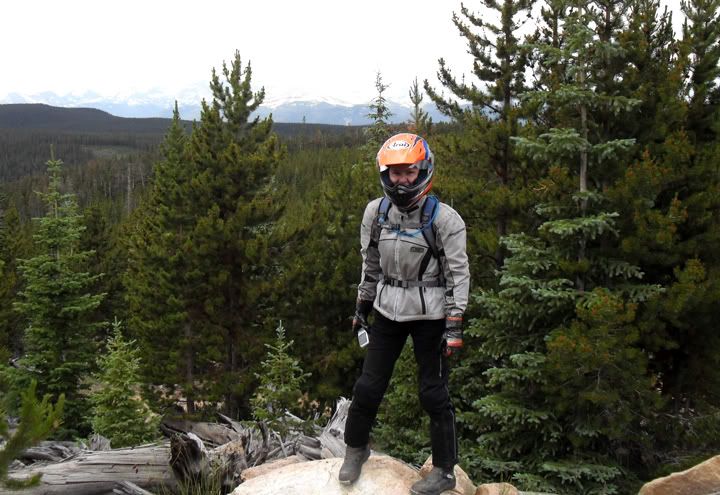
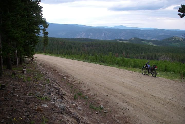
Taking a break on Crown Point Road
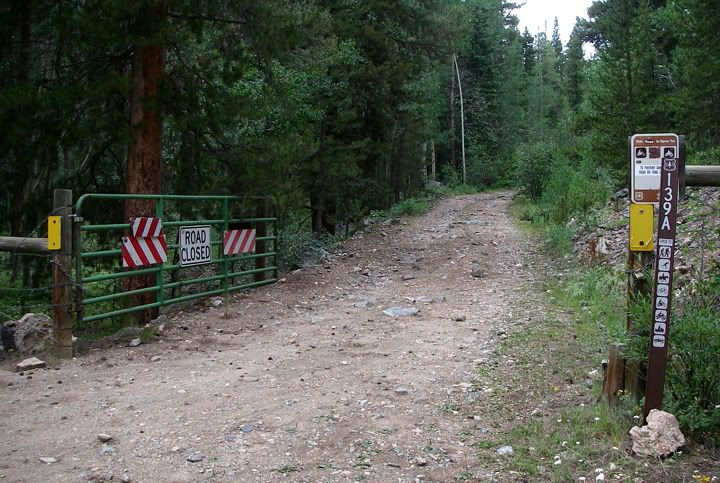
There are many forest roads to ride here, I wonder where 139A goes?
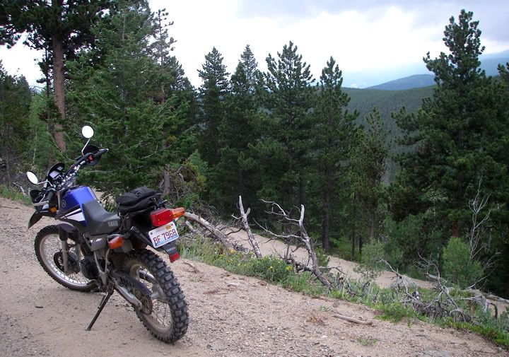
Way up high on Crown Point Road with mountains in the background
Crown Point Road
Some great scenery on Crown Point Road
I really like Crown Point Road, it’s possibly one of my favorite dirt roads out here. What I really like about it is that there isn’t a lot of traffic on this road and the views are just amazing. When you ride Crown Point Road you really feel like you’ve gone to some remote area. Pingree Park Road and Buckhorn Road have quite a bit of traffic on them and the views are not nearly as spectacular as on Crown Point Road. But I have to emphasize that Crown Point Road is just a dirt road, regular cars can travel on it, most people that ride dirt would probably find it boring.

At the end of Crown Point Road we run in to another dual-sport rider
We decided to take a break at the end of Crown Point Road. There was also another rider there on a KLR. We talked to him for a bit before he headed for a hike. It was 3:30PM already so after eating an energy bar we started to head back.
When we got to Pingree Park Road I told CJ that I didn’t really want to ride Monument Gulch Road back, I wanted to take an easier route back. It was getting late, the sky was getting dark and at my slow pace Monument Gulch Road would take forever. Not to mention I was getting a bit tired.
Buckhorn Road, coming down from Pennock Pass - I couldn't get a good picture to capture the switchbacks, but you can see the road continuing below
I wanted to take Buckhorn Road instead. I have never been to the end of Buckhorn Road where Pennock Pass is located. CJ had no issues with which road to ride, he was concerned about how much gas he had left. He had already used the extra gas he brought. Monument Gulch Road was a short cut to Buckhorn Road. From Pingree Park Road to Buckhorn was just 4 miles via Monument Gulch Road, but if we took Buckhorn back from Pingree Park Road, that would be 9.5 miles.
Monument Gulch Road as a short cut vs Pingree Park Road (CR-63E) to Buckhorn Road (CR-44H)
There was another option of course. For CJ to ride Monument Gulch back and for me to take Buckhorn back. We could meet up where the two roads junction. After thinking about it some more, we really didn’t think an extra 5.5 miles would make that much of a difference. Monument Gulch might have been shorter but it was mostly uphill. We decided on Buckhorn and to conserve gas we coasted down from Pennock Pass with the engines turned off. Not sure how many miles we saved doing that. The road eventually leveled off and we had to start the engines back up. I think we night have saved 2 miles worth of gas.
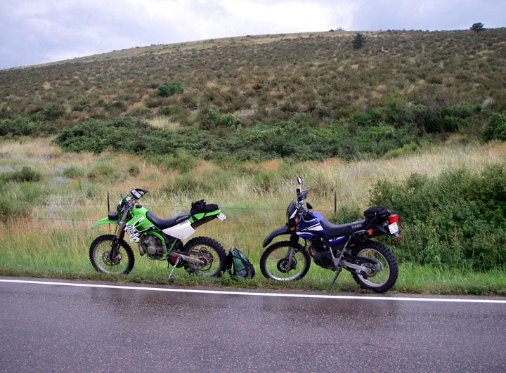
The KDX out of gas
On Buckhorn Road we again ran in to the rider on the KLR who ended up riding with us for a bit. By the time the three of us hit Stove Prairie Road the drizzle was quickly turning in to steady rain. CJ was trying to conserve gas so I rode up ahead and at one point I had to pull over and wait for the other bikes since I didn’t see them anymore. But a few minutes later there they were. The second time I pulled over for the same reason, but there was only one bike. It was the guy on the KLR. He pulled over to tell me CJ ran out of gas, then kept going. I turned around and headed back to where CJ’s bike ran out of gas. Taking a short cut to save the 5.5 miles wouldn’t have helped, we were at least 12-14 miles to the nearest gas station. I still had gas in my tank but unfortunately CJ’s bike is a two stroke and he needed an oil and gas mixture. He made a few phone calls and found someone that was at home and willing to bring him some premixed oil and gas.
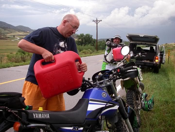
Ben comes to the rescue, and not only brings CJ some premixed oil and gas for his two stroke but also brings gas to top off my bike
About half an hour later Ben showed up. Not only did he bring CJ some oil and gas but he brought another can of gasoline and topped off my tank to make sure I had enough to get back into town. That was really cool of him. The uncool part was, that we had to finish the ride in the rain.
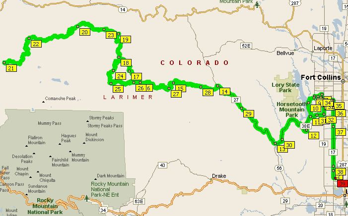
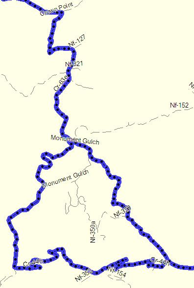
My 148 mile route: Stove Prairie, Buckhorn, Monument Gulch, Pingree Park and Crown Point Roads

2 comments:
LMAO! You forgot to mention, I coasted damn-near 9 miles off Crown Point to save gas, not to mention the switchbacks coming down Pennock...I probably saved 1/2 gallon! But, was still a bit shy :( I loved the looks on the faces of people camped when I cruised by fully geared up, stealthy, with only chain-slap & tire noise...wish I got a photo of that! You forgot to take pics of the 'Burgers we cooked, BTW...;)
Wudscrasher,
9 miles LOL? Buckhorn Road is 18 miles long total. I coasted from the top of Pennock Pass to Monument Gulch Road, that is approx 2-3 miles.
Stealth riding was fun!
The burgers were great, but sitting it out for a bit didn't save me from riding home in the rain. Although I'm glad we got rained on at the end of the ride. At least I didn't freeze my butt this time like I did end of May when I rode Crown Point :)
Post a Comment