
At around noon my friend Al and I departed Fort Collins. My XT felt pretty sluggish with the added weight of the tent and saddle bags. After all, the XT only puts out about 20HP’s.

Threatening clouds in the distance as we ride west on highway 14 out of Fort Collins
The forecast for today and tomorrow in Fort Collins called for sunshine and temps in the 80’s. The temps in Estes Park were slightly cooler but it was still supposed to be sunny there. Jack’s Gulch Campground is west of Fort Collins and just north of Estes Park. As we rode west on highway 14, I started to notice the dark clouds in the distance. They only grew darker and more menacing the further west we rode. About 10 miles from where we were supposed to turn off on Pingree Park Road, the rain started to fall and the wind started to pick up. I had to pull over and throw two layers on, the temps dropped instantly from 80 to 60 degrees.
Rain on Pingree Park Road
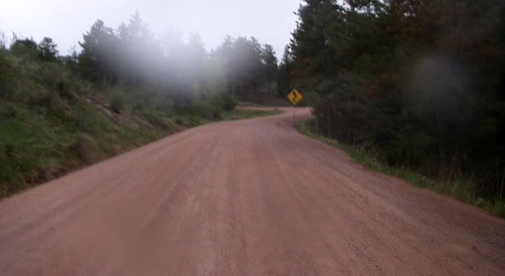
Highway 14 and the twisty and steep beginning of Pinegree Park Road
We continued riding in the rain and turned south on Pingree Park Road (County Road 63E), which is wide dirt and gravel road. The road immediately started climbing with numerous switchbacks. I was surprised how many cars turned off on this road. It took me several miles to adjust to riding dirt, especially with the extra weight. The road leveled off a bit. There is a lot of amazing scenery here, but don’t get too distracted, or you’ll ride straight off a cliff.
Jack’s Gulch Campground is located just a bit over 6 miles from highway 14 on Pingree Park Road. After choosing a campsite, we headed back out for a ride. I was glad to take the saddle bags and the extra weight off my bike.

Pingree Park Road near the CSU campus

CSU campus buildings, more like cabins, ahead
The curvy road to the CSU campus
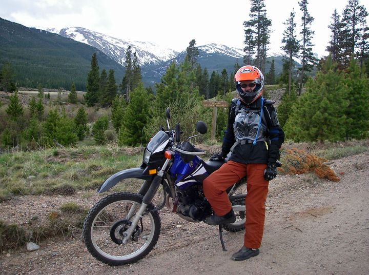
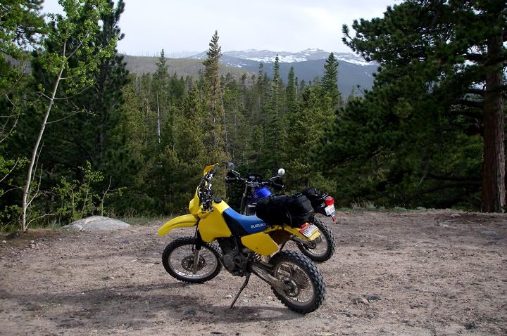
That’s the Mummy Mountain Range behind me
We still had the whole afternoon to explore. First we rode Pingree Park Road all the way to the end, where Colorado State University's Pingree Park Campus and Conference Center is located at some 9,000 feet in elevation in the Mummy Mountain Range. From the Pingree Park mountain valley you can see Rocky Mountain National Park, the Comanche Peak Wilderness Area, and Roosevelt National Forest. There are also five mountain summits accessible form this area: Signal Mountain (11,262‘), Stormy Peaks (12,148’), Fall Mountain (12,258’), Comanche Peak (12,702‘) and Hagues Peak (13,560’).
At the CSU campus we turned around and headed back the other way on Pingree Park Road. The rain started up again, at times, like it does so often in the mountains, the rain would fall and the sun would shine simultaneously.
Sky Ranch Road
Nice views from Sky Ranch Road
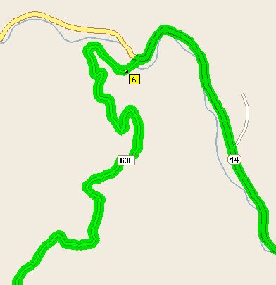
Pingree Park Road (63E) and Sky Ranch Road (CR145)
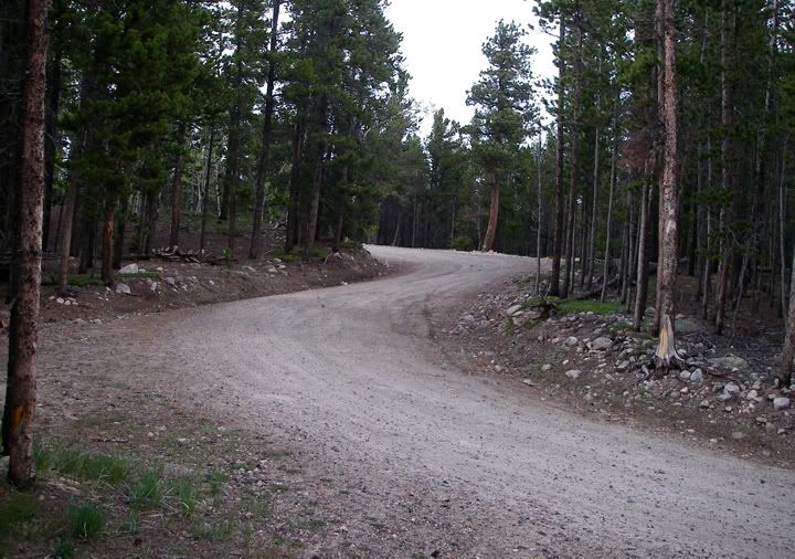
We turned off on the road to Sky Ranch (Country Road 145). This road was much narrower, twistier and rockier. I liked it a lot more then Pingree Park Road, I guess in dirt I like to ride slower, and on Pingree Park Road even though the speed limit is posted at 30MPH, many of the section can be ridden much faster. Sky Ranch road didn’t go very far and ended at some camp.
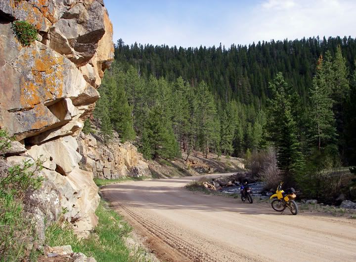
Pingree Park Road and the south fork of the Poudre River
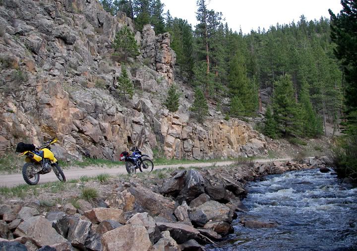
Pingree Park Road and the south fork of the Poudre River, shot from the river
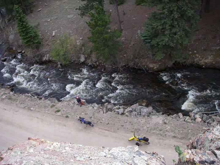
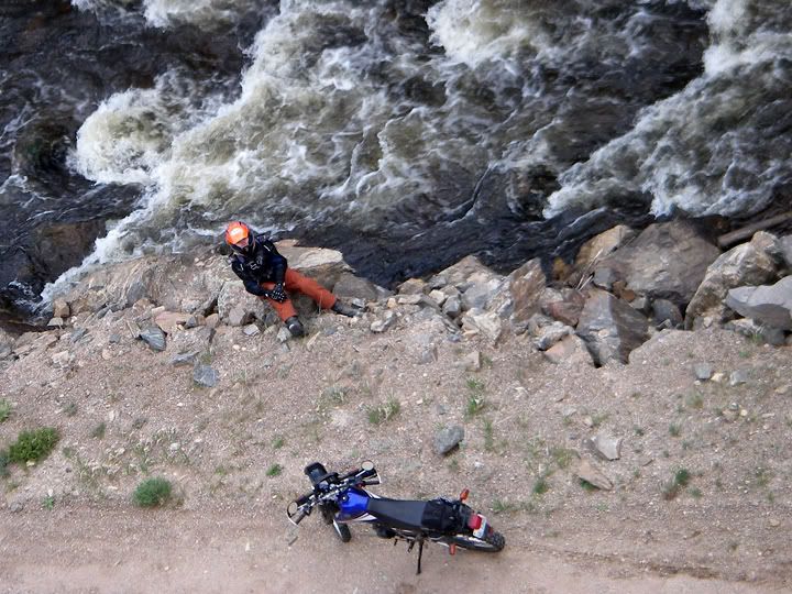
Al climbed that big rock next to the road and took some cool pictures from the top
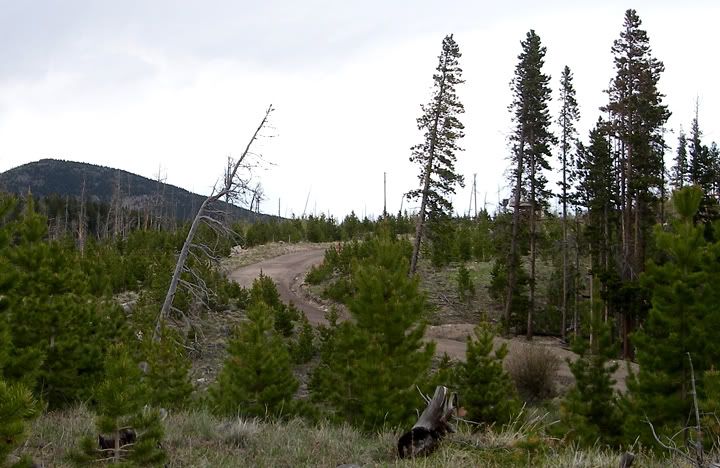
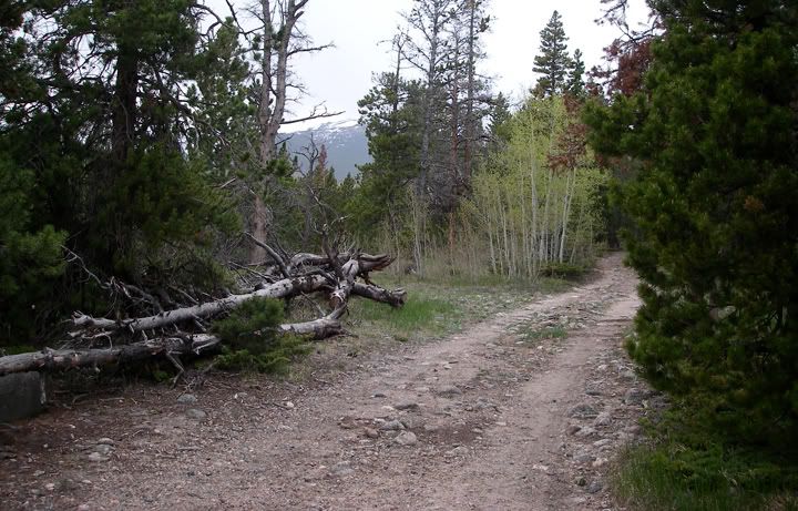
Back on Pingree Park Road, next stop was next to the south fork of the Poudre Rider. Then we rode past Jack’s Gulch Campground, waiting for the deer to cross in two places and turned on to the Crown Point Road. This road goes all the way to the Zimmerman Lake trail, near Cameron Pass. By now it was raining steady and harder at times. By now we realized that this was not of those a noon-time passing mountain rain showers. This was some kind of rain storm. One cloud would go past us, and another one would come. The rain continued on and off all afternoon. So far Crown Point Road was my favorite today. Narrower then Pingree Park Road, no traffic on here what so ever, also a bit bumpy and rocky n some places. We did pass two tents on the side of the road. That’s what I love about Colorado, you can set up a tent almost anywhere for free.
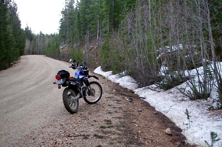
Where we turned around on Crown Point Road
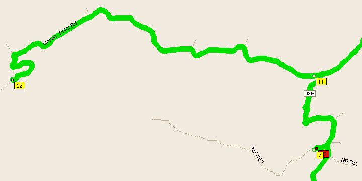
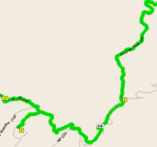
Crown Point Road, Jack's Gulch Campground is located at way point #7
Crown Point Road is about 20 miles long, we only got to about 1/3 of it when the snow appeared on the side of the road. With the rain and the higher elevation here, it was actually cold. We decided to turn back around and head back to the campsite. What a fun day, and I only rode about 85 miles.
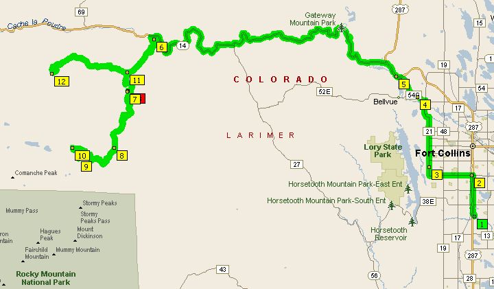
Todays route 85 mile route

No comments:
Post a Comment