
Fort Collins broke a temperature record today - 71 degrees. I had some stuff to do in the morning (you know - looking for jobs, writing cover letters, sending out resumes), that stretched out in to the early afternoon. But I definitely wanted to get out there and enjoy the weather and the warm temperatures and I was due for hike.
My plan was to hike Greyrock Mountain just northwest of Fort Collins. It's one of the more popular places to hike in this area. By the time I got my stuff together and got out there it was already 2PM. I knew I couldn’t make the summit of Greyrock Mountain today, but I at least wanted to check out the trail.
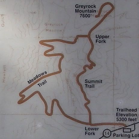
Beginning elevation: 5,300 feet
The summit: 7,600 feet
Elevation gain: 2,300 feet
Distance to summit via:
Greyrock Meadows Trail: 4.3 miles
Greyrock Summit Trail: 3.1 miles
I heard that the Greyrock trails get very busy on the weekends, so I was glad I could check it out during the week, when there are less people hiking.
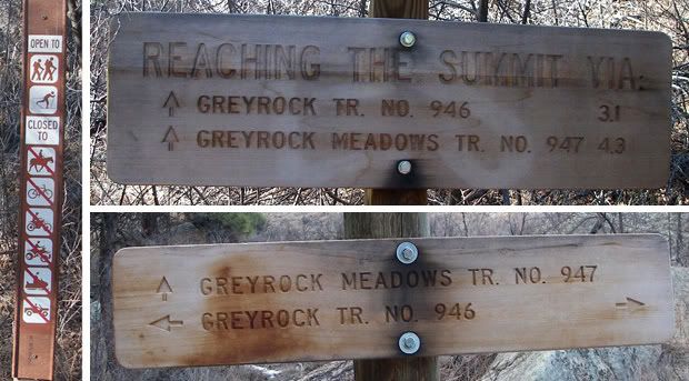
Signs posted along the trail
The Greyrock Trail is one of the first trails you come upon along highway 14 after leaving Fort Collins. The trailhead is located in the Roosevelt National Forest just 9 miles from the junction of highways 287 and 14. There is a small parking lot and vault toilet located above the road on the south side of highway 14. To get to the trailhead you cross highway 14 and then cross the Poudre River via the wooden foot bridge.
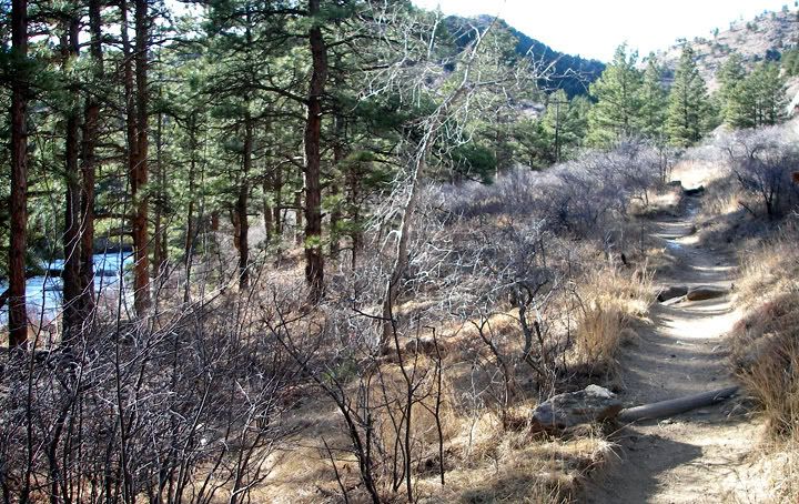
Beginning of the trail following the Poudre River
There are two trails here and both of them will get you to the summit of Greyrock Mountain. The Meadows Trail is 4.3 miles to the summit and the Grey Rock Trail is 3.1 miles to summit. Actually both of these trails meet up near the summit of Greyrock and for the last .75 miles there is only one trail to the top of Greyrock.
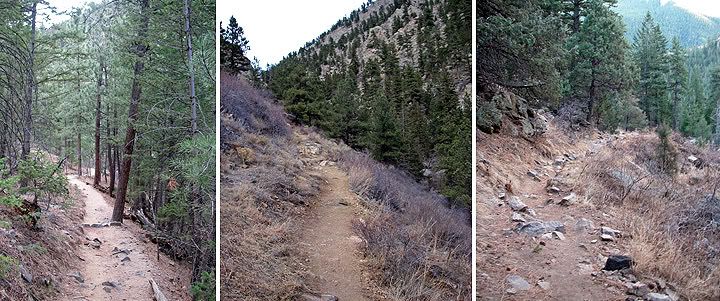
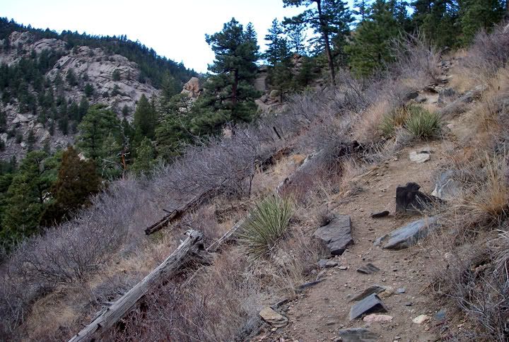
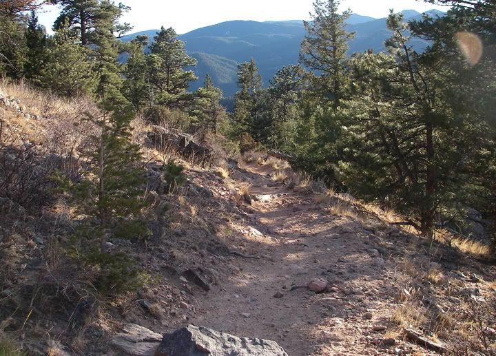
Nice scenery along the trail
From the trailhead you hike west following the Poudre River. After .6 miles the trail splits up. Go left and you’re hiking the longer but slightly less strenuous Greyrock Meadow Trail. Go right and you’re hiking the steep and rocky Greyrock Summit Trail. The longer meadow trail sees less traffic and I've read is more scenic. Many people do a loop by hiking one trail up and the other trail back down. Both trails are considered moderate to difficult.
I find a lot of discrepancies with trail mileage and elevations. Who do you believe? Beginning Elevation: 5,300 feet, the summit is at 7,600 feet, so the elevation gain is 2,300 feet according to the sign posted at the trailhead. This is not what I got from the USDA Forest Service website: Beginning Elevation is 5,580 feet, the summit is at 7,480, so the elevation gain is 1,900 feet. There is a big difference between an elevation gain of 2,300 feet and 1,900 feet. I guess I could start bringing my GPS with me. If you look up a few more websites, you will get lots of different numbers.
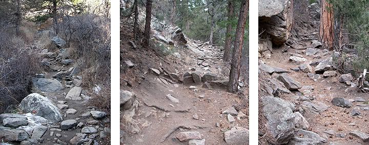
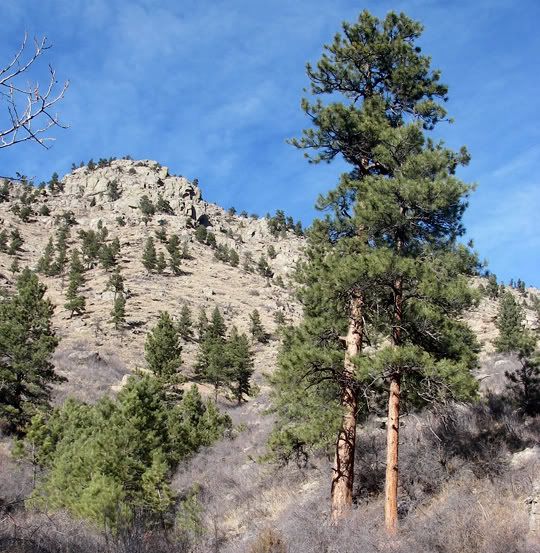
Rocky and steep Greyrock Summit Trail
Looking down at the Greyrock Summit Trail
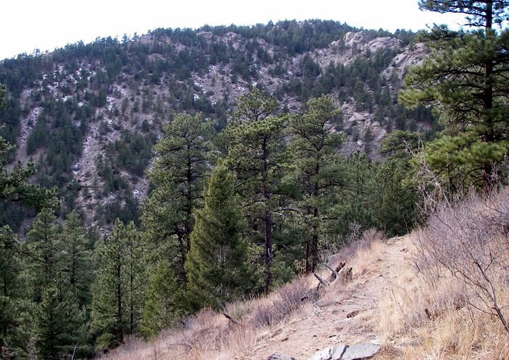
Since I was short on time I decided to take the shorter and steeper Greyrock Summit Trail. The trail travels up the mountain and because it was the afternoon already, the sun was already hiding behind the mountains as I started heading up the trail. It wasn’t until I got half way up the trail that I saw the sun again. I was higher in elevation now and the sun was again shining brightly in the sky but I knew that it wouldn’t be there for long and I was probably going to have to hike back down in the shadows, or worst, in the dark if I took too long.
I brought my SLR camera and tripod in case I got to the summit, but I didn’t make the summit and didn’t use them on this hike
Less rocky and steep parts of the Greyrock Summit Trail
Getting up there now
And higher still
I was huffing and puffing and stopping frequently to catch my breath. I’m still adjusting to the elevation. It was warm and I had on a wicking long sleeve shirt and a fleece vest. I should have lost the vest for a while but unfortunately I brought another layer with me and my pack didn’t have any more space. Once I got ¾ way up the trail the cool wind was blowing gently and the temperatures were already falling and I was very comfortable.
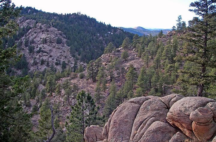
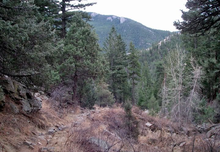
Some amazing scenery after hiking about 3/4 up the Greyrock Summit Trail
Many mountains in the distance
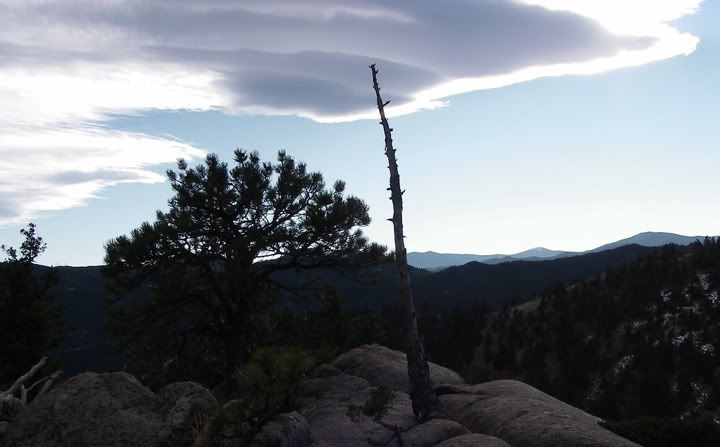
Neat looking cloud
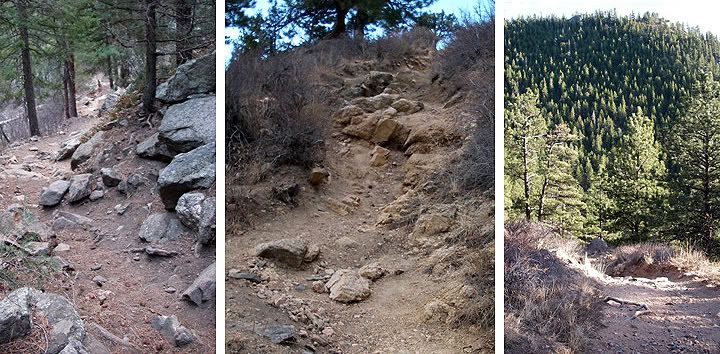
Some steep and sandy sections of the Greyrock Summit Trail
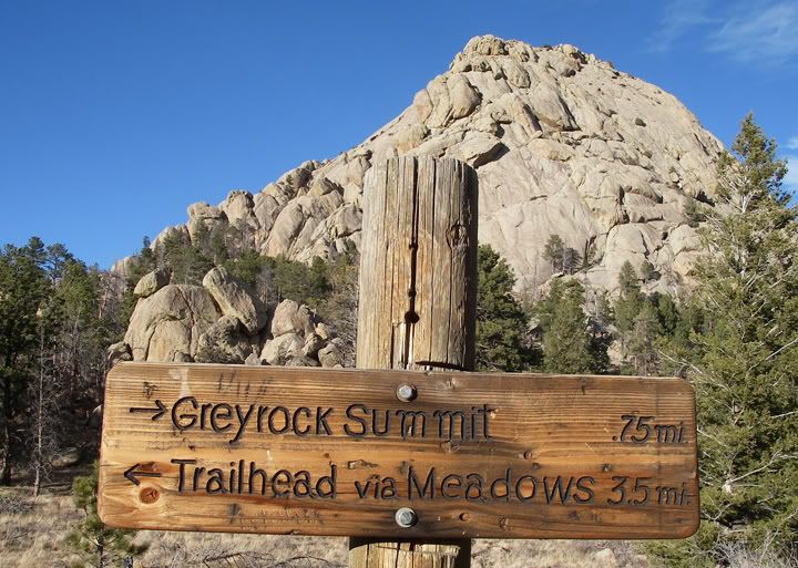
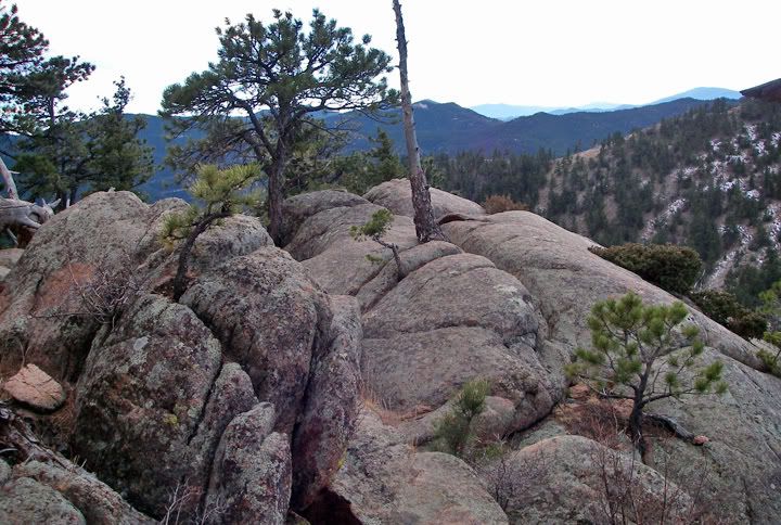
The last .75 miles to the summit, that's Greyrock behind the sign
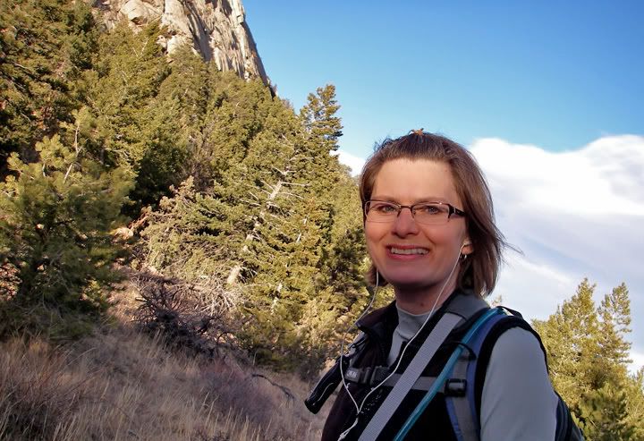
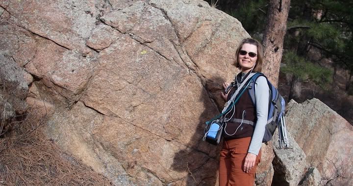
You can't see it well, but that's the Greyrock summit behind me
I arrived at the sign where the Greyrock Meadow and the Greyrock Summit Trails come together. From here it was just .75 miles to the summit of Greyrock Mountain. I decided to continue a little further but a quarter mile later I stopped to check the time (my cell phone was in the back of my pack). It was already 4:15PM and the sun was setting around 5:30PM. I needed to head back down. Now!
Heading back down the Greyrock Summit Trail
I changed out my prescription sunglasses for the clear ones and started back down quickly. Heading down is always easy and I made it back pretty fast arriving at my car at 5:45PM, just as it was getting dark.
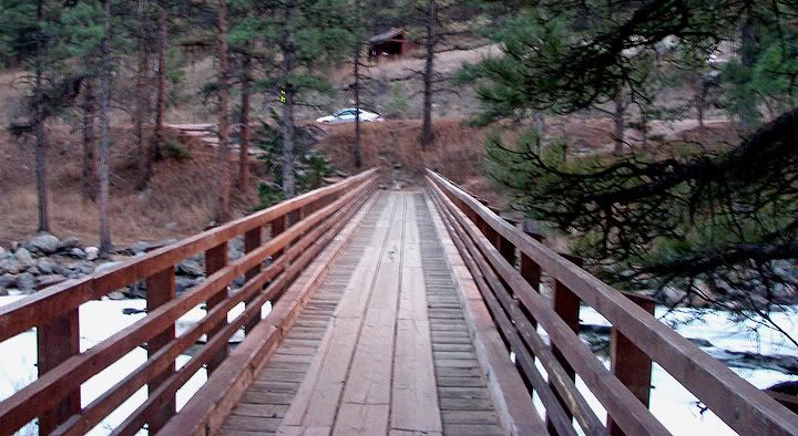
The bridge to the trailhead, that's my car parked on highway 14 and above is the vault toilet and the parking lot
I really enjoyed this hike. The trail was mostly rocky and steep, in places there was a bit of sand also and I should have brought my trekking poles since I was sliding around a bit on the way down. The trail traveled mostly under the cover of trees, but from time to time, especially once you got higher in elevation on the trail, there were some nice views of the surrounding mountains. I hiked just over 5.5 miles today and I had no problems following the trail. I saw about 8 people on the trail, most of them toward the bottom of the trail.
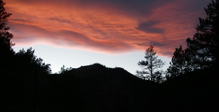
The clouds made for a nice sunset tonight

7 comments:
Where's Mike? I thought he took all the pictures.
I take most of the pictures, he would take some pictures here and there, like the pictures of me. But I’ve gotten quite good at taking pictures of myself with the timer.
I take most of the pictures, he would take some pictures here and there, usually the pictures of me, some but not all. I’ve gotten quite good at taking pictures of myself with the timer.
Good post about a nice hike. Your pictures convinced me to do Greyrock this past Friday and I'm glad I did. The views from the summit were awesome.
Thanks!
Good post about a nice hike! Your pictures convinced me to do Greyrock this past Friday (lived here 9 years and hadn't done it!) and I'm glad I did. The views from the summit were awesome.
Thanks!
HI Anna-
Friends and I are doing Grey rock next week(11/2)...with all of the snow, do you think we'll be OK with regular hiking boots?
Fitzrockies,
I think the snow will melt quick. Hiking boots should be fine. I've only needed snowshoes at high elevations where the snow doesn't melt.
Have fun!
Anna
Thanks, Anna! I'll let you know how it went!
Post a Comment