
It was a cold morning at 42 degrees so the hot coffee that was brewing right outside our tent was great. After some breakfast, Mike made scrambled eggs, which are very tasty and very fluffy. We bundled up and by 8AM we were on the road. I was still actually a bit sore from yesterdays ride, I’m just not used to this kind of riding.
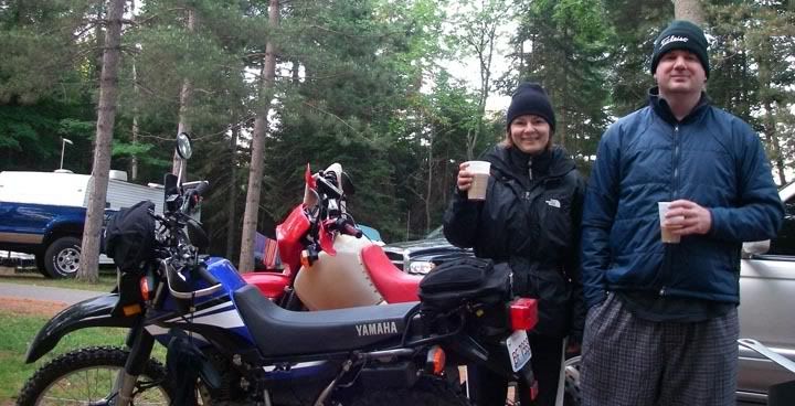
Cold morning, warming up with hats and coffee
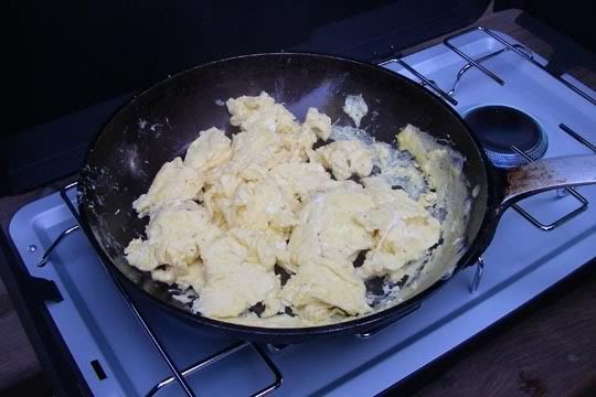
Breakfast: scrambled eggs
Today we had an actual pre-planned route, so today there was not going to be any of this riding in circles and getting lost stuff. We were going to follow the route, which we plugged in to Mike’s GPS. All we had to do is sit back, relax and let the GPS tell us where to turn. Easy, eh?
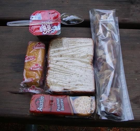
Prepared for the ride this time! We made lunch to take with us, peanutbutter & jelly sandwitch, nuts, and some other stuff
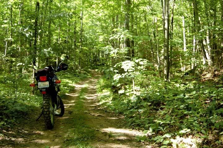
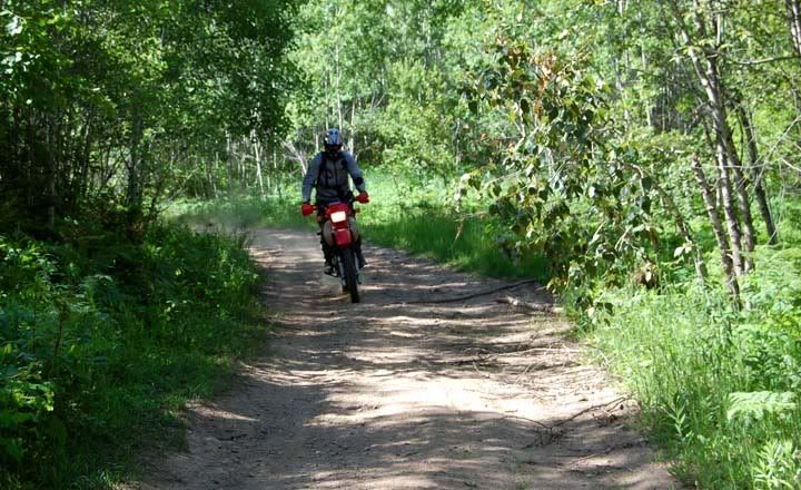
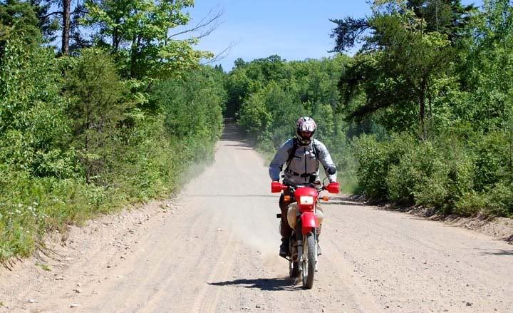
Riding Henry Ford's old road
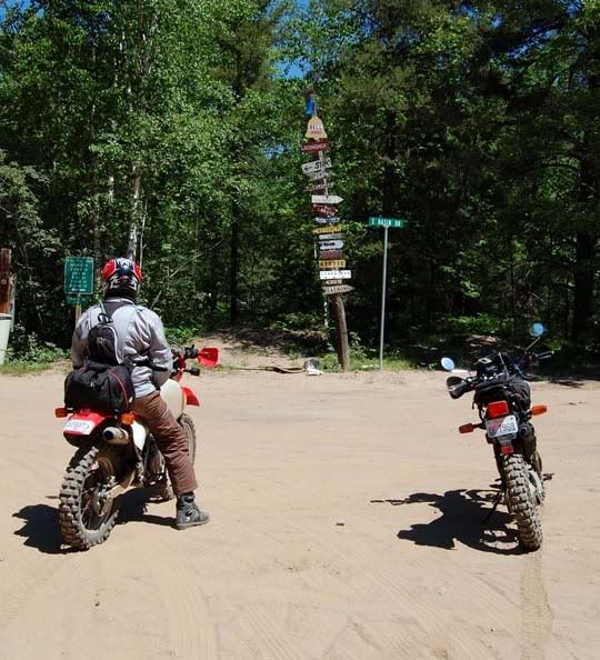
Within the first hour we were turning around and heading back the road we just came since the road we wanted had a “road closed” sign posted. And because we lingered at the closed road too long, checking our GPS’s for another possible road, we attracted the attention of two nearby dogs sitting in their front yard. They were kind of big and angry looking as they came running and barking at us, so we made like a banana, and split. The other road that we chose wasn’t going to get us where we needed to go and hook up with the pre-planned route either so finally we turned off on to something that didn’t even look like much of a road at all, a grass covered trail, but Mike’s GPS said it would get us back on route, so off we went in to the unknown. This road wasn’t even on my GPS, but it did take us in the right direction, we rode and we rode and ended up at an intersection.
We had 3 choices, 3 roads to choose from. Checking the GPS again, we took a road but shortly arrived at a locked metal gate, which I don’t understand, since this was a “real” road. We went around the gate and rode for a while arriving at a clearing and a dead end. Mike went to investigate a smaller road that might have been going off to a river, but who knows, after just a few minutes he rode back up yelling from inside his helmet “go, go, there is a guy chasing me in a pick up truck” so we went back where we came from and now took the other road, no worries, we still had one roead left to try if this one didn't get us where we wanted to go.

So finally after riding for a couple of hours and actually riding some good dirt roads but not getting any closer to our destination, we ended up turning back around and taking a road that would take us to 41, which is a major paved road. Today was already becoming a repeat of yesterday.

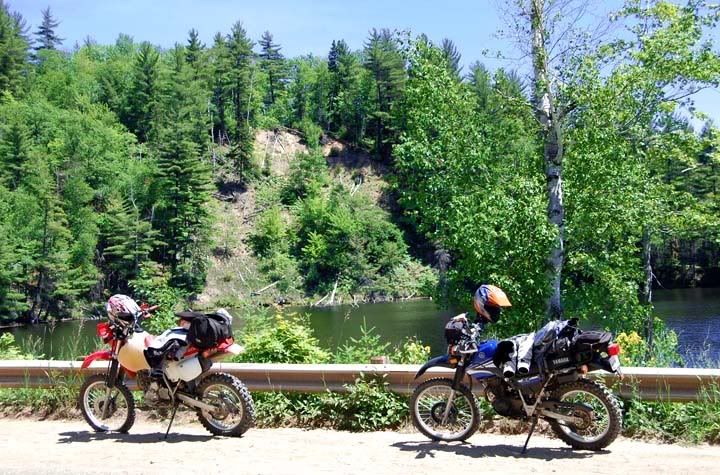
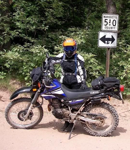
In Negaunee, Lake Teal
In Negaunee we turned off the main road again trying to hook back up with the pre-planned route, we found the road but it also ended. The other road, well, we just couldn’t get to it, so we rode for a few miles and again had to turn back around. And these roads here were not fun roads, they were all sand and very hard for me to ride, to ride them once was OK, an experience, whatever, but having to ride them twice, was tough. Once again we back tracked, tired a bunch of roads, rode around in circles, unable to connect to the roads we wanted to be on.
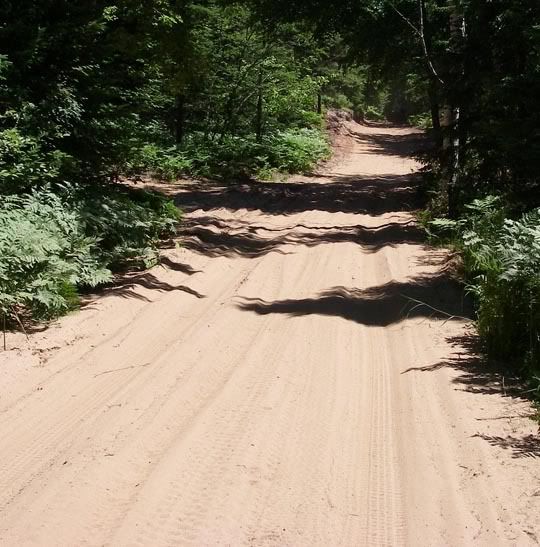
Basin road, a lot of sand
So we made it back to good old 41 again. Riding pavement wasn’t fun, but it was getting late already and we still had a lot of riding to do. We continued directly to 510 this time, this road was “the reason” for today’s ride. 510 used to be called M-35 back in the 1920’s, it was a road that Henry Ford started to build, which was going to cross the Huron Mountains, but the road was never finished. Today County Road 510 starts near the Marquette-Negaunee area, the first 5 miles are paved, the next 19 miles are a well-maintained gravel road. On today’s maps 510 turns northeasterly toward Big Bay and old M-35 route continues for 3 or 4 more miles as a lower-quality road called "Blind 35. We were planning on riding to the end.
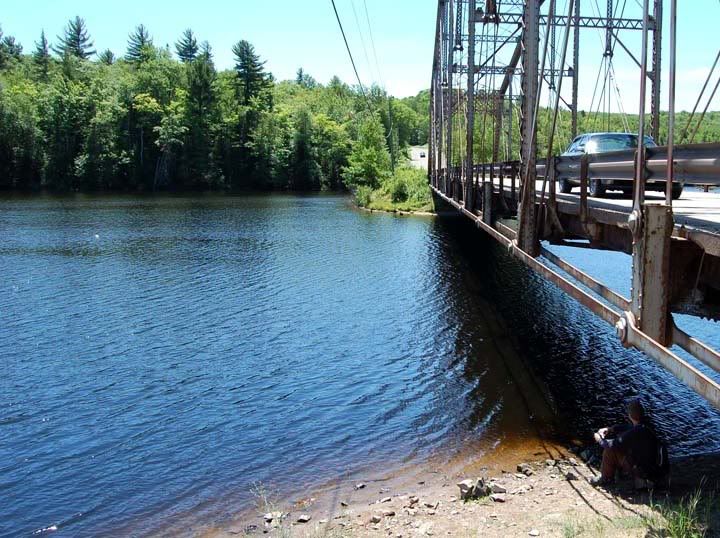
We arrived at the bridge that crossed the Dead River. It was lunch time now and we were hungry and this was a nice place to stop for lunch. Never mind the name “Dead River”, it looked really nice and peaceful here.
Lunch spot
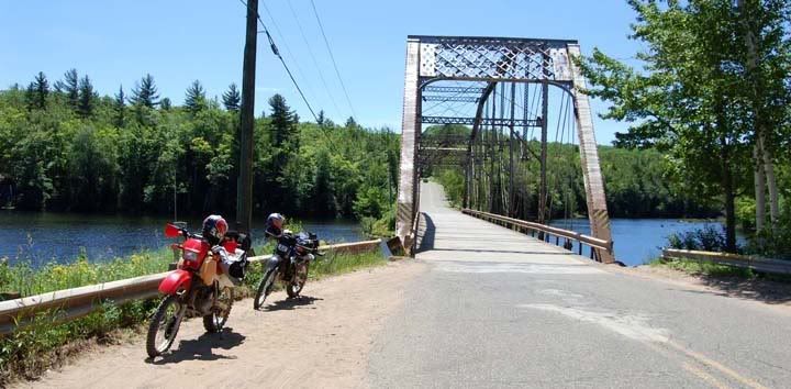
This bridge here was disassembled in Pennsylvania and moved to this location in 1921
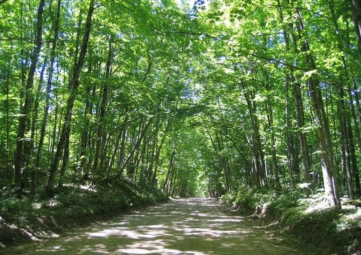
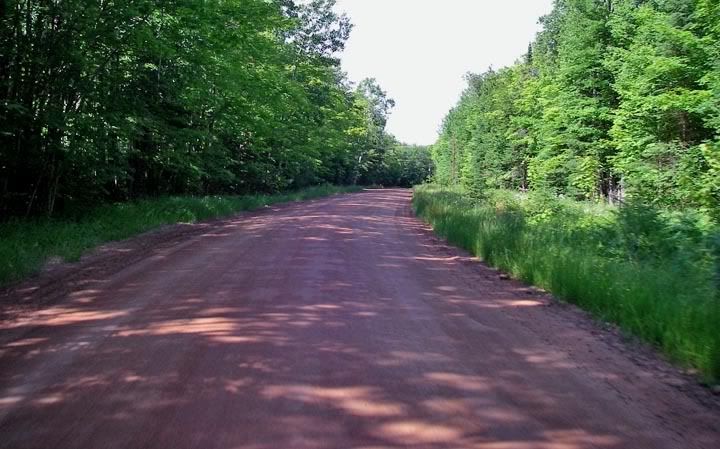
Nice scenery on county road 510
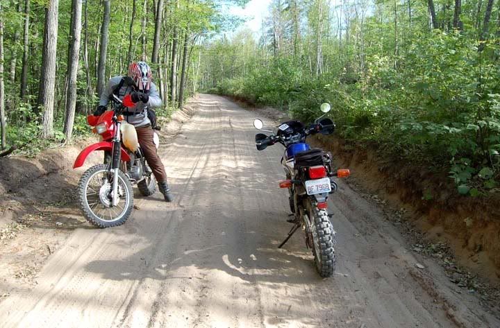
After a relaxing lunch by the river we took off heading north on 510, shortly the pavement ended and I started to worry if I could actually make it to the end of 510. With the many ruts, the gravel thrown on top of the sand, this was not a fun road to ride. There were also a few cars traveling this road, kicking up so much dirt that I had to put my goggles on. Initially I thought my arms were going to fall off, the ruts were so bad, the bouncing so rough, but as we continued further north the road became smoother - which was nice, but the sand got deeper - which wasn’t that nice. The twisty portion had especially deep sand in some places.
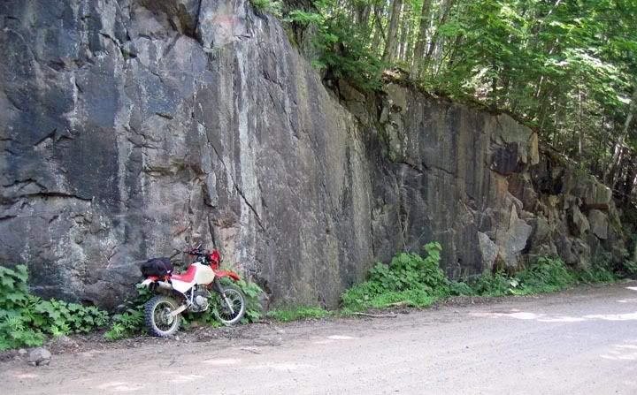

County Road 510
I probably should mention, this was my first experience riding in sand, since I’ve only been riding dirt since winter, and riding that much. As much as I disliked the big and deep gravel, I’d have to say that sand alone or sand with gravel is just a bit worst than that. Looking at Mike tearing it up, I’d have to say it’s just me and my lack of experience with the stuff.
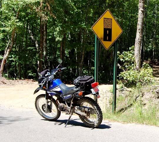
A few very short paved sections on 510
After a long, long while, we arrived at Blind 35, and I even did some of that, I rode it about a mile but then the sand got even deeper. Mike went almost to the end. Then we turned around and went back to where 510 turns east and continued to Big Bay. Rode through town, turned on Dam Road and then turned on to the road that led to the road that went to the Lighthouse, both were dirt, first one was a smooth packed dirt road, the second was a gravel road all the way up to the lighthouse. I guess I’m glad I’m riding the dual-sport today, the packed dirt would have been fine on my street bike, but I wouldn’t want to climb that gravel road with a street bike.

More sand on Blind 35
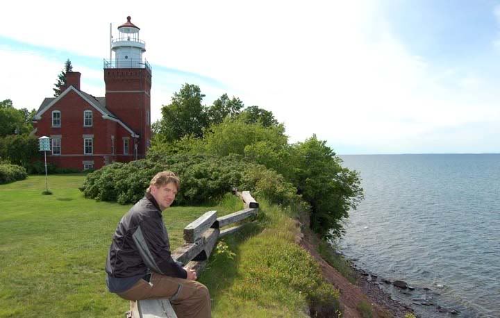
The view of Lake Superior from the cliff that the lighthouse is sitting on was very nice. We walked around for a few minutes, but it was getting late and we needed to start heading back to the campsite. Today’s temperatures were cool, the high was only in the mid 60’s, so the temperatures were dropping already and we were grabbing our warmer layers for the ride back. We looked over the route and decided we wouldn’t have enough time to complete a route full of unknown little dirt roads, especially not knowing if the roads actually continued, we couldn’t waste any more time getting lost so we were going to take some major paved roads back.
Going to the lighthouse
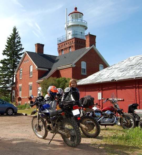
Big Bay lighthouse
So back on the Lighthouse road, then back on Dam Road, and all the sudden there is a black bear crossing the road right here in Big Bay. He waited for Mike’s bike to go by and since I wasn’t right behind him, he figured it was safe to cross. It’s funny, all the out of the way dirt roads that we rode, no animals there, probably because they are all hanging out in towns eating people’s garbage. Speaking of animals, one of the three areas to see a moose in the UP is the park we’re staying at, Van Riper State Park, I somehow doubt we’ll see any moose, there arn't that many up here.
We jumped on 550 south and headed toward Marquette. The road would have been more fun if I was riding fast on my street bike, these new Pirelli M21 knobbies are loud on pavement and the XT225 just doesn’t go very fast, I had the throttle turned as far as it would go and I was topping out at 60 MPH on many of the hills. Once we got closer to Marquette, instead of continuing to 41, we looked for some dirt road short cut and again we turned off on some gravel road, that took us to another road, this one was full of deep sand and just very hard for me to ride. Looking on the GPS there were not any other shortcuts, and we weren’t even sure that this road would take us to 41. We weren’t going to take that chance this time, we turned the bikes around and we would get back to 550 and take that to 41, less fun but more predictable. And then a car appeared, when it got closer we motioned for it to stop, we actually didn’t even have to do that, the 4 people crammed inside this beat up early 80’s door sedan were already slowing down to gawk at us or maybe ask us if we were lost.
A very sandy short cut
Mike: “Will this road take us to 41?”
Driver: “yea… mumble, mumble left mumble”
Well, we didn’t actually understand what she said, but it was a definite “yes” so we turned the bike around again. This road wasn’t that long, which was great because the deep sand was slow going for me, from there a small paved road got us to 41.
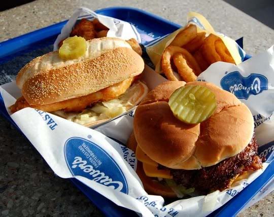
Dinner at Culver's, burger for Mike, fish for me
It was dinner time now and there were places to eat here, we decided to head over to Culver’s to eat. The food was OK. I always get the same thing at Culver’s, the stacked turkey sandwich – hot – today I decided to try something different, a fried fish sandwich, and it wasn’t really good and so greasy, actually, I couldn’t even finish it. Even the cheese curds were kind of a disappointment. While we ate our food outside underneath the umbrella, a bunch of bikers rode in, parked and went inside. Then a few minutes later the whole group came out and got on their bikes and rode across the street to the Applebee’s. Culver’s doesn’t serve beer.
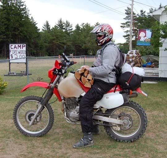
Got ice, got wood
After dinner we rode the 26 miles to Champion, it was a chilly ride, we grabbed some ice and fire wood and arrived at the campsite just as the sun was setting, the deer were already coming out of the woods looking for a nice hood to splat on. Tonight wasn’t as cold as last night, only in the low to upper 40’s.
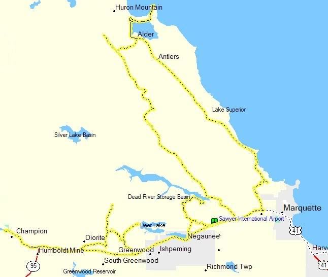
This is where we went today

No comments:
Post a Comment