
Today I rode the famous Devil’s Highway, which is known as one of the twistiest roads in the US by motorcycle riders. Even the Federal Highway Administration considers this drive to be the curviest road in the nation. It is definitely worthy of it’s own post, so I will write about the other roads I rode today in another post.
Miles and miles of 10MPH corners
U.S. 191 is a pretty long highway. You can find it running through Montana, Wyoming, Utah and Arizona. The very twisty Devil bits are located in Arizona, this section is also know as the Coronado Trail Scenic Byway, which runs North - South along the New Mexico border. The Coronado Trail follows the route near Coronado's path as he searched for the "Seven Cities of Cibola" over 450 years ago. But what does Coronado have to do with the Devil? Not much really. In the US there has always been a lot of superstition around places with numbers like 13 or 666. Many tall building don’t even have a 13th floor since 13 is considered an unlucky number. The number 666 has been associated as the number of the beast, or the antichrist so Arizona changed the numbering from 666 to U.S. 191 in 1993. The other states also changed their numbering too, I remember riding in Utah a few years ago and even though my GPS said I was riding U.S. 666 the road sighs had been already changed to 191. I’m not superstitious, after all how can I be? I have three consecutive 6‘s in my social security number.
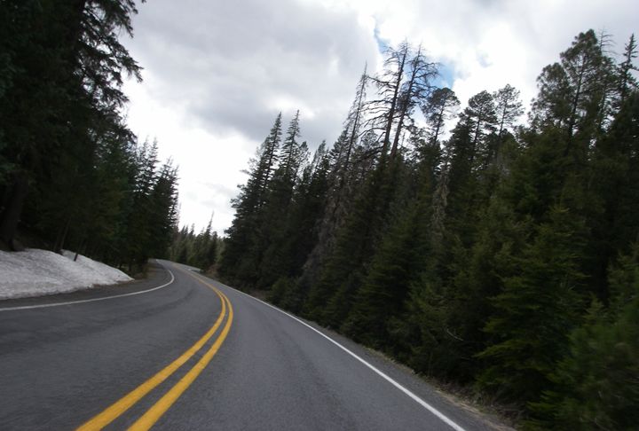

191 near Alpine, AZ in the north at elevations 8000-9000 feet, snow still hiding in the shadows
Springerville and Clifton are 120 miles apart along Highway 191, but some claim there are 1,100 curves in the road separating these two towns so it takes a few hours to get from one town to the other. The curves are tight, very tight. As a matter of a fact in all the years I’ve been riding motorcycles I don’t think I have ever seen a road where the “10MPH” curve sign was not used to mark a particular curve but miles and miles of curves. If you like seeing signs that say “10MPH for the next 6 miles” this is your road. And these speeds are pretty accurate (for cars), although of course on a motorcycle you can go a little faster then 10MPH.
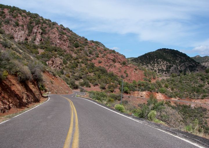
The road is narrow and at times it runs along the cliff side, there is no shoulder and no guard rail separating you from the cliff’s edge. This is not a road to push your cornering abilities on. A mistake can be fatal.
The pavemnet was bumpy and patched up at times
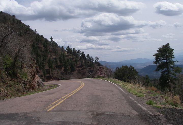
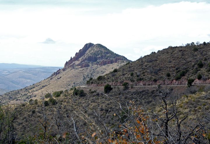
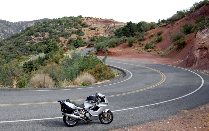
Heading south on 191, you get kind of views for hours
No shoulder, no guard rail
Get your gas before you start! There aren’t a lot of opportunities to get gas on this road so fill up either in Alpine if you’re coming from the north, or Clifton or Morenci if you’re coming from the south. Since there aren’t a lot of towns on this road there isn’t a hell of a lot of traffic either. I think this is the reason why motorcyclists flock to this road. What can be better than miles and miles of super twisties with no other vehicles on the road to spoil the fun? Even on the weekend, all you will see here are motorcyclists and a few tourists. And since no vehicle over 40 feet long are allowed on this road, that eliminates some of the larger road blocks we have to deal with on the other twisty roads.
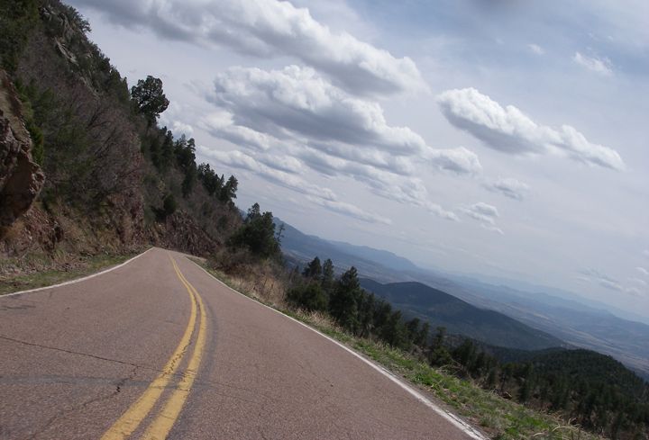
Heading south, most of the time I could see all the curves
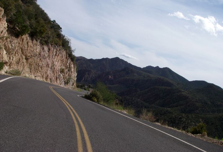
It's very hard to photograph this twity beast of road - pictures can't show that from the seat of the motorcycle there are so many places where you can see the road twisting in the distance
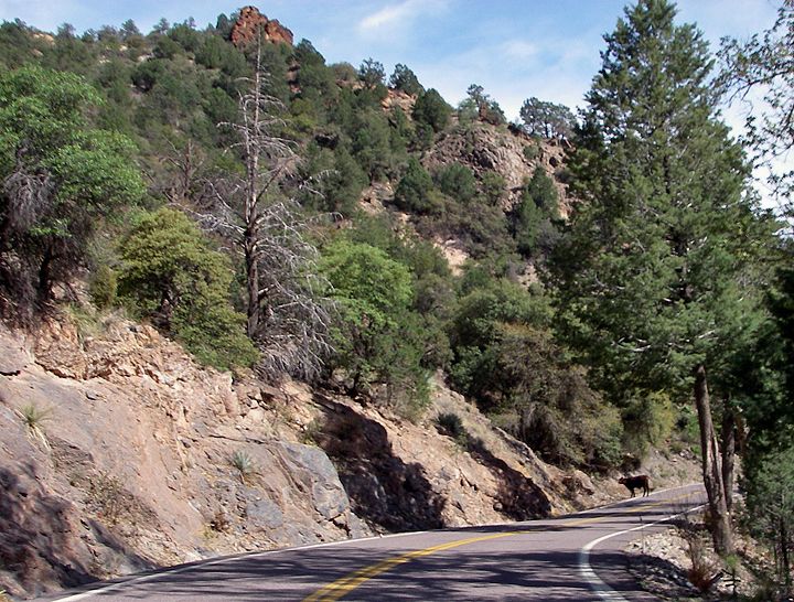
Watch out - a cow in the road
In the north near Alpine the road rises high in elevation. I googled to see what the highest elevation on this road was but came up with many different numbers. I did have my GPS on at times and I do remember seeing at least 9,300 feet in elevation, maybe a lit more. Even in early May there was still snow up there near the road and under the trees in shadows.
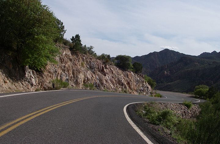
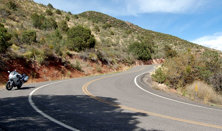
191 as it curves around a cliff

So many spots along this road to take a break with a view, I chose this as my lunch spot - oh, and there were pit bathrooms also
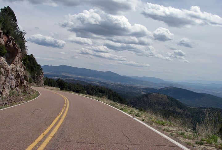
Toward the southern end of 191

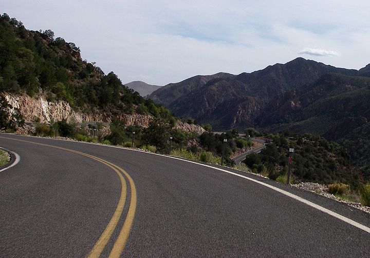
Looking down at the curves I'm about to ride
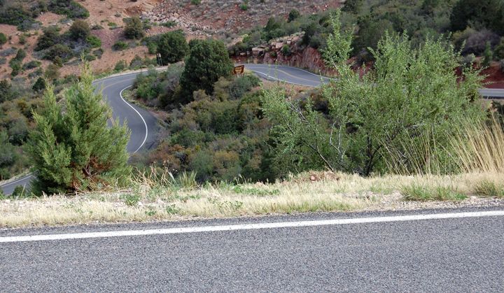
I'm heading down there
The Devil’s Highway runs for miles through the Apache-Sitgreaves National Forest. There is a 6,000 foot elevation change between the upper Sonoran Desert and the near-alpine terrain of the White Mountains. Like some other roads that I’ve been on, it’s also described as a “Palms to Pines” road. Speaking of Palms, there are some awesome ones in the town of Clifton, AZ on the south end of the Devil’s Highway but I didn’t stop to take any pictures of them.
Which direction to ride? I’m the odd ball one. Everyone I knew rode the Devil’s Highway from south to north, where you climb in elevation. I prefer to descend the curves in elevation, so I rode this road from north to south. Even though I rode it north to south, there were still a bunch of curves that I ended climbing, not descending., since at times the road goes up and down. I’m not sure what the views look like heading north, but let me tell you, heading south - curve after curve - you see some amazing scenery ahead of you, especially starting toward the middle of the ride all the way to the southern end.
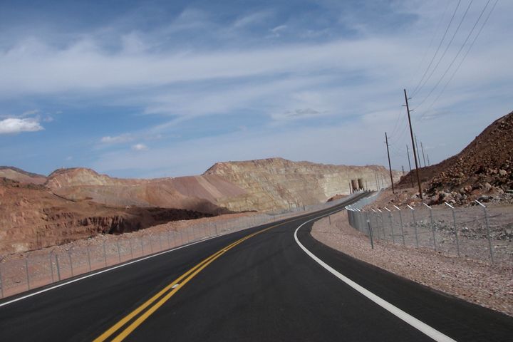
Near Morenci, AZ there are miles of tight curves and mining

A tunnel near Morenci
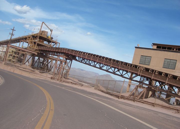
Mining near Morenci - lots of dirt and sand in the air here and on the road
Some just start the ride in Clifton and only ride about 60 to 80 miles and turn around. The southern part of the Devil’s Highway is more twisty and the best pavement is also on the south section of the road. Actually near Alpine in the north, where the road is still a bit loose, with sweepers, the pavement is also nice. But somewhere after that heading south the pavement gets really bad, lots of patch work and bumps and lots of sand.
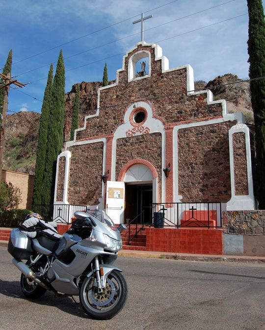
Don't miss the town of Clifton, AZ on the south end of 191, it's really neat
The curves can be exhausting and feel like they go on forever, so prepare for a long ride and make sure you pay attention to the road at all times. There are some technical curves on this road, but even though it’s very tight I didn’t find it all too scary. Especially heading south, I could see most of the road, so I didn’t have to deal with too many blind corners. Although I did come around some corner, that was near the cliff’s edge and the wind almost wanted to blast me off the mountain. As for the curves, I only found one curve that freaked me out. It was a super tight 10MPH left hander. Not sure if I wasn’t paying attention to the road at the moment and it sneaked up on me, or was it just a goofy curve. It just didn’t flow right for me.
I don’t partially like the super tight stuff, but this road has a bit of everything on it. I really enjoyed the curves that were marked at 30MPH best, although it seemed there were way more curves posted at 10-25MPH on this road. It’s definitely a road one must ride at least once in a lifetime. It’s a hell of ride!
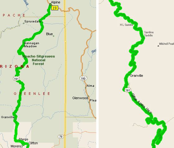
Over a 100 miles of tight twisties from Alpine to Clifton, AZ (left), a details of some of the curves on 191 (right)

3 comments:
US 191 is one of my all time favorite roads I have ridden. I road it early May of 2005. I have pictures from some of the same spots such as the left hand corner with the reflectors and road below. I also road it North to South. I embarked with a little over 3/4 of a tank and barely made it to a gas station in Morenci. The topography and climate change so much during the ride. When you ride through the mines you feel like you are on another planet.
We are departing on this route for the fourth consecutive year. Living here in Arizona makes it a must do at least once a year. We prefer the fall with the chance to catch some changing colors of the trees.
Great review of one the most enjoyable rides in the west. We are about to leave on this route for our fourth consecutive year. Living in Arizona makes it a must ride at least once a year. We prefer the fall and a chance to catch the changing of the seasons.
Post a Comment