
Today was a special day. We got up before sunrise and hit the road heading north from Sedona. We were going to see something very few people get to see. Something referred to as geologic wonderland, but it’s better known as “The Wave”.
The Wave is located on BLM land (Bureau of Land Management) in a place called the Vermillion Cliffs Wilderness. The wilderness is located somewhere south of highway 89 between Kanab, Utah and Page, Arizona. From highway 89 you need take a dirt road that will take you to the traihead, then you can find The Wave.
The dirt road is called House Rock Valley Road (actually on my MS Streets and Trips it called Wire Pass Road on the Utah side and House Rock Valley Road on the Arizona side. I read a bunch of information about this “hike” on the internet to make sure we knew what we were getting in to. In order to get to the trailhead via House Rock Valley Road most websites recommen a four-wheel drive vehicle and most website said that in bad weather the road would be impassable. Most of the details about the road and the hike were sketchy but all websites agreed that driving up 89 through Page, Arizona then continuing on 89 in to Utah then turning on to House Rock Valley Road for 8 miles was the easiest way to get to the trailhead.
Even though there is another dirt road that goes to the trailhead located south of Page, Arizona that could be accessed just off 89A, a lot closer to Sedona then the northern entry point in Utah. All the web sources said that this dirt road was much rougher and much longer.
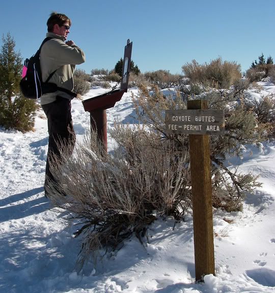
And how much easier was the easier road when most of the web sources were recommending a four-wheel drive vehicle? Honestly, we weren’t really sure we could drive the Acura RSX-S on that road. The plan was to drive there and check out this road and if we determined that we couldn’t drive it we’d go hike somewhere. But that’s the chance we were willing to take. Mostly because you can’t just drive up to the Vermillion Cliffs Wilderness and do the hike to The Wave whenever you felt like it, you needed a permit. And during certain times of the year you need to apply for permits up to months in advance. If you were lucky, in the off-season, you can attain a walk-in permit out at the Bureau of Land Management office in Kanab, Utah, but availability is limited. About 20 people a day are allowed to hike up to The Wave. We had such a permit and it was only good for today. Mike's parents applied for it a while ago, and since the permit is good for two consecutive days and they only wanted to go there one of the days, they gave us today's permit.
By now you must be screaming at the monitor “what is This Wave that you speak of?” The Wave is a multihued rock formation with swirls of sandstone in the shape of a wave. It’s been photographed a thousand times by professional photographers. You might have even seen pictures of it. The Wave itself is located in the Coyote Buttes region of the Paria Canyon-Vermilion Cliffs Wilderness. The Wave is the end of the trail for many, but you can hike further where I've read that there is a second wave. The round trip hike from the trailhead to The Wave and back is about 7 miles long. But here is something different. There is "no trail". The only way to find The Wave is to follow “visual” markers and you better bring your GPS in case you get lost.
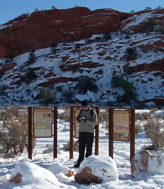
There are no markers or signs posted directing you to The Wave. With the hiking permit came some vague directions. They read something like this. "Cross a wash and hike up the slick rock ahead of you where the two rocks meet" - there would be a small color picture of the rocks that we were to look for.
Well all rocks look the same and the possibility of snow in this area was a good one since northern Arizona and Southern Utah did receive a good bit of snow fall and with high temperature for today of only 38 degrees it wasn't going to melt any time soon. The visual landmarks could be under snow. To make sure we found The Wave Mike found some GPS tracks on the web for the hike and downloaded them to his Garmin. I read somewhere on the web that a high percentage of hikers that attempt this hike never make it to The Wave, they either don't find it or get tired and turn around. We didn’t want to be part of that statistic.
Our route: 89 to House Rock Valley Road
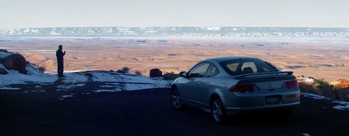
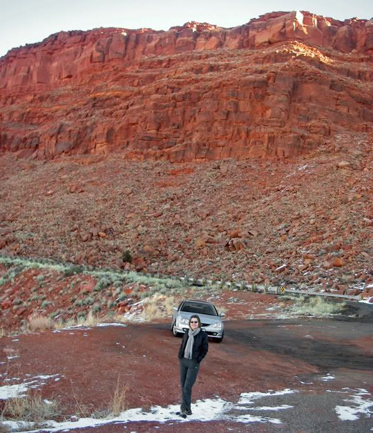
The 7 mile round trip hike to The Wave and back was not an easy hike. Part of that is because there was is no trail. You are supposed to navigate through the rough terrain, most of it made up of slick rock and unusually shaped rock formations, and loose sand. Some web sites rated this hike as moderate and strenuous, some websites listed it in the difficult category. We weren’t sure the car would make it to the trailhead but we were confident that we could complete the hike to The Wave and back.
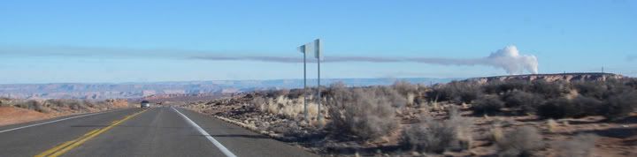
Some power plant along 89 near Page, AZ... I've read the visabiliy around the Grand Canyon is really bad on some days, I can see why, the Grand Canyon is located just a bit west of this power plant
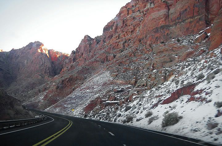
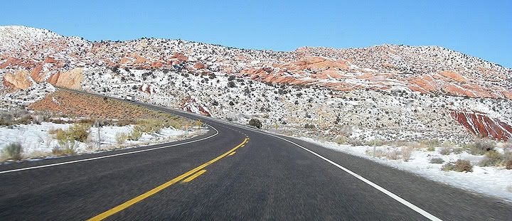
All these pictures above were taken along highway 89
So we left Sedona. Mike drove. We did 89A in the dark, it was a bit icy. Then through Flagstaff. It was a cold morning. Continuing north on 89 past Page, AZ. The dirt road was exactly where it was supposed to be according to the many websites I checked, just past the Utah border between mile marker 25 and 26. There was even a sign for it. We slowed down and looked for it but we ended up passing it up and had to turn around and try again. The road is to the left and hard to see if you're heading North on 89.
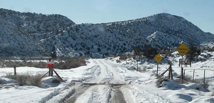
On the House Rock Valley Road - the first sign reads “Unimproved Road” the second sign reads “Impassible When Wet”
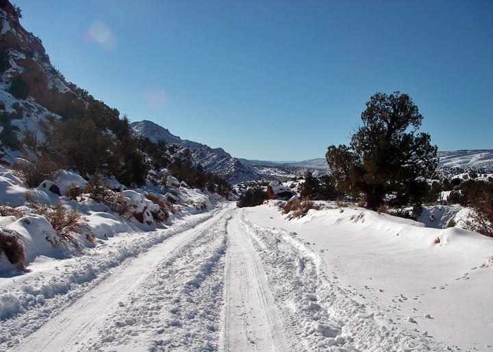
We turned on to House Rock Valley Road drove about quarter mile or less of the paved section, beyond that the road was dirt. Well, we couldn’t really see what it was, it was totally covered in snow. Lots of snow. We sat there reading the “caution” signs posted thinking we couldn’t drive 8 miles down this road. What if it got twisty and hilly. And it was narrow, only one car could fit on it at one time, meaning if we did manage to somehow follow the tire tracks of the other vehicles and if our the car was OK to drive on all this snow, if another vehicle came from the other direction there was no way we could get out of the way without getting stuck.
Moments like these are weird. Because you know that the decision you end up making will either have severe consequences if you’ve made the wrong decision or this might be one of the best adventures of your life if all goes well. So you gather up all the information and start thinking really hard. Four-wheel drive vehicle is recommended for good weather, bad weather makes this road impassible. OK. We have a front wheel drive vehicle with low profile tires and the road is covered in snow. Most people would probably be turning around right about now. Well, most people wouldn't have even driven here without some SUV or truck knowing a 4WD is recommended.
Not us. We continued thinking. So what’s the worst that can happen? We get stranded and have to wait for someone to pull us out - would there be a someone to help us? We had lots of water, some food, a camping headlamp and two zero degree sleeping bags. OK. Getting stranded wouldn’t be that bad, we would live. So what's the worst scenario? Sliding off the road in to a ditch? Sliding off the road off a cliff? There we go. We’ve finally narrowed it down to the real dangers of this excursion.
But we didn't turn back around. We decided to see how badly this car would handle on this road. We figured that if it was really bad we could turn around in a mile or two and head back. We also knew that there might not be any place to turn around and once on the road we were going to have to go all the way the whole 8 miles. This would either end up being the stupidest thing we’ve ever done or it would be great. We really wanted to do this hike and see The Wave.
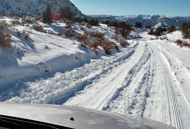
Driving House Rock Valley Road, this road doesn’t look too bad in the pictures
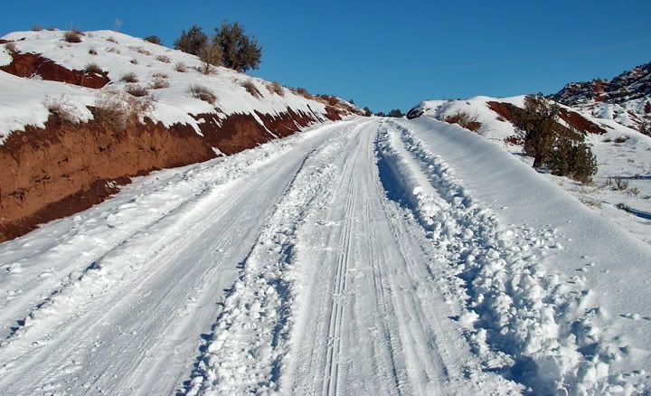
One of the hills on House Rock Valley Road
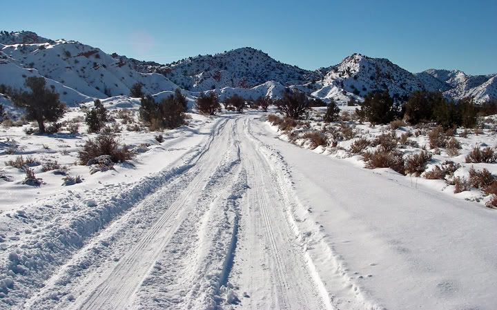
We proceeded with caution. The road was drivable, very slowly, very cautiously, staying in the tire tracks, it was doable - barely at times - but doable. Of course 8 miles at this slow spreed would take 45 minutes. It’s Ok, we wanted to be safe.

That's not a good sign
After the third mile I had this thought pop in to my head. What if we get there, do the hike but the road conditions change and we aren’t able to drive back? Naaaaaaaaaaaaahhh. Then about half way through we see an overturned SUV laying on its side in the ditch. Yikes! Were we making a mistake driving there? We checked the vehicle, there was no one inside. Toward the end of the road there were a few hills, not big hills but significant enough when you’re driving a front wheel drive vehicle with low profile tires. We got through it but we were a bit nervous with a few of them. There was some slipping and sliding.

We checked, there was no one in the SUV
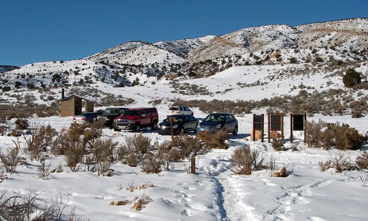
After what felt like forever we arrived at the parking lot. It was harder to park the car then to drive on the road sovered in snow. The snow was very deep in the parking lot. There were a few vehicles there. Some four-wheel drive cross-over types, one Jeep and one Hummer and one sedan. The sedan in the parking lot made us feel good about the decision to drive this road. After all, we made it, they made it, while some SUV is laying on it's side in the ditch.
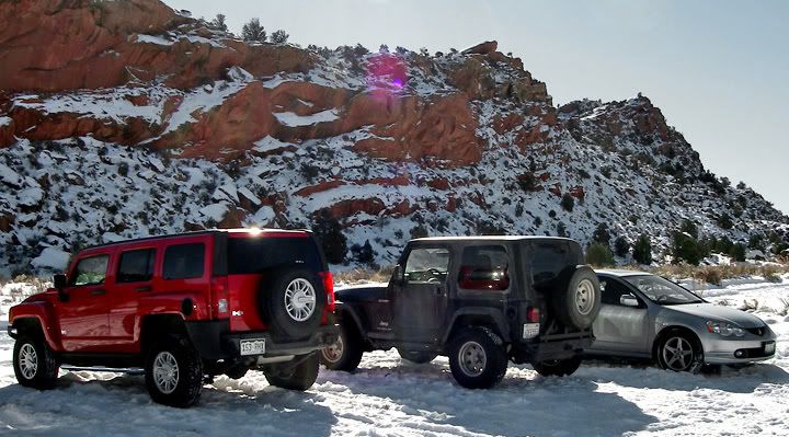
Victory for the RSX-S, playing with the big boys in the snow
Leaving the parking lot and the Wire Pass Trailhead
Wire Pass Trailhead
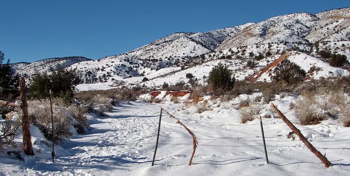
You have to walk around this fence and continue to the Coyote Butte marker
I think this is a wash that we were hiking in, not a road
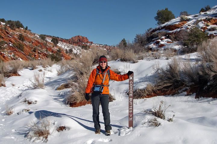
This is where the hike to Coyote Buttes and The Wave really starts
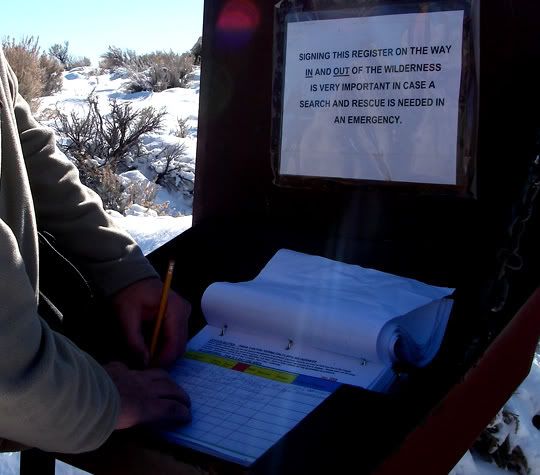
There was a vault toilet next to the parking lot. The Wire Pass Trailhead was near the road. We crossed the road and hiked to the Coyote Butte marker which was further down behind a barbed wire gate. I think the fence is there to prevent vehicles from driving in the wash area. Past the Coyote Butte marker we climbed a large hill and had to sign in. The hike to The Wave started here. To be continued in the next post.

We had to hike up a big hill to the sign in area
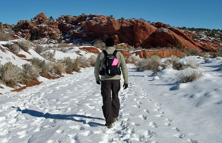
The pink piece of paper on Mike's pack is the hiking permit
Ok, we’re official, let the hike begin

4 comments:
Wow, that's impressive that you decided to take the Acura over that terrain; I would have wussed out and missed all that beauty. What an adventure!
Actually going there was a piece of cake compared to trying to drive back out. Stay tuned and see what pickle we get ourselves in to LOL.
Anna
What was the total drive time from Sedona to the trailhead and how much extra time do you think it took because of the snow on the road? I had never considered Sedona a location from which to do the Wave before...
Sylvia,
It was approx 210 miles from Sedona to the trailhead and about 4.5 hours of driving one way. About 35-45 minutes was spent driving 89A north from Sedona to Flagstaff. This road is very curvy, corners posted at 15mph, and there was a bit of ice on the road in the morning. Another 45 minutes was spent driving the 8 miles of snow covered House Rock Valley Road. If there was no snow I think 20-30 minutes would have gotten us there. If I remember correctly, the speed limit posted on that road is only 25mph. 89 from Flagstaff to Utah border is not very curvy so the miles fly by quickly.
Sedona was a bit far to get to the Wave, but we had free lodging in Sedona, you can‘t beat that. Had we done this trip some other time we would have stayed either in Page, AZ or Kanab, UT. The drive there, the long hike and the drive back to Sedona made it a very long day.
Post a Comment