
At 5PM today I arrived at one of the campsites at Cimarron Canyon State Park in New Mexico. This was an unplanned camping stop, although it was on my list of possible camping places. I only rode 270 miles today.
Today turned out to be a very, very windy day. And after getting blow around for a few hours I decided to change my mind, change my route and change my camping location for tonight. One of the benefits of being unemployed on a motorcycle trip, I didn't really didn't need to get home. I kind of wanted to be back home today, but tomorrow would work as well. I would have to live with the guilt of not sitting at home in front of the computer, looking through job listings for one more day. After all, the listings would still all be there when I got back.
But let me back up a little bit and start at the beginning. When I left Valley of Fires, it was a beautiful day in the low 70’s, sunny and not windy at all. I took 54 north, which continued to have a low speed limit of 55MPH and it was mostly straight. Yes, a bit boring but a direct route to where I was going. My sort of plan, if I could get that far today, was to get to the Great Sand Dune National Park. Then tomorrow morning I‘d have a few hours to explore and hike, then a 280 miles to get home.
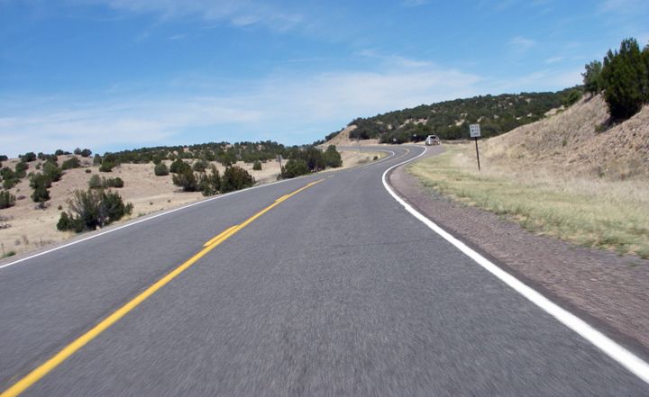
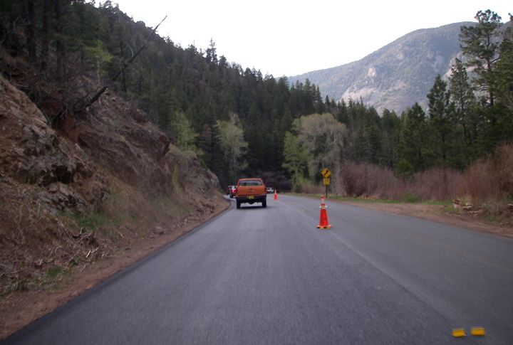
Highway 58 heading north
Highway 58
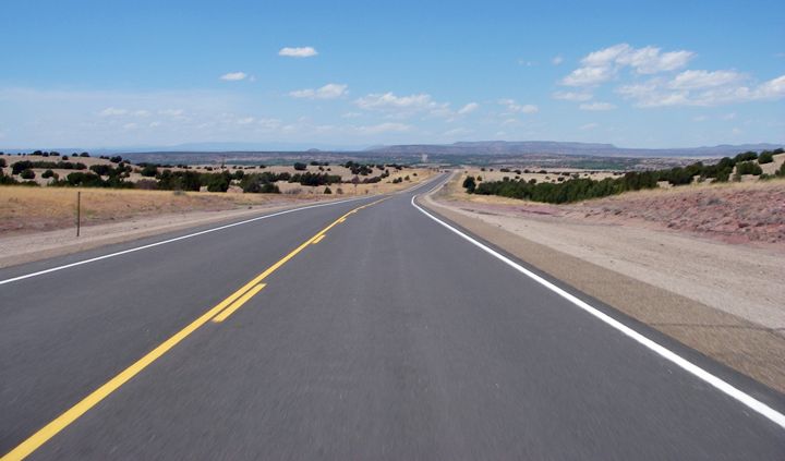
Highway 84 heading north
Highway 84
There was a nice, scenic route to get me out to the Great Sand Dunes, the roads would have twists and turns and the whole ride out there from here would be 350 miles. But not knowing how twisty these roads were, and what the speed limit was I opted out for the longer and less scenic route of 390 miles. 80 of those miles would be on the interstate where I was pretty much guaranteed to make good time.
The further north I got on 54, the more traffic there was on this road. I was glad to turn off on 219 which was a short stretch of road that later changed to highway 84 just past I-40. 84 would then take me to I-25.
Bt the time I got past Vaughn, NM it was breezy but nothing bad, but when I turned on 219 and started to head north, the strong gusts of wind became very noticeable. I was basically leaned over riding straight. The wind was beating on me badly and each semi that was traveling in the opposite direction, the wind from the passing semi would try to blow me off the road. My strategy to stay on the road and in my lane was to basically ride as close to the double yellow, that way when the gust of wind blew my bike over, I still had a bit of distance left from the edge of the road. This kind of riding takes a lot of energy though, especially since my bike weights 500 lbs without the luggage and I only weight 115 lbs. Highway 219 at least didn’t have as much traffic on it as 54, but that changed after I passed I-40 and the road changed to Highway 84. The wind kept getting stronger and after a while I had to slow down a bit.
I got to Ojitos Frios on 84 where the entrance for I-25 was located. I pulled in to the gas station to get gas and decided to have a good lunch since I was going to be on the bike for a while and there was a Subway here. I bought a $5 foot long, ate half of it and put the other half in my luggage for later. Then I got on I-25 and it didn’t seem as windy anymore, I was so glad.
The whole time I was riding along on I-25 I kept thinking if I should continue with my original route to the Great Sand Dunes. I kept doing calculations in my head. 80 miles of interstate, then 153 miles of back roads after getting of the slab past Springer, NM and taking highway 58. The interstate was definitely the fastest way to go. Maybe taking the longer route to the Great Sand Dunes would be best. It would be 20 miles longer, but much faster and I could see more of the park if I continued on I-25 and took the exit for highway 160 heading west.
Decisions, decisions. I just didn’t want to arrive at the park after dark. I even did a calculation in my head of what time I would be back home tonight if I just continued on I-25 all the way to Fort Collins. I really didn’t feel like riding until 11PM or midnight though.
While examining all the possibilities I started to notice that it was getting really windy again. The last 45 minutes of my interstate ride I was again leaned over heading straight and when the exit for highway 58 came up just past Springer, I took it.

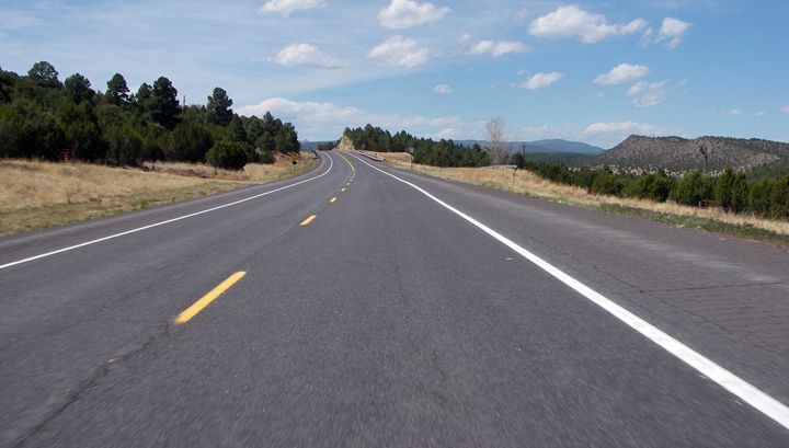
Highway 58 heading west
58 got me to Cimarron, NM where I stopped for gas and then I took 64 west. This road so reminded me of the trip I took out west with my friend Sandy in 2006. We rode through here and I remembered us stopping in Cimarron to gas up as well. I even saw that gas station, although I stopped at another one on the other side of the road. I have a crazy memory like that, I remember all the bizarre little details.

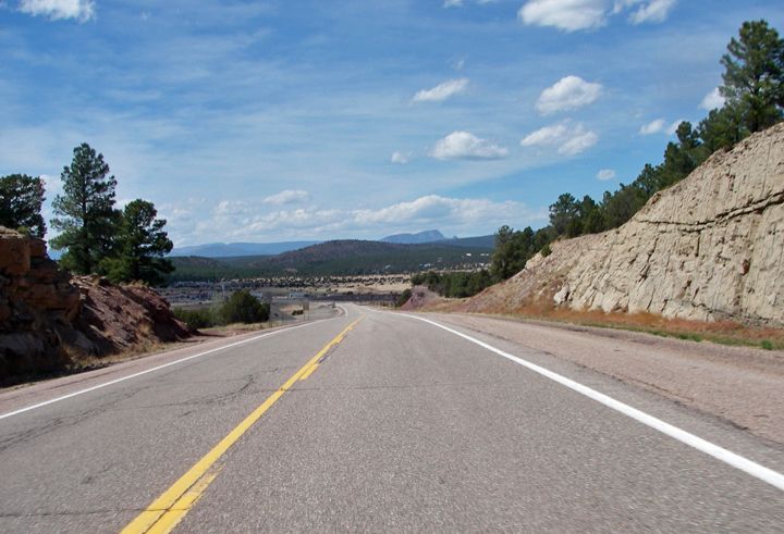
Highway 64 heading west
Highway 64 construction zone
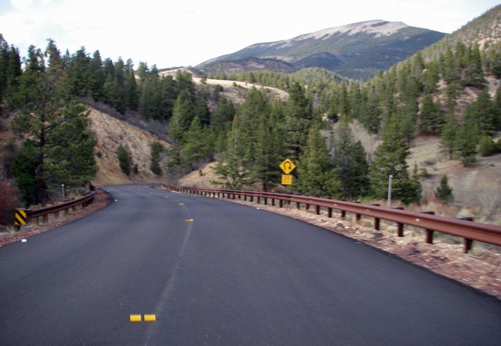
Highway 64 new pavement
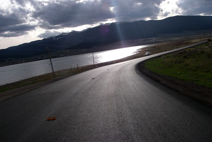
Highway 64, coming in to Eagle Nest, NM... I had to turn around in town and ride back to the campground I saw earlier, but the new paved curves were very nice and I got to do them twice
I chose this route for a few reasons and one of the reasons was that I’d be passing Cimarron Canyon State Park and if I didn’t want to continue to the Great Sand Dunes, I could just camp there. I was concerned that I already wasted some riding time stopping for lunch, and I lost some time riding slower then I would have had it not been so windy today. As I started to pass the large area that is Cimarron Canyon State Park I knew I could still make the 120 miles to the Great Sand Dunes, but I’d be arriving there just before sunset.
I was enjoying the curves of 64, there wasn’t much traffic here. I passed two camp sites already but I never did see the main entrance for Cimarron Canyon State Park. Then I ran in to a construction zone. One of those “one lane road” deals and I got stuck waiting. We had to wait about 15 minutes before the pilot vehicle finished leading the cars from the other direction, then turned around so we could follow it through the construction zone. The going was slow, there were quite a bit of cars ahead of me and the road was curvy here. Further down the road I passed another campground but still I haven't see the main entrance for Cimarron Canyon Sate Park. Then all the sudden, some sweet curves up a mountain, then down the mountain, then nice views of a lake and some big mountains and before I figured out what happened I was in the town of Eagle Nest.
I didn’t know how I could have missed the entrance to the state park. But I did know that that this construction zone made me loose another 30-40 minutes and now I was probably going to be arriving after dark if I continued to the Great Sand Dunes National Park. I really didn’t feel like setting up my tent in the dark so I decided to skip the Great Sand Dunes, skip Cimarron Canyon State Park and just ride to the campground I saw just after the construction zone. It looked pretty empty, where the two campgrounds I passed before the construction zone, there seemed to be a few cars and RV’s there.
About 15 minutes later I pulled in to the Tolby Campground, which according to my GPS was on the west edge of Cimarron Canyon State Park. The signs in the campground confirmed that I was indeed at the Cimarron Canyon State Park, but I was confused. Where was the main entrance and the visitor center?
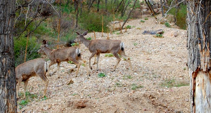
Lots of deer at the Tolby campground
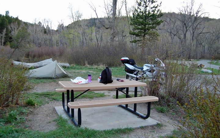
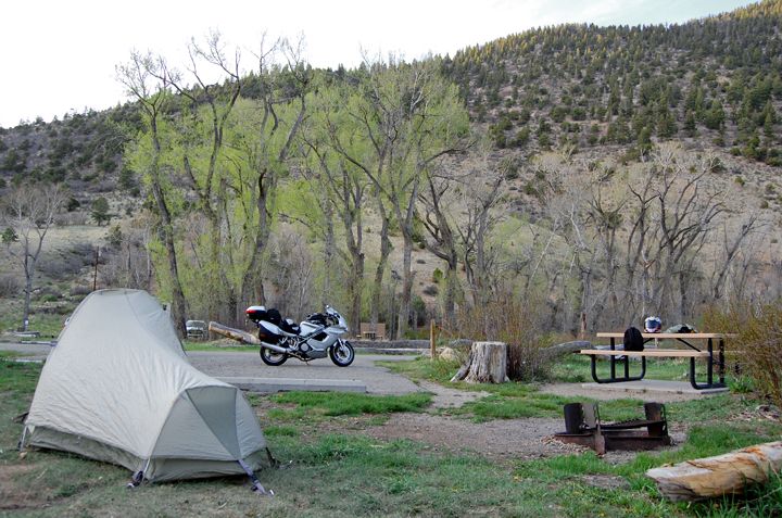
Campsite #8 at the Tolby campground in Cimarron Canyon State Park

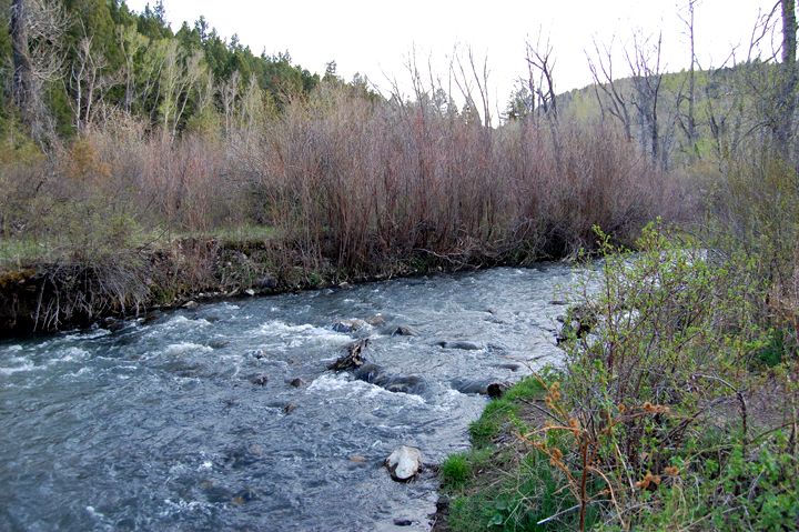
Camping next to Cimarron River
I parked the bike and scoped out the campsites. The place was empty except for the host and their RV and one other camper also in an RV. Remembering what happened yesterday at the other campground where I decided to camp next to the only other camper, I hesitated. But the best camping spot, with the best view of the river was the next camp site to the RV. There was a bit of space between us and as I walked and checked out the other sites, which weren’t as nice, I decided to take site #8, next one over to the RV. The camping spot was $10. After I dropped my payment in to the self-pay registration box I walked over to the bathrooms. There was a sign hanging on the door that said “bathrooms closed for season”. Not the biggest deal, there were some pit bathrooms near the entrance to the campground.
I was setting my tent up when the two camp hosts walked up to me. We chit chatted a bit and I got some answers to my questions. There was no main entrance and visitor center for the Cimarron Canyon State Park. This park is made up of many little individual campgrounds along highway 64. And there was a visitor center here, a small cabin tucked away in the far end of this campground. The bathrooms wouldn’t open until end of May for the busy summer season but there was a faucet on the side of the building for drinking water, which was pretty cool.
Eagle Nest is located at about 8,000 in elevation and this this campground is somewhere at about 7,000 feet. The last two nights of camping were warm, the hosts told me that the low temps for tonight would be in the low 40’s.
Because I was camping in a canyon, I was going to loose daylight earlier, the sun was already getting ready to hide behind the mountains, so I decided to sit down and eat dinner - the other half of my foot long Subway sandwich. Today was a good day for carrying a sandwich on the bike, the previous days not so much with the hot weather. The temps never got warmer then low 70’s today. After only about 4 hours inside my luggage and with no mayo to spoil, my sandwich was very tasty. I was glad I didn’t have to eat any more tuna and crackers for dinner tonight.
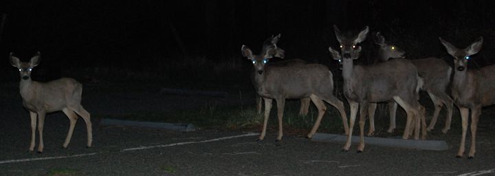
All these amazing forests here, and these guys were hanging out in the parking lot all evening
There was plenty of wood here for a campfire, unfortunately I couldn’t start one. I was told they had big rains here yesterday and the wood was not dry enough for a camp fire. I hung out for a bit outside admiring the night sky again and the full moon. Then I went inside my tent and with the headlamp looked over tomorrow's route on the maps I brought with. With nothing else to do, I decided to call it a night at 9:30PM. I must say it’s very nice camping next to a river. I really like the sound of the running water while I sleep.
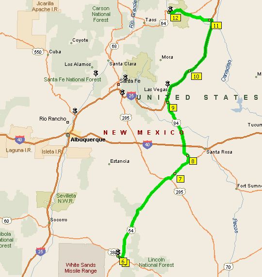
My whole route of 270 miles today
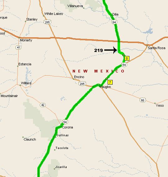
Highways 54 to 219 to 84 north
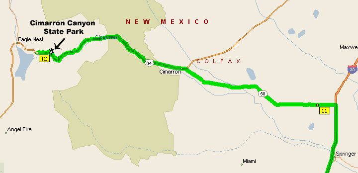
I-25 to 58 to 64 West

1 comment:
what a great ride report! so good to see you back on the ST3.
Post a Comment